
Directions
North (From Richmond, VA)
Follow I-95 South to Richmond, VA. Take I-64 East toward Norfolk/Virginia Beach, VA. Take I-64 or I-664 to Chesapeake, VA. From I-64, take Exit 291B to Route 168, the Chesapeake Expressway (a toll-road costing $3.00 – $6.00 each way). Once in North Carolina, Route 168 turns into US-158 East. Follow US-158 East through Nags Head, NC to the junction of NC-12 South. Continue on NC-12 South through the villages of Rodanthe, Waves, Salvo, Avon, and Buxton. Once you reach Frisco take a left on Billy Mitchell Road and proceed to the campground.
West (From Rocky Mount, NC)
Follow US-64 East through Tarboro, Williamston, Plymouth, Columbia, and Manteo, crossing the Alligator River Bridge and the Virginia Dare Bridge. Keep going on US-64 East to Nags Head, NC, going over the Washington Baum Bridge, to the junction of NC-12 South. Turn right onto NC-12 South and you will be at the north entrance to Cape Hatteras National Seashore. Continue on NC-12 South through the villages of Rodanthe, Waves, Salvo, Avon, and Buxton. Once you reach Frisco take a left on Billy Mitchell Road and proceed to the campground.
South (From Florence, SC)
Take I-95 North to Wilson, NC. Take US-264 East through Greenville, NC and Washington, NC. From Washington, NC, take US-17 to Williamston and follow US-64 East to Nags Head, NC and the junction of NC-12 South. (For an alternate route to NC-12 South, continue on I-95 North to Rocky Mount, NC. Take US-64 East through Tarboro, Williamston, Plymouth, Columbia, and Manteo, crossing the Alligator River Bridge and the Virginia Dare Bridge. Keep going on US-64 East to Nags Head, NC, going over the Washington Baum Bridge, to the junction of NC-12 South). Turn right onto NC-12 South and you will be at the north entrance to Cape Hatteras National Seashore. Continue on NC-12 South through the villages of Rodanthe, Waves, Salvo, Avon, and Buxton. Once you reach Frisco take a left on Billy Mitchell Road and proceed to the campground.
Phone
252-995-5101
Activities
CAMPING, VISITOR CENTER
Keywords
Frisco
Related Link(s)
North Carolina State Road Conditions
Overview
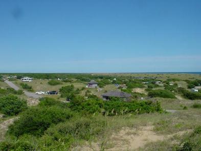
Frisco Campground is part of Cape Hatteras National Seashore on the Outer Banks of North Carolina. Camping here will put you in a prime location to experience the history, culture, and breathtaking beauty of North Carolina’s barrier islands.
Recreation
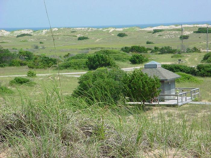
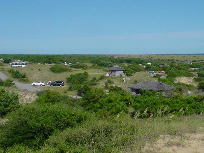
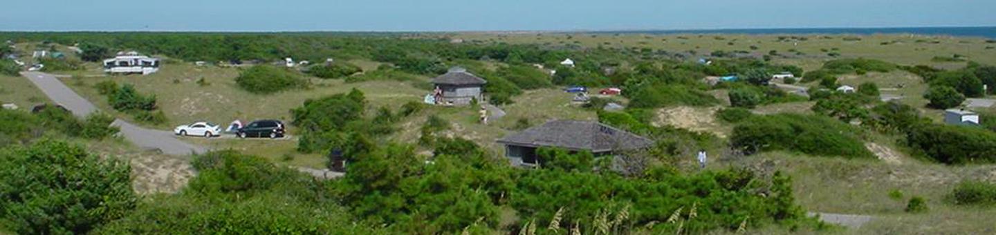
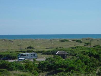
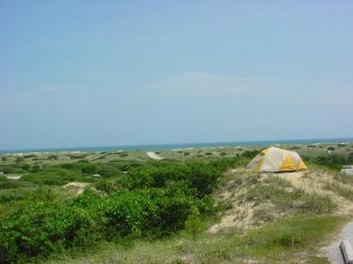
On a walk around the Frisco Campground visitors can enjoy the rolling topography, views of the Atlantic Ocean, and at night, the sweeping beacon of the nearby Cape Hatteras Lighthouse. Boardwalks from the campground to the beach give pedestrians easy access to enjoy activities such as surfing, swimming, and fishing. There is also an off-road vehicle (ORV) ramp at the entrance of the campground for beach driving with a Cape Hatteras ORV permit.
Facilities
Campers have access to modern restrooms with flushing toilets, potable water, and outdoor unheated showers. Each campsite is equipped with a paved parking pad, picnic table, and a charcoal grill for cooking. There are no RV hook ups in the campground. Dumpsters and a recycling center are located at the entrance of the campground. Wooden boardwalks make it easy for campers to travel to and from the beach.
Natural Features
The elevated dunes in Frisco Campground afford campers the opportunity to have an ocean view from some of the campsites. Dense vegetation creates a sense of privacy not present in the other campgrounds on Cape Hatteras National Seashore.
Nearby Attractions
Frisco campground is within a short drive of the historic Cape Hatteras Lighthouse. The beacon gained fame in 1999 when it was picked up and moved 2900 ft. to its current location. It is also the tallest brick lighthouse in the country. From the third Friday in April until Columbus Day it can be climbed with a ticket purchased on-site.