


Directions
From Bend, travel 26.8 miles south on Hwy 97 to Wickiup Junction, then 11.0 miles west on County Road 43, then continue 4.6 miles west on Forest Road 42, and finally 2.0 miles south on Forest Road 4260.
Phone
541-323-1746
Activities
CAMPING
Keywords
Related Link(s)
Overview
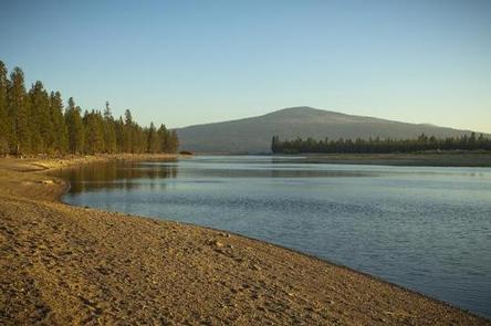
Located on the shore of Wickiup Reservoir in Deschutes National Forest, West South Twin Campground offers visitors easy access to an abundance of recreational activities along the Cascade Lakes National Scenic Byway.
Recreation
West South Twin Campground offers visitors opportunities for hiking, boating, canoeing, swimming and fishing.
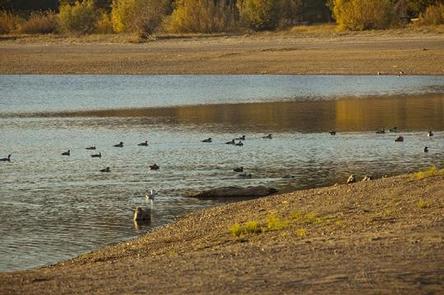
The reservoir’s relatively warm water and cooler deep channels generate some of the best fishing in Central Oregon. The area is renowned for its brown trout, often reaching 20 pounds, with normal catches in the 5-to-8 pound range. The reservoir also sustains good numbers of kokanee and coho salmon and decent populations of rainbow trout, brook trout, whitefish and chub.
Facilities
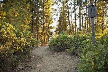
Located between South Twin Lake and the Wickiup Reservoir, West South Twin Campground has easy access to both lakes. Campsites can accomodate tent, trailer and RV camping. Each campsite features a picnic table and campfire ring. This campground offers flush toilets, as well as, a boat launch area leading to Wickiup Reservoir.
Natural Features
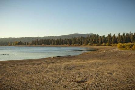
The reservoir covers an area on the Deschutes River that was historically used by Native Americans during the fall. Several tribes throughout the area built “wickiups,” shelters made from reeds, grass, or brush, while living in the area. At full pool, Wickiup is a beautiful, pine-edged reservoir, with some willows and sandy beach areas. At low water, steep soil and gravel banks drop abruptly to the water. Wetlands, diverse forests, and rocky slopes near the campground provide a necessary habitat for shorebirds, porcupine, deer, bats and the occasional black bear.
Nearby Attractions
Lava Lands Visitor Center in nearby Bend, Oregon, is a great starting point for visitors to learn about the diverse landscape and history of the area through interpretive programs and exhibits.
Visitors can also explore the Lava River Cave, located in the Newberry National Volcanic Monument. At 5,211 feet in length, the northwest section of the cave is the longest continuous lava tube in Oregon.