


Directions
From Bend, travel 23.5 miles south on Hwy 97, then 14.5 miles east on Road 21, and 0.5 miles north on Forest Road 2100 570.
Phone
541-383-5300
Activities
CAMPING
Keywords
Related Link(s)
Overview
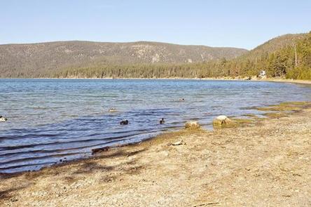
Situated on the edge of the beautiful Paulina Lake, Little Crater Campground is conveniently located within Newberry National Monument. Visitors to this area are taken aback by the incredible views this area has to offer, highlighting volcanic landscapes intermixed with diverse forests, typical of central Oregon.
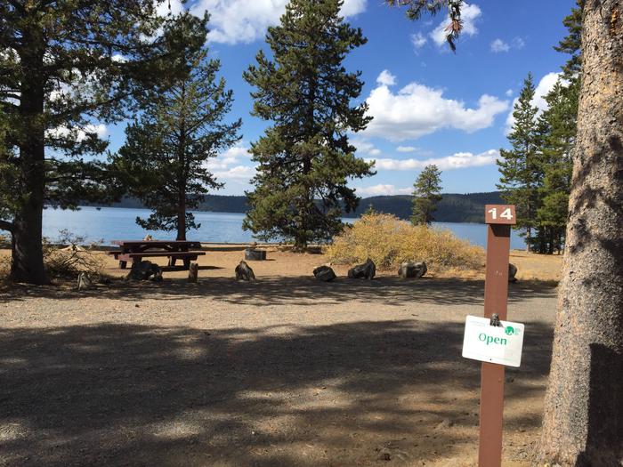
Popular for both its geological significance and multitude of recreational activities, Little Crater Campground is ideal for individual and family camping excursions. If you are visiting Oregon with the aim of getting the best camping experience, this might be it. Offering campsites next to Paulina Lake, activities available at this campground include hiking, bird watching, bicycling, sightseeing and access to nearby trails.
Recreation
The unique location of Little Crater Campground offers visitors opportunities to hike shoreline trails and alpine vistas.
Visitors can also take advantage of time on the lake, boating, kayaking, swimming and fishing.
For anglers, this lake offers fantastic fishing opportunities. Spanning a surface area of 1,531 acres, the lake supports rainbow trout, brown trout and Kokanee salmon.
In September, the outlet of Paulina Lake may be choked with Kokanee moving to spawn in Paulina Creek.
Facilities
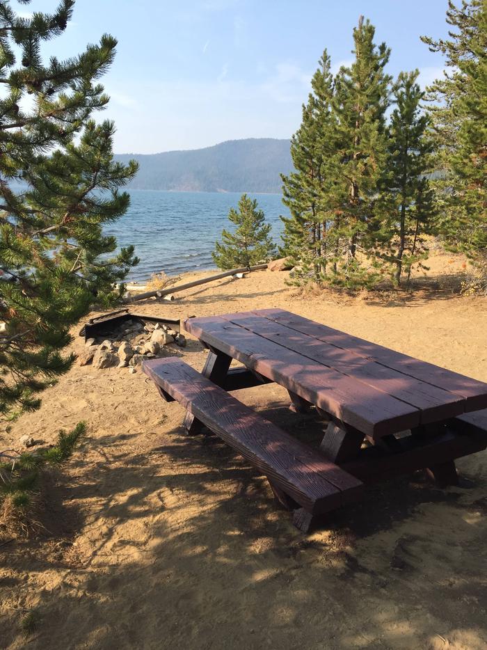
There are 49 sites located on a fairly thin ledge right on the lake and all the campground sites are a very short walk to the water. The sites are ample sized and most are good for tents, trailers or RVs. Picnic areas, boating, shoreline trails, and stunning views of the lake, along with the conveniences of drinking water and vault toilets, give visitors the opportunity to enjoy the outdoors while still having some of the conveniences of home.
Natural Features
Paulina Lake is located within the collapsed calder of Newberry Volcano. Nearly five miles in diameter, this caldera encircles the basins of Paulina Lake and its twin, East Lake. Neither lake receives water from an inlet or stream – instead both rely on rain, snowmelt and hot springs for water. Paulina Creek flows from the lake and has chiseled a narrow gorge through the caldera’s west wall creating a remarkable twin waterfall. Thermal vents and hot springs along the lake’s northeast edge help create a highly productive ecosystem. The surrounding undeveloped wilderness, clean streams and diverse forests support a variety of wildlife, including porcupine, bighorn sheep, deer, bats native fish, migratory birds and even the occasional black bear.
Nearby Attractions
Lava Lands Visitor Center in nearby Bend, Oregon, is a great starting point for visitors to learn about the diverse landscape and history of the area through interpretive programs and exhibits.
Visitors can explore the Lava River Cave, also located in the Newberry National Volcanic Monument. At 5,211 feet (1,588 m) in length, the northwest section of the cave is the longest continuous lava tube in Oregon.