
Directions
From Moab, drive north to Highway 128, turn right on 128. Between mile markers 21 and 22 you will see the sign marking the Onion Creek road. Turn right and go about a half a mile. The group areas are on the left side of the road.
Phone
435-259-2100
Activities
CAMPING, OFF HIGHWAY VEHICLE, HORSE CAMPING, MOUNTAIN BIKING, OFF ROAD VEHICLE TRAILS, STAR GAZING
Keywords
Related Link(s)
Overview
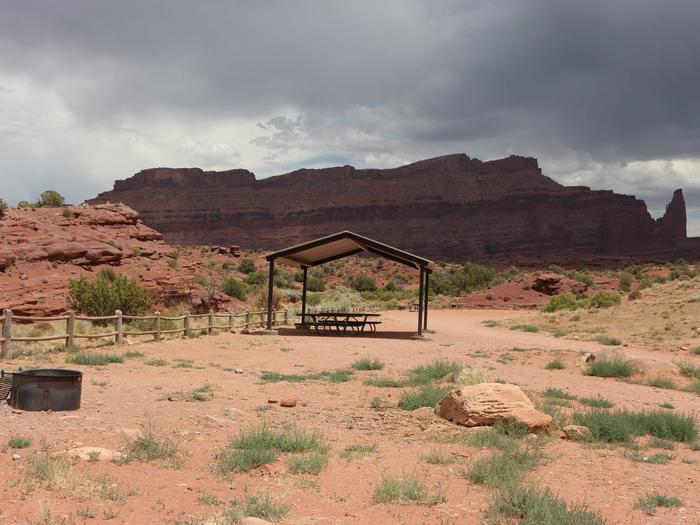
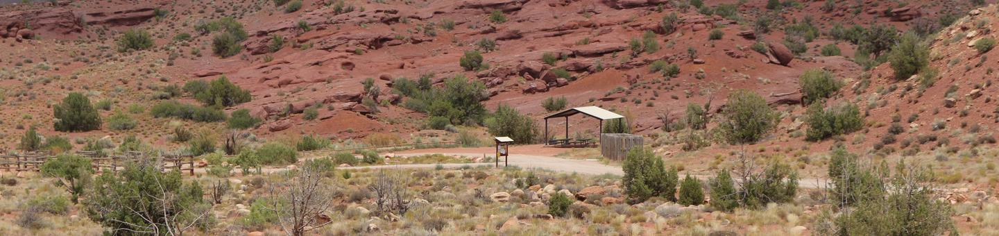
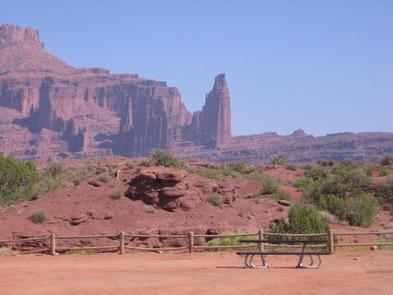
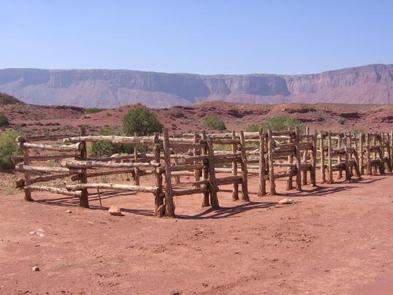
Upper Onion Creek Group Sites are ideal for small family or group gatherings. Group Site A is designed for people with horses and has a horse corral and nearby equestrian trails. The campground offers striking views of the Colorado River canyon and the surrounding red rock cliffs, mesas and spires, with the La Sal Mountains as a dramatic back-drop. There is direct access to the Onion Creek four-wheel drive road (watch for seasonal rains and flash floods). The town of Moab is approximately 40 minutes away and has dining, shopping, sports rentals, tour companies and museums.
Recreation
Group Site A is designed for guests with horses and has a horse corral and nearby equestrian trails. Access to Onion Creek four-wheel drive road is adjacent to the campground and is popular for motorized and horse travel. The road has 27 wash crossings (be careful of seasonal rain and flooding hazards.) Within close proximity to national parks and open space, outdoor enthusiasts will enjoy hiking, mountain biking, whitewater rafting, and four-wheel drive tours in the surrounding area.
Facilities
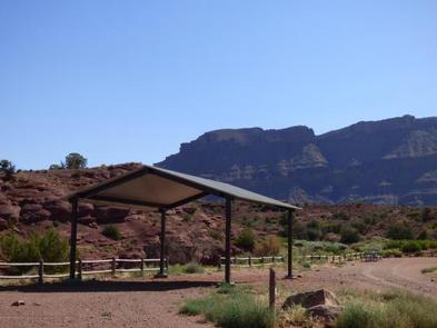
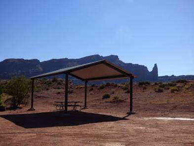
Group sites have fire grates, picnic tables, vault toilets and shade shelters. Group Site A has a horse corral. The group sites do not have water, dump stations or electric hook-ups.
Natural Features
Upper Onion Creek Campground is located along scenic Highway 128. The views from the campground are spectacular and include Fisher Towers, Castle Valley and the Colorado River Canyon. The La Sal Mountains provide a stunning backdrop to the red rock cliffs, spires and mesas.
Nearby Attractions
There are many hiking trails and viewpoints along Highway 128. The Fisher Towers area offers hiking, rock climbing and scenic vistas. There are boat launches at nearby Lower Onion Creek and Hittle Bottom Campgrounds. Upper Onion Creek Campground is about 40 minutes from Arches National Park and 55 minutes from Canyonlands National Park.