Big Bend Group Sites, UT Campground Reservation, Info, Images, Map, Directions

Big Bend Group Sites, Utah Campground Images, Info & Reservations

Directions

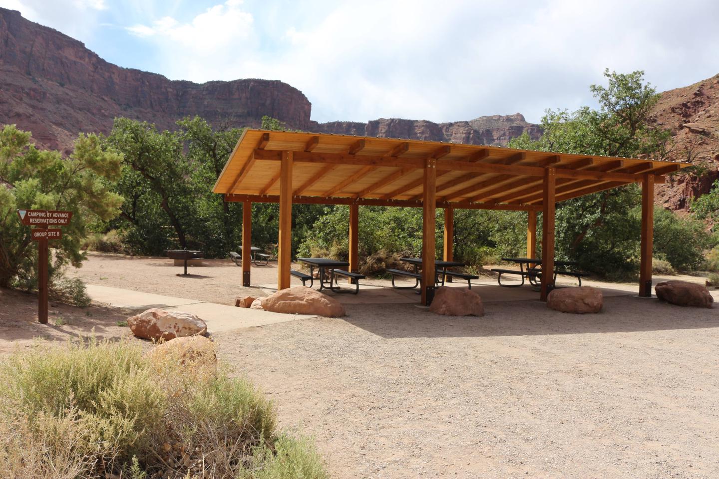
From Moab, drive north to the junction with Highway 128. Turn right and travel 8 miles along the river road. Group sites A and B are in the main campground, site C is up the dirt road directly across from the main campground.

Phone

435-259-2100

Activities

AUTO TOURING, BIKING, CAMPING, PHOTOGRAPHY, MOUNTAIN BIKING, SCENIC DRIVE

Keywords

Related Link(s)

Rec Area Info & Images

Utah State Road Conditions

Utah State Tourism

Overview

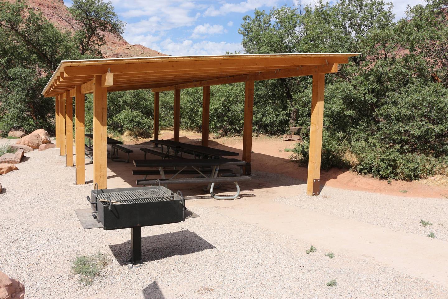
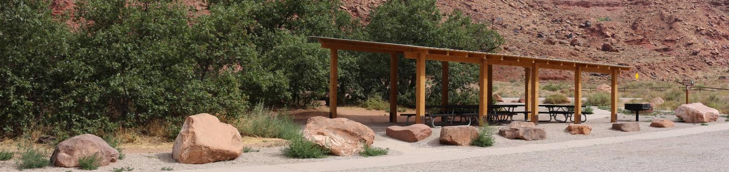
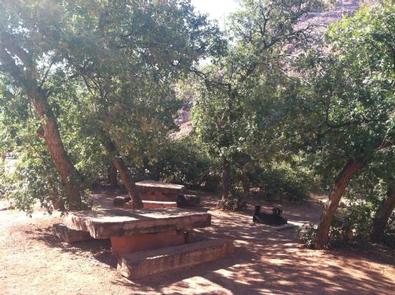
Families and large groups will enjoy the three reservable group sites at Big Bend. Group sites A and B are located within the main campground along the Colorado River. Group Site C is located across SR 128 and up a small canyon offering a more secluded location. Outdoor enthusiasts will enjoy hiking, mountain biking, whitewater rafting, and four-wheel drive tours in the surrounding parks and public lands. The town of Moab is approximately 30 minutes away and has dining, shopping, sports rentals, tour companies and museums.

Recreation

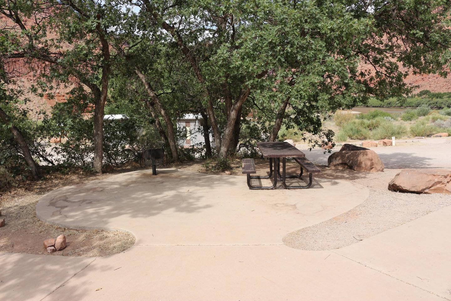
Big Bend Campground is a great base camp for mountain biking, hiking, rafting, taking scenic tours, and exploring the area’s backcountry roads. Those looking to relax enjoy sitting under the cottonwoods at the group site or on the small beach nearby.

Facilities

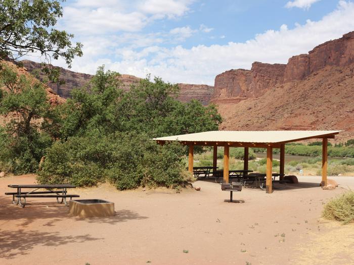
The Big Bend group areas have fire rings with grates, picnic tables, vault toilets, shade shelters, and trash removal. Sites A and B are near the river. Site C is in a side canyon, allowing for privacy. Water, dump stations and electricity are not available. Trailer and RV parking is limited. (Multiple trailers and RVs can be accommodated at the Lone Mesa Group Sites along SR 313.) Please call the Moab Field Office for more information on vehicle limitations 435-259-2100.

Natural Features

Big Bend group sites A and B offer shade and access to the Colorado River. Site C is across SR 128 and in a side canyon with no river access. All three sites have spectacular canyon views.

Nearby Attractions

Big Bend is near Arches National Park, Canyonlands National Park, and Dead Horse Point State Park. The “daily” section of the Colorado River offers half and full day river activities suitable for the whole family. The Manti-La Sal National Forest and the La Sal Mountain Loop Road provide cooler explorations during the hot summer months.

Reservation

More from CampingHiking.net:

LUBY BAY, Idaho Campground Images, Info & Reservations

Directions From I-90, east or west, turn at Post Falls, Idaho on Highway 41 going north to Newport, Washington. Take Highway 2 east to Priest River. At the junction of Highways 57 and 2, turn left at the stop light (there is only one in town) onto Highway 57. Go

BALD MOUNTAIN LOOKOUT, Idaho Campground Images, Info & Reservations

Directions From Coeur d’Alene, Idaho, drive 70 miles south on U.S. Highway 95 to State Highway 6. Turn left on State Highway 6, White Pine Scenic Byway, travel through Potlatch and continue on for 22 miles. Turn right on Forest Road 377, Palouse Divide Road. This is a single lane,

HICKORY CREEK PARK, Arkansas Campground Images, Info & Reservations

Directions From Rogers, AR, take Highway 264 east for 4.5 miles. Turn right on Cow Face Road. After a mile, turn left on Hickory Creek Road. The park entrance sign is on the right after about a mile. Phone 479-750-2943 Activities BOATING, CAMPING, FISHING, HIKING, SWIMMING SITE Keywords HIC2,BEAVER LAKE,HICKORY

DAN MOLLER CABIN, Alaska Campground Images, Info & Reservations

Directions Located 3.5 miles southwest of Juneau on Douglas Island. Access is by a 3-mile trail on Pioneer Street off Cordova Street in West Juneau or at a trailhead at the end of Jackson Road. The cabin is also accessible by helicopter. Phone 907-586-8800 Activities CAMPING, HIKING, WILDLIFE VIEWING, BERRY

UPPER PAYETTE LAKE CAMPGROUND, Idaho Campground Images, Info & Reservations

Directions From McCall, Idaho, take Highway 55 north to Warren Wagon Road/Forest Highway 21. Turn right and continue for 16 miles to gravel Forest Road 495 and follow for a mile into the campground. Phone 208-634-0400 Activities BOATING, CAMPING, FISHING, HIKING, HUNTING, WILDLIFE VIEWING, SWIMMING SITE Keywords UPPA,Upper Payette Lake

SOUTH CAMPGROUND, Oregon Campground Images, Info & Reservations

Directions From Bend, travel 35.5 miles southwest on Cascade Lakes Hwy (46), then 1.3 miles east on Forest Road 4625. South Campground will come up on the right side first and then Mallard Marsh. Phone 541-323-1746 Activities CAMPING Keywords Related Link(s) Rec Area Info & Images Oregon State Tourism Oregon