Gold Bar Group Sites, UT Campground Reservation, Info, Images, Map, Directions

Gold Bar Group Sites, Utah Campground Images, Info & Reservations

Directions

From Moab, drive five miles north on Hwy 191 to the intersection with Hwy 279. Turn left/west on Hwy 279 and drive ten miles to the campground entrance road.

Phone

435-259-2100

Activities

BIKING, BOATING, CLIMBING, CAMPING, HIKING, OFF HIGHWAY VEHICLE, RECREATIONAL VEHICLES, PHOTOGRAPHY, PADDLING, MOUNTAIN BIKING, OFF ROAD VEHICLE TRAILS, WATER ACTIVITIES, CANOEING, NON-MOTORIZED BOATING, WATER ACCESS, SCENIC DRIVE, RAFTING, RIVER TRIPS, ROCK CLIMBING

Keywords

Related Link(s)

Rec Area Info & Images

Utah State Road Conditions

Utah State Tourism

Overview

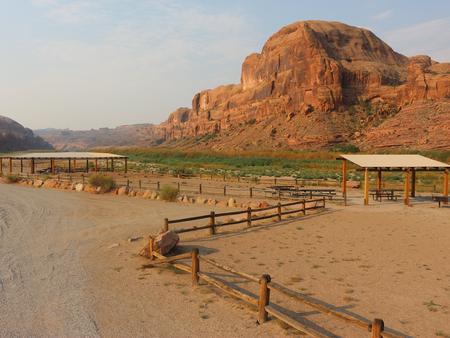
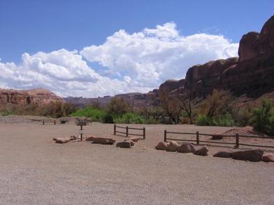
The four group sites at Gold Bar are located along the Colorado River and are ideal for large gatherings such as school groups or family reunions. Within close proximity to national parks and open space, outdoor enthusiasts will enjoy hiking, mountain biking, whitewater rafting, and four-wheel drive tours in the surrounding area. The town of Moab is approximately 15 minutes away and has dining, shopping, sports rentals, tour companies and museums.

Recreation

There is a boat ramp located at Gold Bar giving access to the Colorado River. The group sites are close to the trailhead for Corona Arch and numerous hiking and four-wheel drive roads. Both Arches and Canyonlands National Parks are nearby.

Facilities

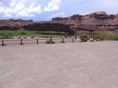
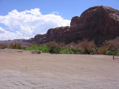
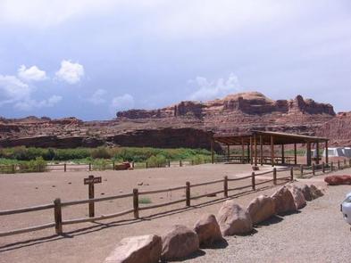
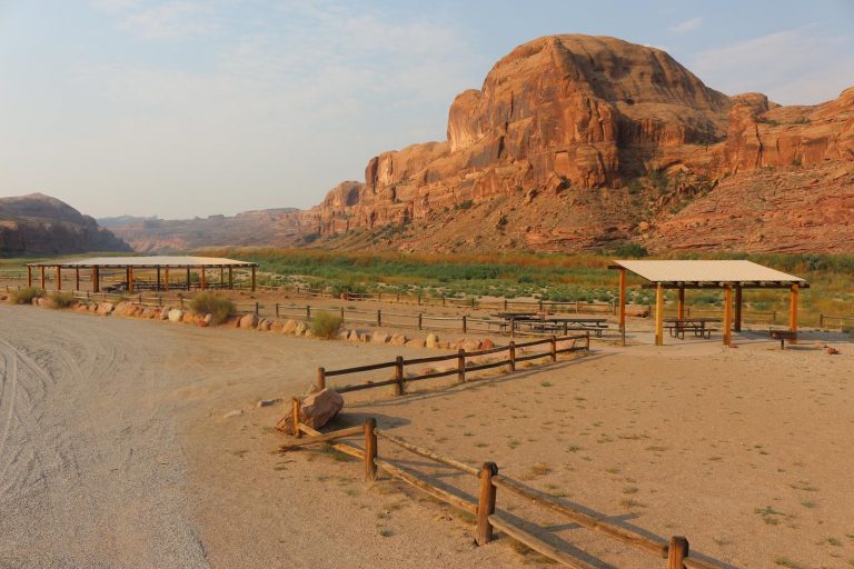
Group areas have fire grates, picnic tables, vault toilets and sites A, B, and C have shade shelters. Site D does not have a shade shelter, but is ideal for groups with motorhomes. The group sites do not have water, dump stations or electric hook-ups. Trailer and RV Parking is limited as sites are meant for tent camping.

Natural Features

The group sites at Gold Bar are located on the Colorado River and provide for striking views of the red rock canyons and mesas.

Nearby Attractions

Scenic Highway 279 parallels the Colorado River and there are multiple opportunities for hiking, biking and four-wheeling. Arches and Canyonlands National Parks and Dead Horse State Park are nearby as well as the Manti-La Sal National Forest and the La Sal Mountain Loop Road which offer cooler temperatures.

Reservation

More from CampingHiking.net:

MARTEN LAKE CABIN, Alaska Campground Images, Info & Reservations

Directions The cabin is located at the north end of Marten Lake, southeast of Wrangell. The lake is on the mainland (at an elevation of 178 feet) above Blake Channel and the Bradfield Canal. This cabin is accessible by float plane only and is 25 miles by air from Wrangell.

LOWER LITTLE TRUCKEE, California Campground Images, Info & Reservations

Directions From either east bound or west bound Interstate 80 in Truckee take exit 188, Highway 89 north to Sierraville. In aproximately 11 miles turn left into the campground. Phone (530) 994-3401 Activities CAMPING, FISHING, HIKING, HUNTING, MOUNTAIN BIKING, SCENIC DRIVE Keywords LOLI,TAHOE NF – FS Related Link(s) Rec Area

SHERIDAN, Montana Campground Images, Info & Reservations

Directions From U.S. Highway 212, turn off at Eastside Road and go 2 miles to the campground. The entrance is on the left. Phone 406-587-9054 Activities BIKING, BOATING, CAMPING, FISHING, HIKING Keywords SHDN,CUSTER NF – FS,SHERIDAN Related Link(s) Rec Area Info & Images Overview Sheridan Campground is located seven miles

NOTCH CABIN, Montana Campground Images, Info & Reservations

Directions Notch Cabin is about 62 miles from Ennis, Montana. The final 28 miles are gravel, dirt or primitive two-track. From Ennis, take Montana Highway 287 west for 23 miles to Alder. At Alder, turn south toward Ruby Reservoir (County 248) and travel 21 miles. Turn right on Ledford Creek

RAY BEHRENS, Missouri Campground Images, Info & Reservations

Directions From Hannibal MO, travel west on Highway 36 for 17 miles, turn south onto Route J and go 12 miles to the campground. Phone 573-735-4097 Activities BIKING, BOATING, CAMPING, DAY USE AREA Keywords RABE,BEHRENS CAMPGROUND,MARK TWAIN LAKE,MARK TWAIN LAKE Related Link(s) Rec Area Info & Images Missouri State Tourism