TWIN CREEK CAMPGROUND GROUP CAMPING SITE, ID Campground Reservation, Info, Images, Map, Directions

TWIN CREEK CAMPGROUND GROUP CAMPING SITE, Idaho Campground Images, Info & Reservations

Listen

Directions

Twin Creek Campground Group Camping Site can be accessed from two directions on Highway 93. From North Fork, Idaho, travel 15 miles north on US 93, turn left on Forest Road 156 and travel an additional .5 miles. Turn left into the Group Camping Site. From the top of Lost Trail Pass travel 8.5 miles south on US 93, turn right on Forest Road 156, travel an additional .5 miles and turn left into the Group Camping Site.

Phone

(208)-756-5209

Activities

CAMPING

Keywords

Related Link(s)

Rec Area Info & Images

Idaho State Tourism

Idaho State Road Conditions

Overview

Twin Creek Group Camping Site is part of the larger Twin Creek Campground. This beautiful campsite is located 15 miles north of North Fork, Idaho, and is situated along Twin Creek at an elevation of 5,100 feet.

Recreation

The recreational opportunities are abundant in this corner of the Salmon-Challis National Forest. There are fishing opportunities in the North Fork of the Salmon River and in Twin Creek. For the hikers, there are numerous trails in the area but trails #6108 and #6109 are located just behind the campground (pick up a visitor map or contact the North Fork District Office for more information). During certain parts of the year berry picking can be excellent around the campground.

Facilities

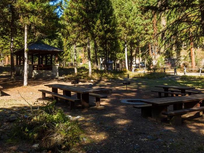
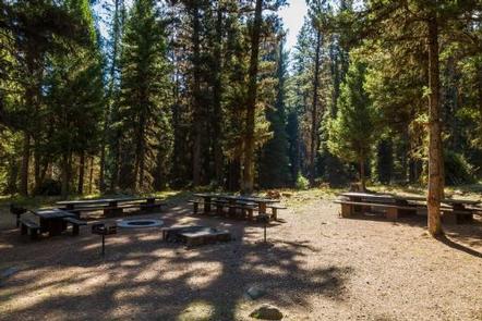
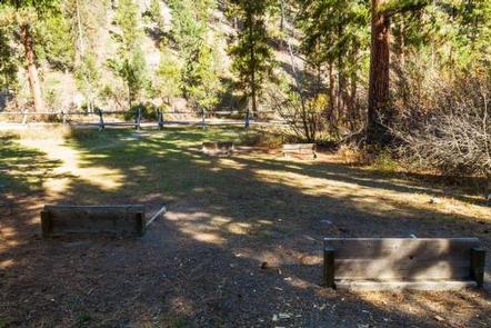
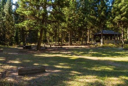
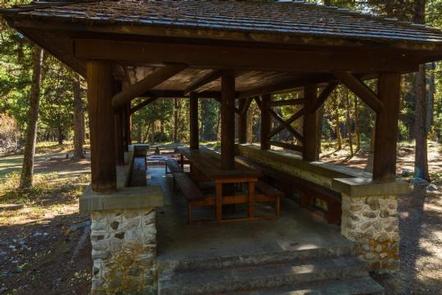
Twin Creek Campground Group Camping Site has numerous amenities including a large parking area (for multiple vehicles and or trailers), a double vault toilet, drinking water, four picnic tables (two of which are extra-long), a large fire ring, multiple barbeque pedestals, a large barbeque pit, a historic pavilion with a picnic table and benches, and two horseshoe pits. Electricity and water/sewer hookups are not available at this site/campground.

Natural Features

Twin Creek Campground Group Camping Site is located in the Twin Creek drainage near its confluence with the North Fork of the Salmon River. Large pine trees and brush surround the campsite offering plenty of shade and privacy.

Nearby Attractions

While you are in the area be sure to check out the beautiful Salmon River, located 15 south of the campsite. Also, brush up on some history and imagine you are Lewis and Clark as you travel along Highway 93, which contains portions of the Lewis and Clark National Historic Trail.

Reservation

More from CampingHiking.net:

SKULL CREEK, Utah Campground Images, Info & Reservations

Listen Directions Located off Highway 44, just west of the junction of Highways 44 and 191 in the Flaming Gorge area, about 35 miles north of Vernal, Utah. Phone 435-784-3445 Activities BIKING, BOATING, CAMPING, FISHING, HIKING, WILDLIFE VIEWING Keywords SKUL,SKULL CREEK,FLAMING GORGE,ASHLEY NF – FS,Flaming Gorge National Recreation Area Related

ASPEN GROUP AREA, New Mexico Campground Images, Info & Reservations

Listen Directions In southeast New Mexico, approximately 20 miles east of Alamagordo. From Alamagordo take US 82 east and go 16 miles. Just before Cloudcraft turn right (South) on NM 130. Go 1.4 miles. Turn left (east) on Forest Road 24B, go 0.5 miles. Aspen Group Area is on the

COW MEADOW CAMPGROUND, Oregon Campground Images, Info & Reservations

Listen Directions From Bend, OR: Travel about 45 miles south on Cascade Lakes Highway (46), 0.5 mile east on Forest Road 40, then 2 miles south on Forest Road 4000-790. Phone 541-323-1746 Activities CAMPING Keywords Related Link(s) Rec Area Info & Images Oregon State Tourism Oregon State Road Conditions Overview

RIVER FOREST GROUP SITE, Florida Campground Images, Info & Reservations

Listen Directions From Deland, Florida, drive west on State Route 44 to the first intersection after crossing the St. Johns River. Turn right on County Road 42, and the entrance to the campground is on the right. Phone 352-625-2520 Activities CAMPING, FISHING, HIKING Keywords RFGS,NFs IN FLORIDA – FS Related

ALPINE RIDGE, Arkansas Campground Images, Info & Reservations

Listen Directions From Interstate 30, take exit 73 and merge onto State Highway 8 west for 19 miles. Turn right on Fendley Road and continue 8.5 miles to the campground. Phone 870-246-5501 Activities BOATING, CAMPING, FISHING, SWIMMING SITE Keywords ALPR,DEGRAY LAKE,ALPINE,DEGRAY LAKE Related Link(s) Rec Area Info & Images Arkansas