CRAIG CREEK RECREATION AREA, VA Campground Reservation, Info, Images, Map, Directions

CRAIG CREEK RECREATION AREA, Virginia Campground Images, Info & Reservations

Listen

Directions

From New Castle: Follow US 615 east for 11 miles to SR 817 in Oriskany. Turn right on SR 817, go 1/2 mile then take right at sign for Craig Creek. Continue straight. Veer right for the camping area gate, while the left fork leads to the day use parking area.

Phone

540-552-4641

Activities

FISHING, HIKING, WATER ACTIVITIES, CANOEING

Keywords

Related Link(s)

Rec Area Info & Images

Virginia State Tourism

Virginia State Road Conditions

Overview

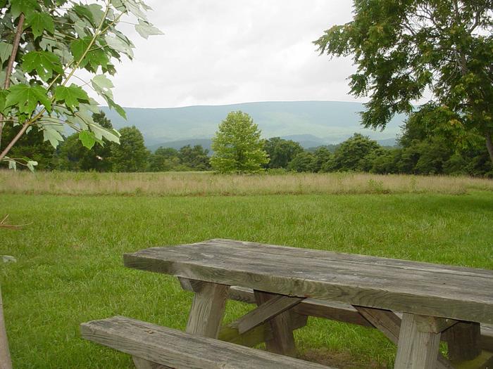
Craig Creek Recreation Area provides old-fashioned, rustic group camping for those that require few amenities. The large open field is great for groups that wish to picnic and tent camp together. There is a day-use area adjacent to the campground that is not reservable. Overnight camping is prohibited in the day-use area.

Recreation

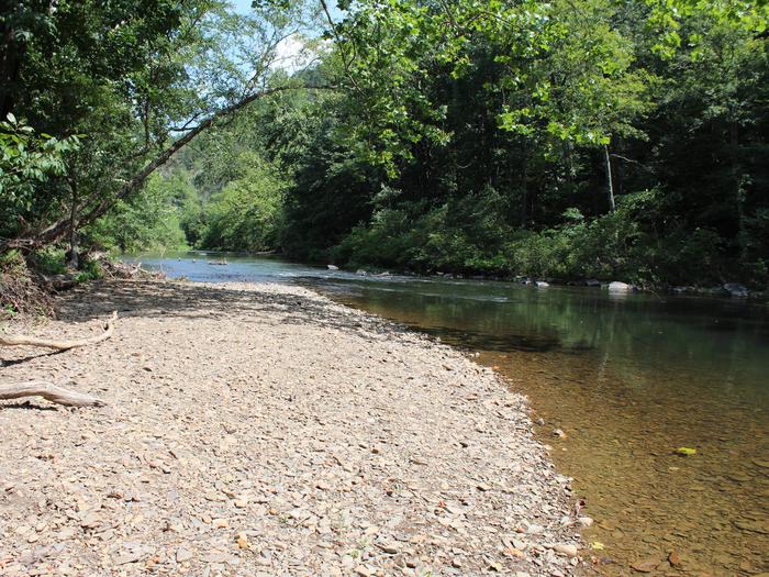
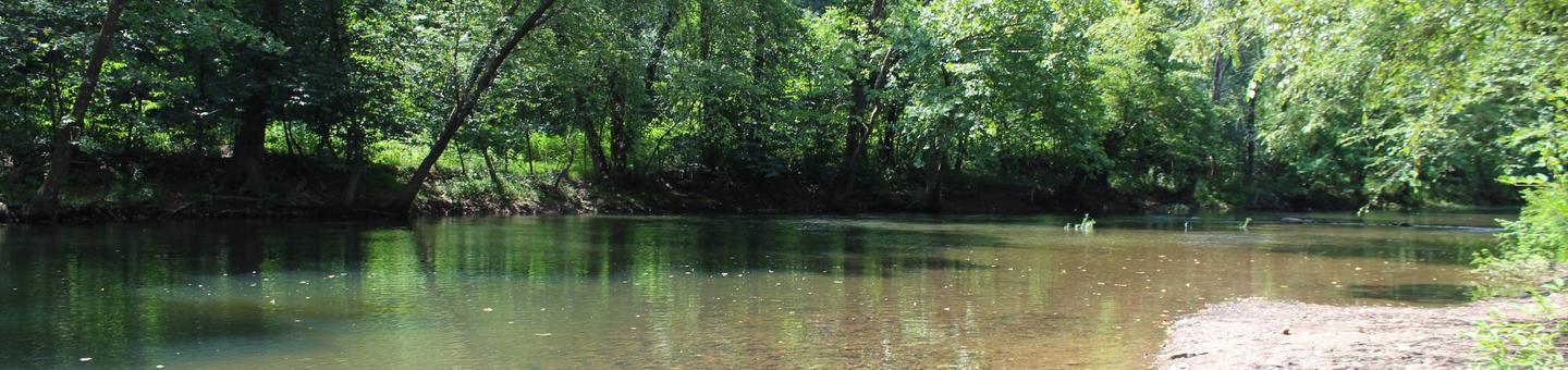
Craig Creek has a small swimming hole and canoes may access the creek as well. The creek is stocked with trout and can provide good fishing opportunites for anglers. A two-mile loop trail is located within the recreation area.

Facilities

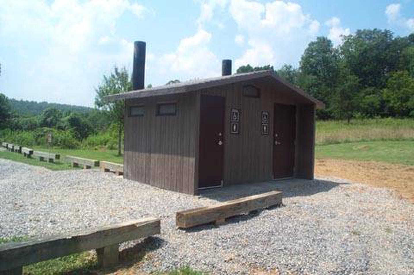
Craig Creek may be reserved for groups of 30 or less. There is an an entrance gate, group fire ring, picnic table and vault toilet. There is no potable water and no camping hookups. The field is for tent camping only.

Natural Features

The recreation area is located in a narrow valley, flanked by National Forest land. The open field used for tent camping and is edged with large, shade trees.

Nearby Attractions

Craig Creek is located 20 minutes from New Castle, VA.

Reservation

More from CampingHiking.net:

BLUE BAY, Oregon Campground Images, Info & Reservations

Listen Directions From Sisters, travel approximately 13 miles northwest on Highway 20/126. Turn left onto Forest Road 2070 (Suttle Lake Campgrounds). Travel just less than 1/2-mile to Blue Bay entrance on the right. Phone 541-323-1746 Activities BOATING, CAMPING, INTERPRETIVE PROGRAMS, FISHING, HIKING Keywords BLBA,SUTTLE LAKE CAMPGROUND,DESCHUTES NF – FS Related

SILVER CREEK CAMPGROUND, Idaho Campground Images, Info & Reservations

Listen Directions From Boise, travel north on Highway 55 to Banks. Turn east on the Banks-Lowman Highway and continue east for 8 miles toward Garden Valley. Turn north on Middle Fork Road (Forest Road 698) and pass through Crouch, continuing north on the Middle Fork Road approximately 16 miles to

FREMONT POINT CABIN, Oregon Campground Images, Info & Reservations

Listen Directions Summer Travel: From the Paisley Ranger District Office in Paisley, Oregon: Travel north on State Route 31 for 34.2 miles, between mile posts 64 and 65, turn left (west) onto the graveled Forest Service Road (FSR) 2901. Follow FSR 2901 for 16.1 miles. Turn left (east) on FSR

Sentinel Campground, California Campground Images, Info & Reservations

Listen Directions From Fresno, CA, follow California State Highway 180 East to Cedar Grove. Sentinel Campground is located on the left (north) side of the road in the village. Phone (559) 565-3341 Activities CAMPING, INTERPRETIVE PROGRAMS, HIKING, HORSEBACK RIDING, VISITOR CENTER, DAY USE AREA Keywords Related Link(s) Rec Area Info

BIG GAME CAMPGROUND, Wyoming Campground Images, Info & Reservations

Listen Directions From Cody, Wyo., follow Sheridan Avenue west through Cody until the road leaves town, and becomes Buffalo Bill Scenic Byway (U.S. Highway 14/16/20). The campground is 29 miles west of Cody, on the north side of the highway and next to the river. It is between Wapiti Campground