FOURBIT FORD CAMPGROUND, OR Campground Reservation, Info, Images, Map, Directions

FOURBIT FORD CAMPGROUND, Oregon Campground Images, Info & Reservations

Listen

Directions

From Medford, OR, travel north approximately 16 miles on Highway 62 going through Eagle Point, OR, to the Butte Falls / Willow Lake turnoff. Turn east (right) and travel 16 miles to the town of Butte Falls, OR. Continue through Butte Falls, OR, on County Road 821 for 9.1 miles to Forest Road 3065. Turn north (left) and travel 1.4 miles to the campground entrance to the west (left).

Phone

541-560-3900

Activities

CAMPING, FISHING, HIKING, VISITOR CENTER, DAY USE AREA

Keywords

Related Link(s)

Rec Area Info & Images

Oregon State Tourism

Oregon State Road Conditions

Overview

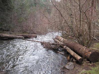
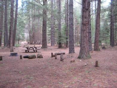
Fourbit Ford campground and campsites are located along Fourbit Creek in the City of Medford, OR, watershed. This remote and picturesque campground is a short distance from Willow Lake and Fish Lake, and nearby to Whiskey Springs Campground.

Recreation

Numerous hiking trails are within easy access, including the Mt. McLaughlin Trail #3716.

Facilities

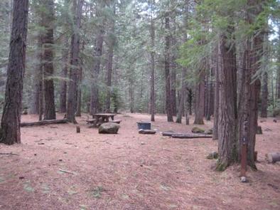
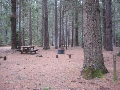
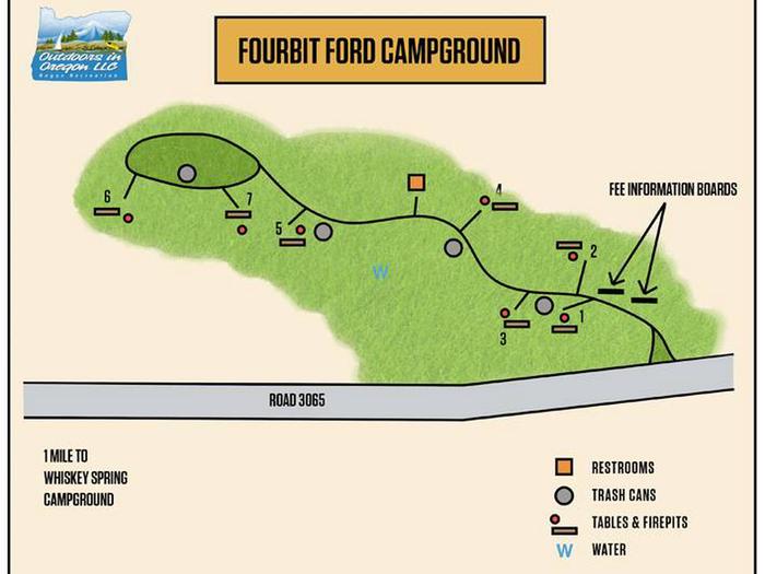
This small campground contains a variety of campsites to accommodate all types of visitors and campers, including group, family and single campsites. Drinking water is available at nearby Whiskey Springs Campground. The campground has one vault toilet. Firewood is available for purchase from the off-site Host.

Natural Features

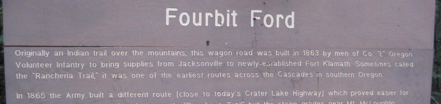
Quiet and secluded this campground is located on the site of the original supply road (Old Military Road) for Fort Klamath. Sites are located along Fourbit Creek.

Reservation

More from CampingHiking.net:

FURNACE CREEK, California Campground Images, Info & Reservations

Listen Directions Death Valley is in eastern California on the Nevada border, 130 miles west-northwest of Las Vegas, Nevada and 106 miles east of Lone Pine, California. Furnace Creek Campground is a half-mile north of Furnace Creek Visitor Center on State Highway 190. Phone 760-786-2441 Activities BIKING, HISTORIC & CULTURAL

BEAR CANYON, Utah Campground Images, Info & Reservations

Listen Directions From I-15, take Nephi exit 225. Travel about 5 miles east on Highway 132 to the Nebo Loop Scenic Byway. Turn left onto the byway and travel 3.5 miles to the Bear Canyon turnoff. Turn left. Bear Canyon Campground is located at the end of the road, just

COUGAR ROCK CAMPGROUND, Washington Campground Images, Info & Reservations

Listen Directions Cougar Rock Campground is located 14 miles east of Ashford, Washington, on State Route 706/Paradise Road. Phone 360-569-6626 Activities CAMPING, INTERPRETIVE PROGRAMS Keywords CG44,Mount Rainier National Park Related Link(s) Rec Area Info & Images Washington State Tourism Washington State Road Conditions Overview Cougar Rock Campground, on the southwest

WINKLER PARK, Texas Campground Images, Info & Reservations

Listen Directions From Interstate 35 in Temple, Texas take State Highway 53/36 west towards Gatesville (approximatey 10 miles). Just after Leon River Bridge, turn right on White Flint Park Road. Turn left on Winkler Park Road and follow it to the park entrance. Phone 254-986-1579 Activities BIKING, BOATING, CAMPING, FISHING,

STUB CREEK CABIN, Colorado Campground Images, Info & Reservations

Listen Directions From Fort Collins, get off I-25 at the Mulberry Street/Highway 14 exit. Travel west on Mulberry to Riverside Ave, then north on College Avenue to Highway 287. Turn left and go west on Highway 14 (Poudre Canyon) for about 60 miles, to County Road 103. Go north on

BARBER CABIN, Alaska Campground Images, Info & Reservations

Listen Directions At mile 52.6 of the Sterling Highway turn into Russian River Campground and travel 1 mile to Russian Lakes Trailhead, follow the Russian Lakes Trail 3.3 miles turning onto the Barber Cabin Spur trail at mile 2.5. The route is 4.2 miles in the winter and follows the