SINKHOLE CAMPGROUND, AZ Campground Reservation, Info, Images, Map, Directions

SINKHOLE CAMPGROUND, Arizona Campground Images, Info & Reservations

Listen

Directions

Located on Willow Springs Lake Road approximately 1/2 mile off of Highway 260.

Phone

928-535-9859

Activities

CAMPING

Keywords

Related Link(s)

Rec Area Info & Images

Arizona State Road Conditions

Arizona State Tourism

Overview

Located in the ponderosa pine forest, this campground is within walking distance of Willow Springs Lake which provides boating and fishing opportunities. Hiking and mountain biking opportunities are nearby in the non-motorized Wildlife Area. The General Crook National Recreation Trail is also within a mile of the campground. Be prepared for rain, often heavy, through July and August. Expect cool to cold nighttime temperatures.

Recreation

Fishing and boating are available at nearby Willow Springs Lake which is approximately one mile from the campground.

Facilities

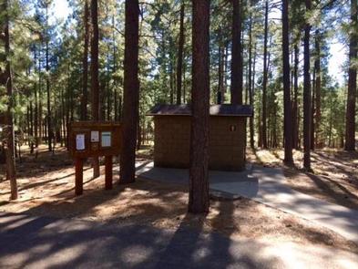
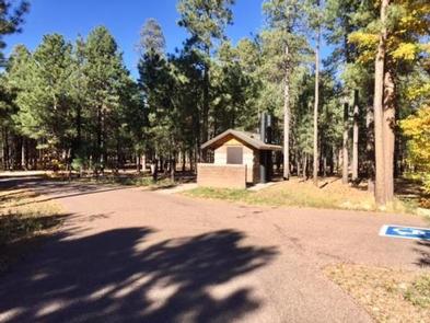
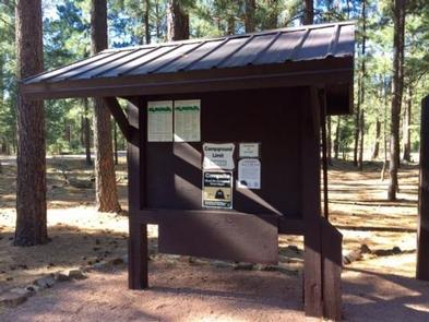
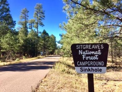
Sinkhole Campground has 26 sites (sites 14 through 26 are available for advanced reservation). Sites 1 through 13 are first-come, first served. There are two accessible sites, two double sites and the rest are single sites. All sites are back-in. Each site offers a campfire ring with grill and picnic table. Additional amenities include accessible vault toilets, drinking water and trash service. A camp host is available at the site.

Natural Features

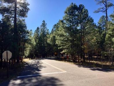
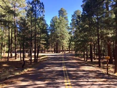
Sinkhole Campground is surrounded by ponderosa pines. The entrance, roads and back-in section is asphalt.

Nearby Attractions

Woods Canyon Lakes is located approximately 10 miles west off of Road 300 and Road 105. The store at the lake has boat and kayak rentals. Gas, phone and groceries are available approximately four miles east at Forest Lakes.

Reservation

More from CampingHiking.net:

EL PRADO GROUP, California Campground Images, Info & Reservations

Listen Directions The campground is located 50 miles east of San Diego, California. Take I-8 to the Sunrise Highway (State Route S1) exit. Go approximately 15 miles north to Laguna/El Prado Campground, just beyond the 26 mile marker. Stop at the entrance station for information and site location. Phone 619-445-6235

Paradise Creek campground, Washington Campground Images, Info & Reservations

Listen Directions Take Highway 14 to Carson. From Carson, travel about 19 miles northwest on Wind River Highway. The campground is between mile post 20 and 21. Phone 541-338-7869 Activities CAMPING, FISHING, HIKING, HUNTING Keywords PACR,GIFFORD PINCHOT NF – FS Related Link(s) Rec Area Info & Images Washington State Road

TRANSFER GROUP CAMPGROUND, Colorado Campground Images, Info & Reservations

Listen Directions From Mancos, CO: travel 1/4 mile north on Hwy 184, turn right on West Mancos Road (Forest Road 561) and travel 10.5 miles to the campground. Most of the road is unpaved, but has a good gravel surface. Phone 970-882-7296 Activities CAMPING, HIKING Keywords Transfer Group Related Link(s)

THE NARROWS, Kentucky Campground Images, Info & Reservations

Listen Directions From Glasgow, KY: Take 31-E south for 10 miles, turn right on 1318. Follow signs into campground entrance. Phone 270-646-3094 Activities CAMPING, HIKING, DAY USE AREA Keywords NARROWS,THE NARROWS,THEN,BARREN RIVER LAKE,BARREN RIVER,BARREN LAKE Related Link(s) Rec Area Info & Images Kentucky State Tourism Kentucky State Road Conditions Overview

BOCA SPRING, California Campground Images, Info & Reservations

Listen Directions From Reno, take I-80 west to Hirschdale Exit. Go north approximately 3 miles then turn right and go 1 mile to the campground. From Truckee, take I-80 east to Hirschdale exit. Turn left and travel approximately 3 miles then turn right and go 1 mile to the campground.