
Directions
https://www.nps.gov/piro/planyourvisit/directions.htm
Phone
906 387 3700 MUNISING FALLS VISITOR CENTER EMAIL: INFORMATION_PIRO@NPS.GOV
Activities
INTERPRETIVE PROGRAMS, HIKING, WINTER SPORTS, VISITOR CENTER, PHOTOGRAPHY, WATER ACTIVITIES, KAYAKING, CANOEING, SEA KAYAKING, CROSS COUNTRY SKIING, ICE CLIMBING, BACKPACKING
Keywords
Related Link(s)
Pictured Rocks National Lakeshore Backcountry Camping
Pictured Rocks National Lakeshore Kayak Safety
Michigan State Road Conditions
Munising National Weather Forecast
Pictured Rocks National Lakeshore
Overview
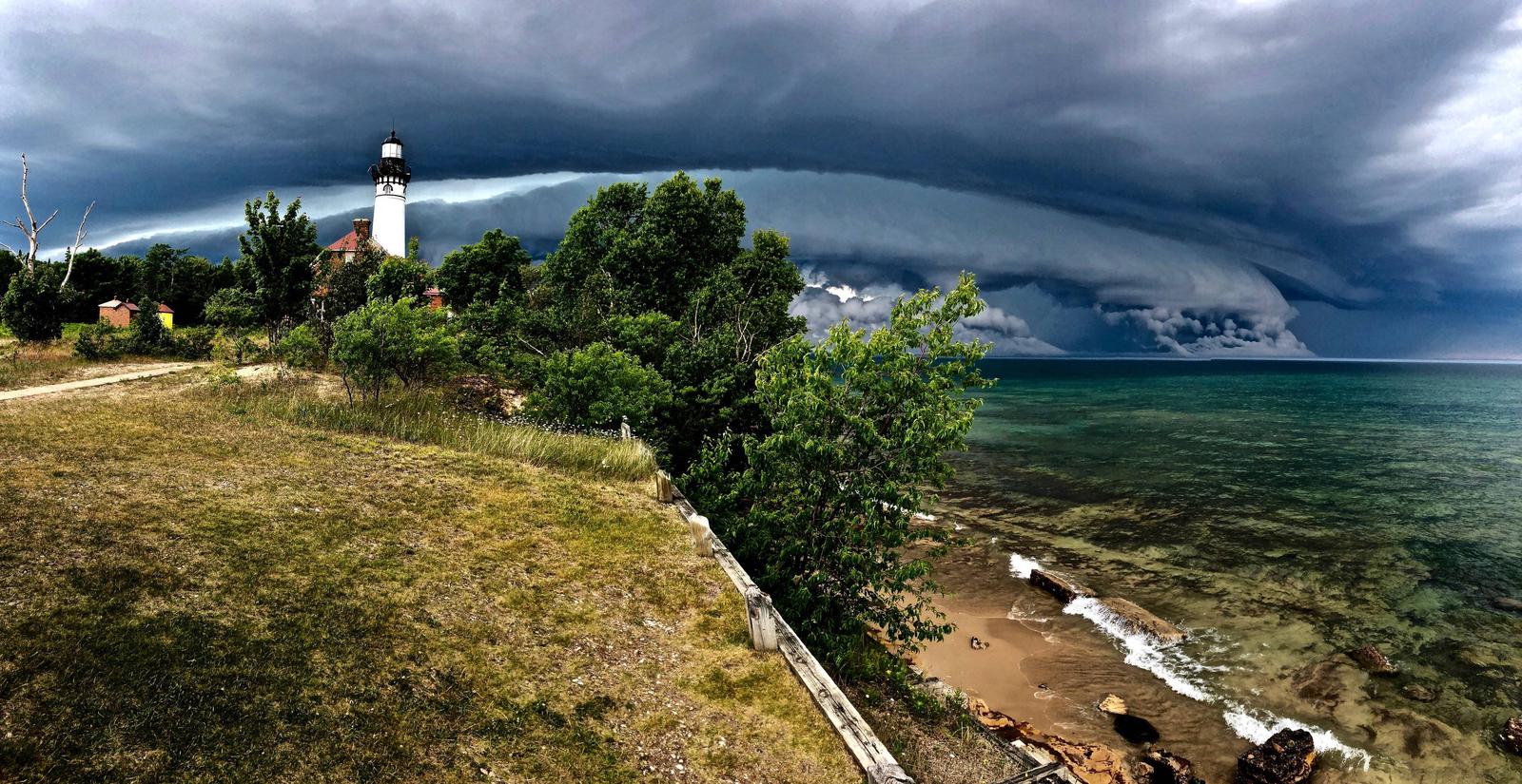
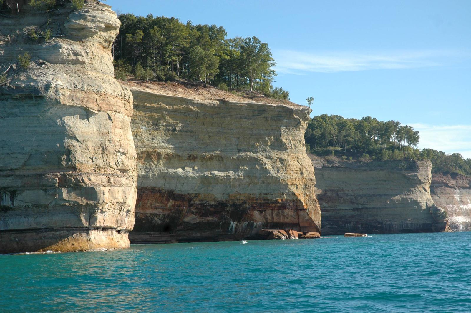
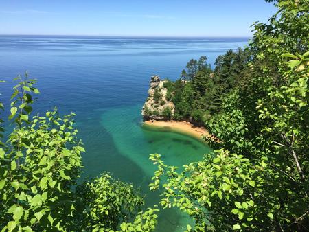
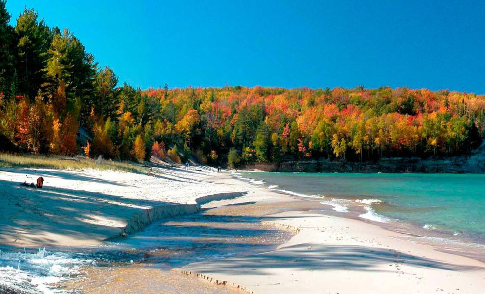
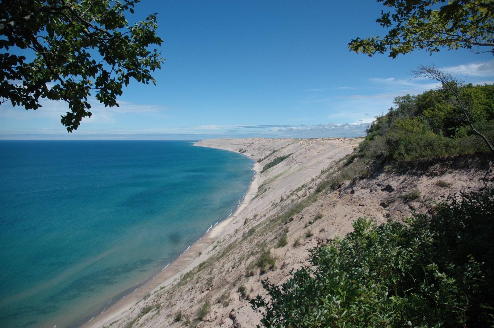
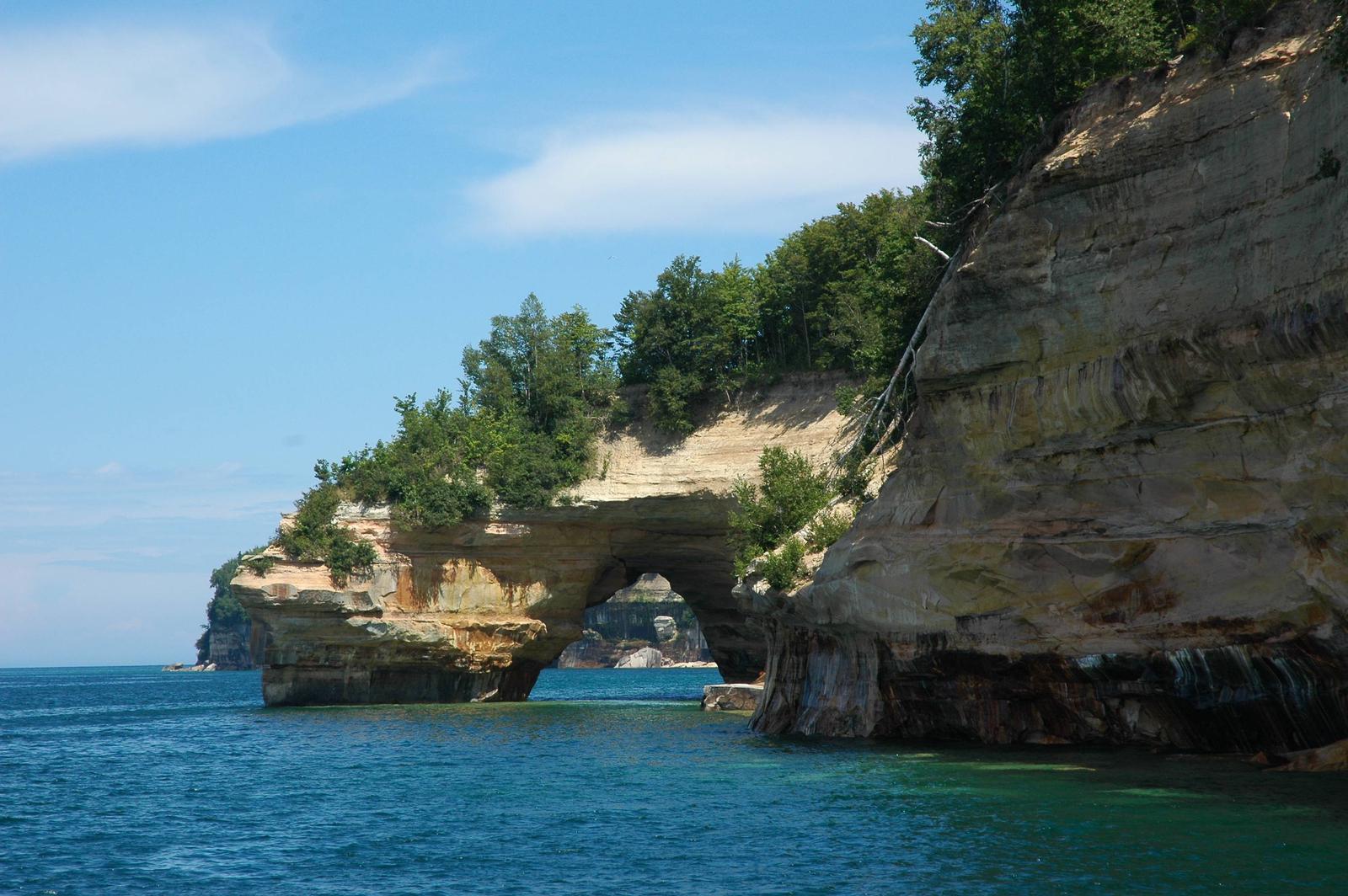
Pictured Rocks National Lakeshore hugs the Lake Superior shoreline for more than 40 miles along Michigan’s northern coast. Lake Superior is the largest, deepest, coldest, and most pristine of all the Great Lakes. In addition to boating and kayaking on the lake, the park’s backcountry offers nearly 100 miles of walking and hiking trails and opportunities for solitude, inspiration, physical challenge, renewal, and camping. Access to Pictured Rocks’ backcountry is primarily along the ‘Lakeshore Trail’, a part of the 42-mile long North Country National Scenic Trail where you can experience forests, dunes, beaches, waterfalls and wonderful panoramic views. Bicycles and motorized vehicles are prohibited. A backcountry camping permit is required year-round for all overnight trips into the Pictured Rocks National Lakeshore backcountry. Permits are not required for day hiking. Backcountry Camping To assist in planning an overnight backcountry trip into Pictured Rocks National Lakeshore, take time to carefully plan and prepare for your adventure. Pictured Rocks offers fourteen backcountry campgrounds , all of which require a backcountry camping permit: Cliffs, Potato Patch, Mosquito River, Chapel Beach, Coves, Lowney Creek, Beaver Creek, Pine Bluff, Trappers Lake, Sevenmile Creek, Benchmark, Au Sable Point East, Masse Homestead, and Grand Sable Lake Boat-In. The backcountry campgrounds are accessed by hiking or kayaking only. You cannot reach these back country campgrounds by vehicle. Shuttle services are available. Permit holder must print and retain one copy of the permit when hiking to the campground; permit must be visibly secured to tent at campsite. You will be assigned a campsite number at every backcountry campground. Permit holder may have only one permit reserved at one time. Camp only in designated sites and follow permit itinerary. You must camp within 15 feet of the numbered post at your chosen campsite. Individual campsites are available for groups of 1-6 people (2 tents or 2 hammocks maximum, or 1 tent and 1 hammock). Groups of 7-20 people and up to a 10 tent max must camp in designated group sites. Campgrounds are located at two to five mile intervals along the Lakeshore Trail. Each campground has a specific capacity; campsites within each backcountry campground are identified by a numbered post. Commercial transportation is available for hikers wishing to take a bus to the starting point and hike back to their vehicle. Learn about authorized shuttle service options within the park.
Charges & Cancellations
Cancellation Policy:
Prior to printing your permit, you may cancel any time before your reservation date and receive a 50% refund of all backcountry camping permit fees ($5 per person, per night). The $15 reservation fee is non-refundable. If you have printed your permit, there are no refunds.
Change Policy:
Prior to printing your permit, you may make changes to your permit before your reservation date. Changes may be made to the group size, campground, and the duration of your trip. An additional $15 non-refundable fee will be charged for changes.
Changes may be made to the group size through your Recreation.gov account or through the Call Center and may incur additional backcountry camping permit fees or be refunded these fees depending on whether you increase or decrease your group size. If decreasing your numbers, you will receive a full refund of the backcountry camping permit fees for the numbers you are decreasing only.
A change to the duration of the trip or campground may only be made through the Call Center. For changes to the duration of the trip, you may incur additional backcountry camping permit fees or be refunded these fees depending on whether you increase or decrease your number of nights. If decreasing your numbers, you will receive a full refund of the backcountry camping permit fees for the numbers you are decreasing only.
To change your entry date, you must cancel your permit and reserve a new permit. All fees apply.
No Show Policy:
If you do not print your permit by 11:59 p.m. on the first day of your scheduled trip, your entire backcountry camping permit will be canceled. No refunds. Please cancel your reservation if you are unable to use it to open space for others.