RAVEN CLIFF PICNIC SHELTER, VA Campground Reservation, Info, Images, Map, Directions

RAVEN CLIFF PICNIC SHELTER, Virginia Campground Images, Info & Reservations

Listen

Directions

Raven Cliff Campground is located in Wythe County, Virginia approximately 16.5 miles southeast of Wytheville. From I-81 take exit 67, 70, or 72 at Wytheville onto US 11 (Main Street). On the west end of town, US 11 turns off and Main Street becomes US 21 south. Follow US 21 south for approximately 11.5 miles to Virginia State Route 619 at Speedwell. Turn east on VA 619 and go about 7 miles to the campground.

Phone

276-783-5196

Activities

BIKING, BOATING, HISTORIC & CULTURAL SITE, CAMPING, FISHING, HIKING, WATER SPORTS, WILDLIFE VIEWING

Keywords

Raven Cliff Campground Shelter,Raven Cliff Shelter

Related Link(s)

Rec Area Info & Images

Virginia State Tourism

Virginia State Road Conditions

Overview

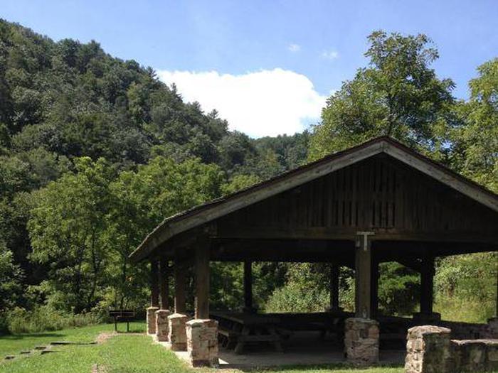
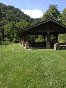
Located in Raven Cliff Campground, enjoy this large shelter for your next gathering! Along with the amenities of the shelter, it adjoins a large field for games, the rushing waters of Cripple Creek for wading and fishing, hiking trails, and the historic Raven Cliff Furnace. Primitive camping is also available for $5.00 per night on a first-come, first-served basis.

Recreation

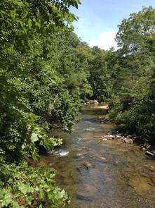
Besides the available primitive campsites, Cripple Creek runs through the picnic area and is popular for fishing, wading, and tubing. There are large open fields that are great for sports and picnics.

Facilities

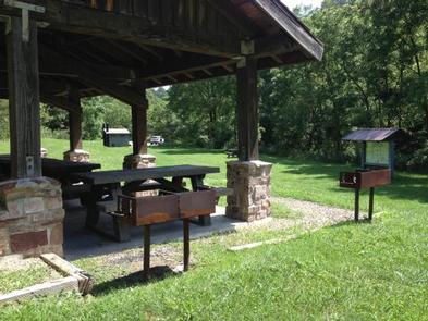
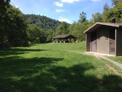
A wooden picnic shelter that accommodates groups up to 75 people and 15 cars with overflow parking nearby. No drinking water available. The shelter contains picnic tables, grill, and parking. There are available vault toilets. Primitive campsites available for camping.

Natural Features

From the 200-foot sandstone Raven Cliff to the 1810 historic iron ore furnace, this recreation area is off the beaten path, but worth the effort.

Nearby Attractions

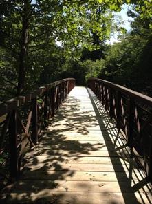
Cripple Creek for fishing or wading. A trail follows along Cripple Creek to the historic Civil War Era Raven Cliff Furnace.

Reservation

More from CampingHiking.net:

SARAH TOTTEN CAMPGROUND, California Campground Images, Info & Reservations

Listen Directions From I-5, take exit 786 to Highway 96 (Klamath River Highway). Follow Highway 96 west for about 35 miles. The campground entrance is on the right, about 1 mile east of Hamburg, CA. Phone 530-493-2243 Activities CAMPING, FISHING, SWIMMING, WHITEWATER RAFTING Keywords SATO,KLAMATH NF – FS Related Link(s)

UPPER WOLF CREEK GROUP, Arizona Campground Images, Info & Reservations

Listen Directions From Phoenix, Arizona: Traveling Northbound on I-17 take Exit 262 onto Hwy 69 North to Prescott and cointnue on Hwy 69 for 41 miles. Turn onto South Mt. Vernon Avenue (a.k.a Senator Highway) and drive south for about 6 miles. Pass the entrance to Goldwater Lake and the

APGAR GROUP SITES, Montana Campground Images, Info & Reservations

Listen Directions Located 1 mile northeast of the west entrance near West Glacier, Montana. Access is from U.S. Highway 2, approximately 32 miles northeast of Kalispell, Montana. Phone 406-888-7800 Activities BIKING, BOATING, CAMPING, INTERPRETIVE PROGRAMS, FISHING, HIKING, VISITOR CENTER, WILDLIFE VIEWING, DAY USE AREA, SWIMMING SITE Keywords Apgar Campground,Apgar,Glacier,Glacier National

DEVIL CREEK CAMPGROUND, Montana Campground Images, Info & Reservations

Listen Directions From Hungry Horse head east on US Hwy 2 approximately 45 miles. From East Glacier Park, take US Hwy 2 west for approximately 19 miles to campground. Phone 406-752-7924 FOR RESERVATIONS CALL: 1-877-444-6777 Activities BIKING, CAMPING, FISHING, WATER SPORTS, WILDLIFE VIEWING Keywords Related Link(s) Rec Area Info &

TIMBERLINE CAMPGROUND, Colorado Campground Images, Info & Reservations

Listen Directions From Denver, Colorado, take Highway 285 southwest to Park County Rd. 58. Turn right at County Rd. 58 and follow road to Forest Road 125. Turn right and follow road about 0.5 miles to the campground entrance. Phone 303-275-5610 Activities BIKING, CAMPING, FISHING, HIKING, HUNTING, WILDLIFE VIEWING Keywords

BALD BUTTE LOOKOUT, Oregon Campground Images, Info & Reservations

Listen Directions From the Paisley District Office, travel 0.5 miles north on Highway 31 and turn left on Mill Street. Stay on Mill Street to the Y junction (turns into gravel at this point) , then turn right on Forest Road 3315. Continue on Forest Road 3315 for 21 miles.