

Directions
From Sisters, OR: Travel 9.6 miles northwest on Highway 20, then 13.6 miles north on Forest Road 14.
Phone
541-323-1746
Activities
CAMPING
Keywords
Related Link(s)
Overview
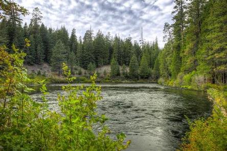
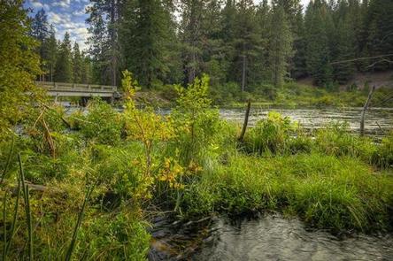
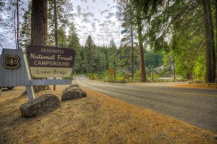
Lower Bridge Campground earned its name for being located on the Metolius River where it flows under the corresponding bridge. You can’t miss the beauty of this campground with its towering ponderosa pines and incense cedars providing ample shade.
Recreation
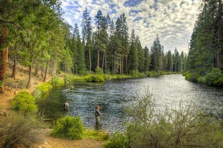
Hiking and fishing top the list of recreational activities for visitors.
For anglers, the spring-fed Metolius river offers a stunning setting for fly-fishing. The clear, cold water supports rainbow trout, whitefish, bull trout and kokanee salmon.
For day hikers and backpackers, the area offers a wide variety of scenic terrain, ranging from riverside trails to routes in subalpine forests.
Facilities
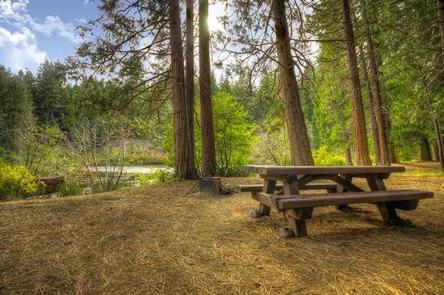
Lower Bridge Campground can accommodate RV, trailer or tent-campers however water and electric hookups are not available. All sites are equipped with a picnic table and campfire ring with grill and the campground has vault toilets and drinking water available.
Natural Features
The headwaters of the adjacent Metolius River are at Metolius Springs at the base of Black Butte, a 3,076-foot cinder cone. The clear, cold river flows north from the springs through diverse coniferous forest and a landscape of volcanic activity. The area provides habitat for mammals such as mule deer, coyote and cougar. Migratory birds and native fish also call the area home.
Nearby Attractions
The Camp Sherman Fish Viewing Platform allows visitors the chance to view a variety of types of fish while the Metolius Research Natural Area gives bird watchers ample opportunities. Visit the Metolius Fish Hatchery or Wizard Falls Fish Hatchery display ponds to observe and feed different types of salmon and other fish.
The Metolius-Windigo Trail, open to hikers, bikers and horses, is more than 100 miles in length and begins near the Metolius River headwaters west of the town of Sisters, Oregon. The trail was created in the 1980s primarily to serve long-distance horse riders seeking an alternative to the Pacific Crest Trail.
Lava Lands Visitor Center in nearby Bend, Oregon, and the unique geological landscape of Newberry National Volcanic Monument draw visitors to the region as well. It is a great starting point for visitors to learn about the diverse landscape and history of the area through interpretive programs and exhibits. Visitors can also explore the Lava River Cave, located in the Newberry National Volcanic Monument. At 5,211 feet in length, the northwest section of the cave is the longest continuous lava tube in Oregon.