

Directions
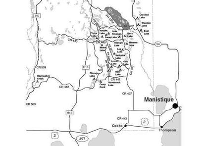
From the Intersection of US-2 and Forest Highway 13 (about 14 miles east of Rapid River or 22 miles west of Manistique), drive north 8.4 miles on Highway 13 to CR 442. Turn right (east) and drive 5 miles to County Road N-3. Turn left (north) on N-3 and drive 0.1 mile to FR 2422 turning left (northwest) on to 2422 and continuing about 0.25 mile to the campsites.
Phone
906-474-6442 OR 906-387-2512
Activities
CAMPING
Keywords
Dispersed campsites,Manistique,Rapid River,lyman lake,swan lake,bass lake,bear lake,camp cook,carr lake,chicago lake,clear lake,crooked lake,east lake,gooseneck lake,ironjaw lake,jackpine lake,lake nineteen,leg lake,little bass lake,minerva lake,mowe lake
Related Link(s)
Michigan State Road Conditions
Overview
The Rapid River/Manistique campsites are located on inland lakes and are in a rustic forest environment with few, if any amenities. The rustic environment offers a wonderfully serene and peaceful setting for your next campout
Recreation
Visitors will be able to enjoy swimming, berry picking, and fishing at these campsites. Licenses are required for fishing in Michigan waters. Some of these campsites offer only one site on these inland lakes allowing for a very peaceful and wilderness-like experience.
Facilities
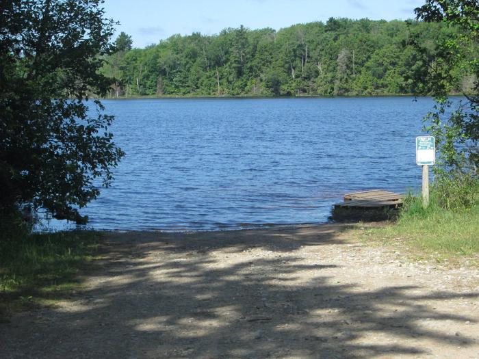
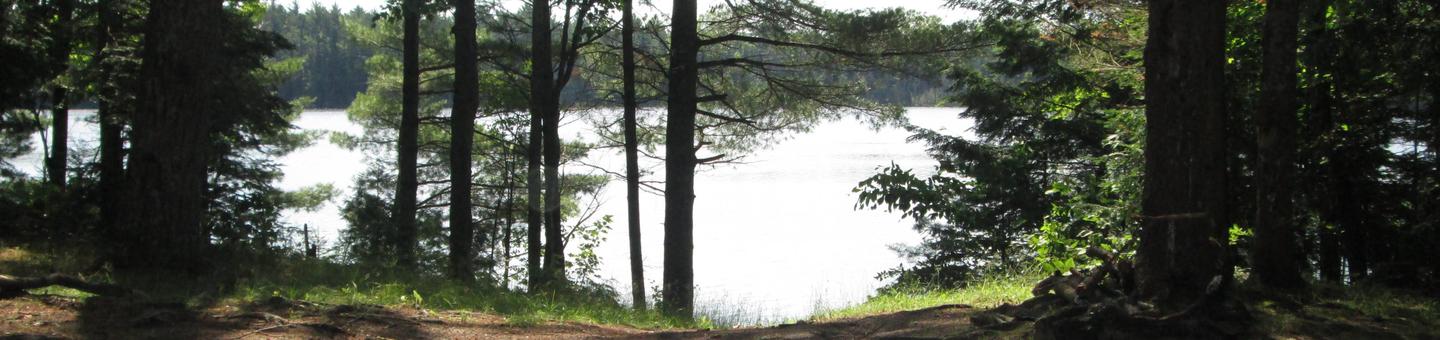
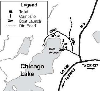
Even though Chicago Lake (188 acres) is a busy lake, you can still see and hear loons. Four campsites and an improved boat launch can be found on Chicago Lake, all clustered around its north end.
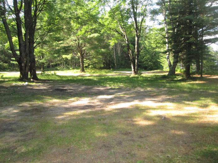
Site #1 is small (20 ft x 15 ft), heavily wooded and isolated. The access road is poor and a 4 wheel drive and tents are recommended. This site is suitable for one family only and is desired by those looking for privacy from other campers. Swimming is considered to be poor.
Site #2 is in an open area. It is 55 ft. by 45 ft. and can accommodate 2 families and trailers. There is a primitive toilet at this site. Swimming is fair.
The road to sites #3 and #4 is shared by anglers using the boat launch, and site #4 is adjacent to the launch site so it can be busier than the other campsites. Site #3 is surrounded by tall pines and is near the lakeshore. It is 60 ft. by 50 ft. and is suitable for two families. Trailer access is difficult, however because of limited turning area. Site #4 is a semi-open area that is 55 ft. by 50 ft. and can accommodate two families and trailers. A primitive toilet is shared with site #4. Swimming conditions are good at these sites.
The boat launch is located adjacent to site #4 and features an improved gravel ramp for accessing its good population of northern pike and bluegills. Largemouth bass and perch are also present.
Groceries, gasoline, fishing and camping supplies, ice, and deli are available seven miles northeast on County Road 437 in the Thunder Lake Area.
| Lake Name | Number of Sites | Maximum number of people per site | Toilets | Boat Access | Lake Size (acres) |
|---|---|---|---|---|---|
| Chicago Lake | 4 | Site1 (8) Sites 2-4 (1) | Yes | BI | 188 |
Natural Features
All of these sites are nestled in hardwood trees and pines. All of them are on small inland lakes, which offer a wide variety of fishing opportunities. There is one exception; Camp Cook, which is close to the Fishdam River and provides opportunities for good brook trout fishing.
Nearby Attractions
There are a number of horse, bike, and hiking trails within minutes of several of the sites. In over a mile from these campsites, visitors can expect to find: bait shops, general and grocery stores, gas, a pay phone, trailheads, a fishing pier, biking, and kayak/canoe rentals.