Huckleberry Campground, ID Campground Reservation, Info, Images, Map, Directions

Huckleberry Campground, Idaho Campground Images, Info & Reservations

Listen

Directions

From St. Maries, ID go south on Highway 3 for a half mile then turn right (east) onto the St. Joe River Road. Once on the St. Joe River Road travel for approximately 29 miles.

Phone

208-769-5000

Activities

CAMPING, FISHING, RECREATIONAL VEHICLES, WILDLIFE VIEWING, WATER ACCESS

Keywords

None

Related Link(s)

Rec Area Info & Images

BLM Idaho Twitter

Overview

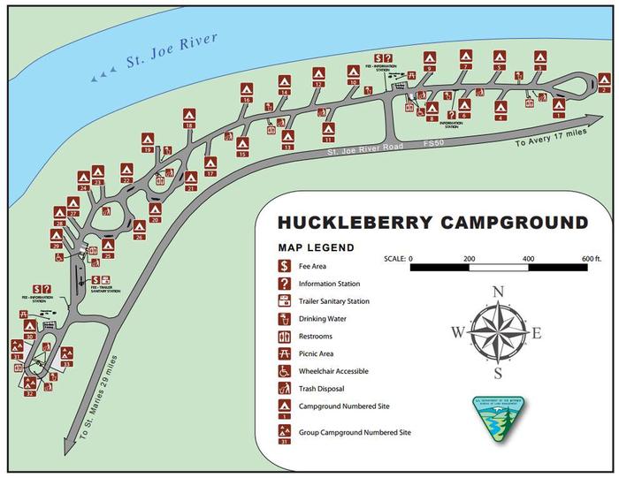
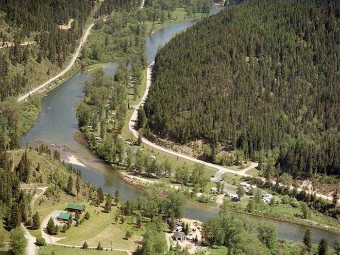
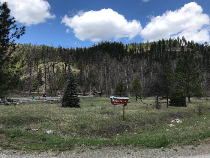
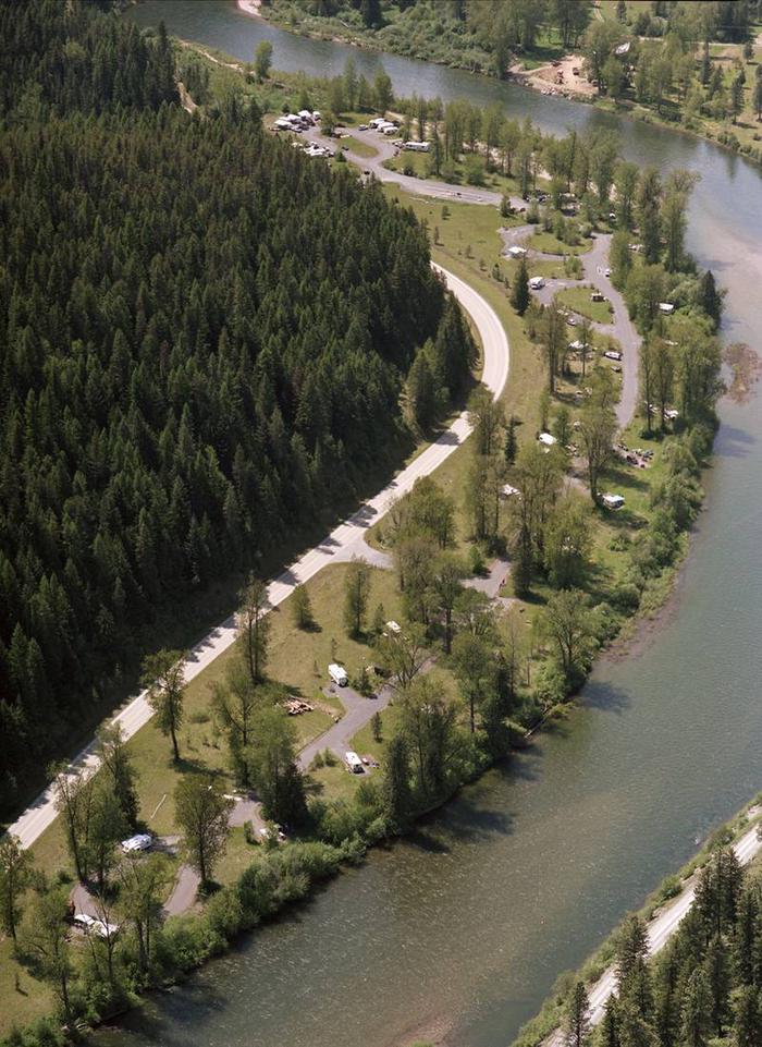
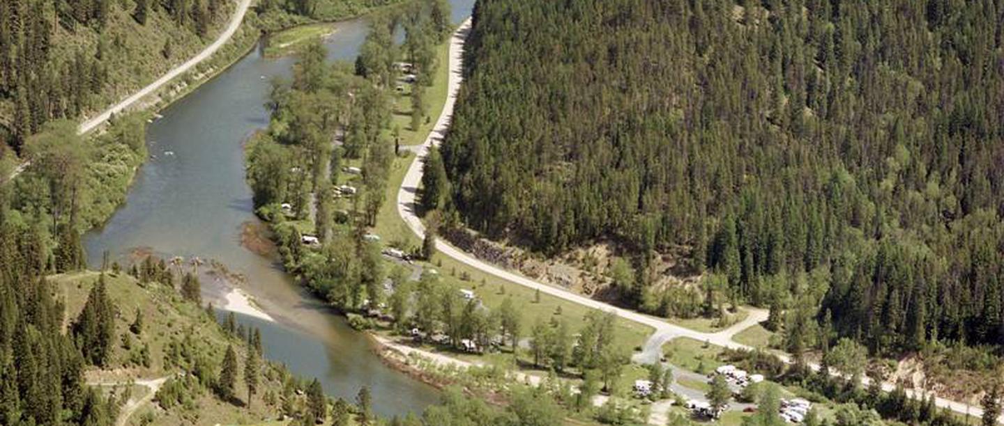
Huckleberry Campground is located along the shores of the St. Joe River, 29 miles east of St. Maries, Idaho on the St. Joe River Road. Reserve a campsite here: https://www.recreation.gov/camping/campgrounds/273785/campsites

Recreation

RV Camping, Fishing, Wildlife Viewing. In close proximity to Forest Service lands

Facilities

The Huckleberry Campground has 33 camp sites; 30 sites have a maximum capacity of four vehicles and 15 people, and three group sites that have a maximum capacity of six vehicles and 25 people. Sites 1-30 each have paved parking, potable water, electricity, picnic table, and a camp fire ring. The group sites (31-33) each have a gravel parking site, three potable water and electric hook ups, two picnic tables, and two fire rings. The campground has six concrete outhouses, an undeveloped boat ramp, and an RV waste dump station.  

Natural Features

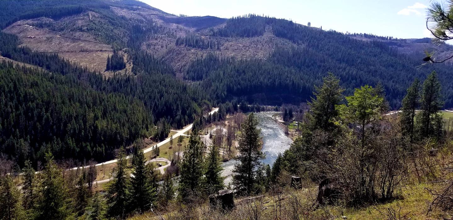
Riverfront Campground

Nearby Attractions

The campground’s location serves as a central hub for campers and recreationists recreating along the river between Calder and Avery Idaho. Multiple hunting, fishing, and ATV/UTV user groups travel to the campground and use it to access the nearby miles of US Forest Service and Idaho Department of Lands (IDL) roads. The campground also serves as a central location to stage for fishing and floating trips.

Reservation

More from CampingHiking.net:

GRAYS MEADOWS, California Campground Images, Info & Reservations

Listen Directions Grays Meadows is 6 miles west of the town of Independence, California. Take U.S. Highway 395 to Independence. Turn west on Market Street (which turns into Onion Valley Road) and follow for 6 miles. The first gate accesses sites 36-52. The second gate is 0.25 miles up the

SPENCER BENCH CABIN, Alaska Campground Images, Info & Reservations

Listen Directions To catch the train (reservations required) into the Spencer Whistle Stop, drive south from Anchorage on the Seward Highway to the Portage Rail Depot (Milepost 80) and check in at the Train station. In the winter months there are 2 snowmachine parking lots at Seward Highway Milepost 78

LeBaron Campground, Utah Campground Images, Info & Reservations

Listen Directions Travel east of Beaver approximately 10 miles on SR 153, turn right on to Forest Road 137 for about 10 miles. Phone 435-438-2436 Activities CAMPING, FISHING, WILDLIFE VIEWING Keywords LEBARON CAMPGROUND,LEBERON,LABARON Related Link(s) Rec Area Info & Images Utah State Road Conditions Utah State Tourism Overview LeBaron Campground

EAGLE GLACIER CABIN, Alaska Campground Images, Info & Reservations

Listen Directions Located 23 miles northwest of Juneau. Access by the Amalga trail, 5.5 miles to the cabin from mile marker 27.3 on the Glacier Highway. The trailhead is on the north end of Eagle River Bridge and follows upstream on north side of Eagle River. The cabin is also

BLACKBERRY, Oregon Campground Images, Info & Reservations

Listen Directions From Waldport, Oregon, take State Route 34 east about 18 miles and turn right at the sign for the campground. Phone 541-528-7424 Activities BIKING, BOATING, CAMPING, FISHING, HIKING, CANOEING, BERRY PICKING, CRAWFISHING Keywords BLBE,SIUSLAW NF – FS Related Link(s) Rec Area Info & Images Oregon State Road Conditions