

Directions
From the North: From I-40 take Exit 20 Maggie Valley, NC and travel US-19 towards Cherokee, NC. Access the Blue Ridge Parkway at Soco Gap and continue South to mile 458.2, turning right onto Heintooga Ridge Road. Enter Great Smoky Mountains National Park at Black Camp Gap and continue 9 miles to Balsam Mountain Campground. From the South: Follow US-441/US-23 North. At Dillsboro merge onto US-74 West/US-441 North. At exit 74 merge onto US-441. Continue on US-441 through Cherokee, NC and into the park. Access the Blue Ridge Parkway traveling North to mile 458.2, turning left onto Heintooga Ridge Road. Enter Great Smoky Mountains National Park at Black Camp Gap and continue 9 miles to Balsam Mountain Campground.
Phone
828-497-9270
Activities
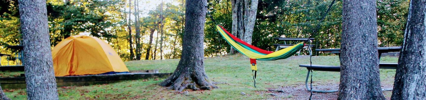
BIKING, CAMPING, HIKING, WILDLIFE VIEWING
Keywords
Related Link(s)
North Carolina State Road Conditions
Overview
Balsam Mountain Campground is located in a relatively remote part of Great Smoky Mountains National Park. The secluded setting offers visitors the ability to enjoy a multitude of recreational activities without the crowds which are sometimes common in other parts of the park.
Recreation
Great Smoky Mountains National Park is a hiker’s paradise, with over 800 miles of maintained trails ranging from short, leg-stretchers to strenuous treks. The Balsam Mountain area features several trails that are less heavily used compared to other areas of the park.
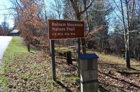
The campground offers a short nature trail located beside site 43. The hiker only Flat Creek Trail is a pleasant walk through a hardwood forest. For the adventurous hiker the Hemphill Bald and Rough Fork trails provide a 14-mile loop hike, with outstanding views and old growth trees.
Campers can enjoy high-quality backcountry fishing in the cool waters of the countless streams and rivers that snake through the mountains. Anglers will agree that some of the best trout fishing in the area can be found along the Balsam Mountain and Straight Fork Roads, some of the most remote sections of the park. Fly fishing is particularly good during spring months when aquatic insects hatch in large numbers.
Wildlife viewing is a popular pastime, and with around 1,500 bears living in the park, it is not uncommon for visitors to spot one. The park is a sanctuary for a magnificent array of animal and plant life, all of which is protected for future generations to enjoy.
The park also holds one of the best collections of log buildings in the eastern United States. Over 90 historic structures have been preserved in the park.
For the auto touring enthusiast, the 14-mile Heintooga Round Bottom Road, a one-way unimproved gravel drive, offers spectacular scenery with mountain vistas and the occasional bear or elk sighting. Buses, motorhome, vans longer than 25′ and any vehicle towing a trailer are prohibited on this road.
Facilities
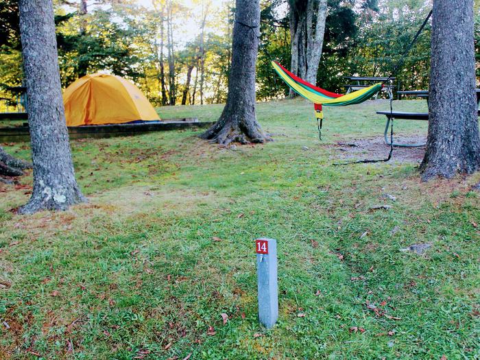
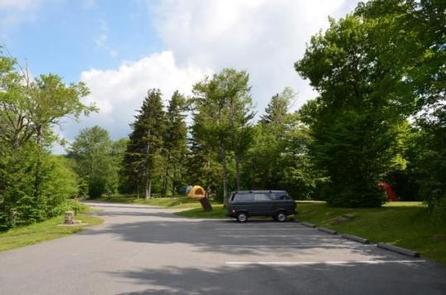
Balsam Mountain Campground offers 42 campsites for a traditional outdoor camping experience with the added convenience of flush toilets and drinking water. There are no hookups or showers at the campground. No lights are available in the restrooms at this campground. For campers’ safety use of a flashlight, lantern or headlamp is recommended when accessing these facilities after day light hours.
Natural Features
Balsam Mountain Campground is surrounded by picturesque mountain ranges and pristine mountain streams. Elk are common in this part of the park during the spring and fall. Located at 5,310 feet elevation, Balsam Mountain’s daytime temperatures rarely exceed 70 degrees F and night time temperatures may dip into the low 50’s.
Nearby Attractions
Nearby attractions include: Maggie Valley, NC, Cherokee, NC, the Oconaluftee Visitor Center, the Mountain Farm Museum, the Blue Ridge Parkway, the Nantahala Outdoor Center, the Bryson City Railway and Asheville, NC