Directions
To reach Turkey Creek, drive 15 miles northwest of Safford on Highway 70. Turn west on Aravaipa-Klondyke Road and go approximately 40 miles, passing through the town of Klondyke, to the Aravaipa Canyon trailhead parking lot. From there, continue on the road, which turns left up Turkey Creek.
Phone
(928) 348-4400
Activities
AUTO TOURING, CAMPING, FISHING, HIKING, WILDLIFE VIEWING, PHOTOGRAPHY
Camping Reservations
Reserve your campsite at these camping areas:
Hiking Trails
Looking for nice hiking areas to take a hike? Choose from these scenic hiking trails:
Related Link(s)
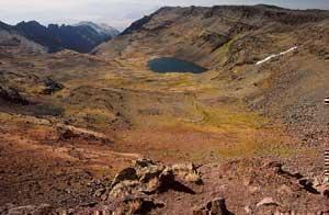
Nestled in the northern foothills of the Galiuro Mountains of southeastern Arizona lies Turkey Creek, a small riparian canyon that flows into Aravaipa Creek. Lined with large sycamore, Arizona walnut, and Arizona white oak trees, this narrow canyon provides a quiet retreat for picnicking and camping. Numerous small pull-outs along the three-mile length of the canyon are perfect for primitive camping. Day hiking is easy along the canyon bottom, a jumping off point to the east entrance of Aravaipa Canyon Wilderness. Colorful birds, as well as an occasional deer, javelina, or even a coatimundi, can be seen on early morning walks along the dirt road. A short trail leads to a prehistoric cliff dwelling; remnants of 120 years of homesteading and ranching are visible in the canyon. Due to its rich natural and cultural resources, part of Turkey Creek has been identified as an Area of Critical Environmental Concern by BLM.
The Turkey Creek cliff dwelling is one of the most intact structures of its kind in southeastern Arizona. It was probably occupied for a few months each year by prehistoric farmers around 1300 A.D. These people, of the Salado culture, probably collected plants along Turkey Creek, grew corn, and hunted wild animals. Salado farmers disappeared suddenly around 1450 A.D.
Access to Turkey Creek is via a dirt road that is maintained by Graham County. Conditions vary with seasonal precipitation and may require high-clearance vehicles and sometimes four-wheel drive. Restrooms are located at a small parking area near the wilderness boundary; maps and information about the wilderness are available at the BLM ranger station in Klondyke.
Restrooms and general information at the wilderness parking lot, additional information at the ranger station in Klondyke, developed campsites at Fourmile Canyon Campground in Klondyke, interpretive sign at cliff dwelling.