Directions
From Interstate 5 at Williams, continue north on the Interstate for approximately 20 miles; exit at Road 68. At the Road 68 and Highway 99W interchange, turn north and travel approximately 1.6 miles to the Refuge entrance. For southbound travelers, exit Interstate 5 at County Road 57. Turn east over the overpass to Highway 99W. Drive approximately 4.5 miles south to the Refuge entrance.
Phone
530-934-2801
Activities
AUTO TOURING, INTERPRETIVE PROGRAMS, HIKING, HUNTING, VISITOR CENTER, WILDLIFE VIEWING
Camping Reservations
Reserve your campsite at these camping areas:
Hiking Trails
Looking for nice hiking areas to take a hike? Choose from these scenic hiking trails:
Related Link(s)
More California Recreation Areas
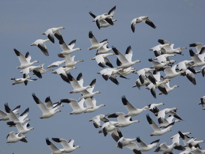
The Sacramento National Wildlife Refuge is the headquarters for the Sacramento National Wildlife Refuge Complex and is one of six refuges located in the Sacramento Valley of north-central California. The refuge is approximately 90 miles north of Sacramento, adjacent to Interstate 5. The 10,783-acre refuge consists of about 7,600 acres of intensively managed wetlands, uplands, riparian habitat, and vernal pools. It typically supports wintering populations of more than 600,000 ducks and 200,000 geese. More than 95 percent of the wetlands of the central valley have been lost in the last 100 years, and waterfowl have become increasingly dependent upon the refuges of the Sacramento Valley. The refuge supports several endangered plants and animals, including transplanted colonies of palmate-bracted bird’s-beak, several species of fairy shrimp, vernal pool tadpole shrimp, giant garter snake, wintering peregrine falcon, bald eagle, and breeding tricolored blackbird. Resident wildlife includes grebe, heron, blackbird, golden eagle, beaver, muskrat, black-tailed deer, and other species typical of upland and wetland habitats. Approximately 9,000 people hunt on the refuge each year, and 73,000 people use the visitor center, auto tour route, and walking trail.


