Directions
Tule Lake Refuge is in northern California near the small town of Tulelake. Located 25 miles north of the refuge, Klamath Falls, Oregon, is the closest city. The refuge headquarters and visitor center is located on Hill Road., approximately 5 miles west of Tulelake, California. Hours are Monday through Friday, 8 a.m. to 4:30 p.m.; weekends and holidays, 10 a.m. to 4 p.m.
Phone
530-667-2231
Activities
AUTO TOURING, BOATING, INTERPRETIVE PROGRAMS, HIKING, HUNTING, VISITOR CENTER, WILDLIFE VIEWING
Camping Reservations
Reserve your campsite at these camping areas:
Hiking Trails
Looking for nice hiking areas to take a hike? Choose from these scenic hiking trails:
Related Link(s)
More California Recreation Areas
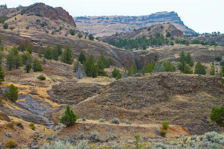
Tule Lake National Wildlife Refuge is located in the fertile and intensively farmed Tule Lake Basin of northeast California. It was established in 1928 by President Calvin Coolidge “as a preserve and breeding ground for wild birds and animals,” yet was still subject to conversion from wetland habitats to farmland under the Bureau of Reclamation’s Klamath Project. Under the Kuchel Act of 1964, wetland reclamation was stopped and Tule Lake Refuge was “… dedicated to wildlife conservation&for the major purpose of waterfowl management, but with full consideration to optimum agricultural use that is consistent therewith.” This 39,116- acre refuge contains 13,000 acres of open water surrounded by 17,000 acres of commercial croplands. The endangered Lost River and shortnose suckers, as well as bald eagle, live in or use this refuge. The refuge is a significant staging area for migrating waterfowl during spring and fall migrations. It is used primarily by white-fronted, snow, Ross, and cackling Canada geese, all of which nest in the Arctic tundra. Under the Kuchel Act, the refuge contains 15,500 acres of commercial croplands leased by the Bureau of Reclamation with oversight by the U.S. Fish and Wildlife Service. The main crops grown are small grains, potatoes, onions, sugar beets, and alfalfa. By law, no more than 25 percent of the refuge croplands can be devoted to row crops. The residual grain stubble left after harvest provides an important source of waste grain used as a food source by migrating waterfowl.

