

Directions
The main access points for the Upper Missouri are in Fort Benton, Loma, Coal Banks Landing, Judith Landing and James Kipp Recreation Area. In the town of Fort Benton river access points may be found at the Chouteau County Fairgrounds Canoe Launch and Campground (River Mile 0), and Fort Benton Boat Launch (River Mile 1.4). In Loma the Wood Bottom Recreation Area, accessed via Loma Bridge Rd east of US Highway 87 N features a campground, parking area and boat launch (River Mile 20.2). Coal Banks Landing Recreation Area (River Mile 41.5) is best accessed via Gardiner Rd, east of US Highway 87 N at mile marker 66.7. Coal Banks is the main and most popular launch point on the Upper Missouri. Judith Landing Recreation Area (River Mile 88.5) is best accessed via State Highway 236 (Judith Landing Rd), east of US Highway 87 N at Big Sandy, MT. James Kipp Recreation Area is the terminus of the Upper Missouri National Wild and Scenic River and main takeout point for boaters boating the badlands section of the river. Upstream travel restrictions are in effect from June 15 through September 15 annually.
Phone
406-622-4000
Activities
AUTO TOURING, BOATING, INTERPRETIVE PROGRAMS, FISHING, HIKING, HUNTING, PICNICKING, WILDLIFE VIEWING
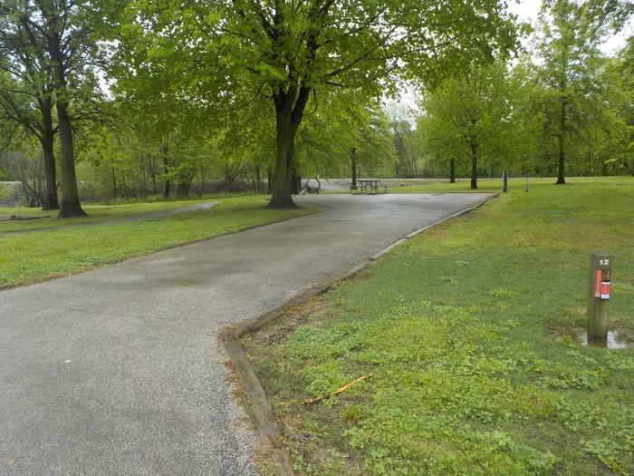
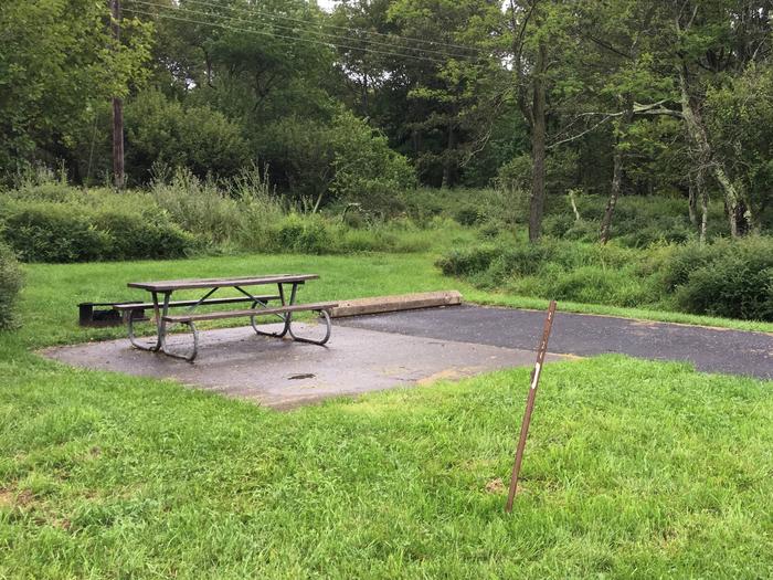
Camping Reservations
Reserve your campsite at these camping areas:
Hiking Trails
Looking for nice hiking areas to take a hike? Choose from these scenic hiking trails:
Related Link(s)
Upper Missouri River Breaks National Monument
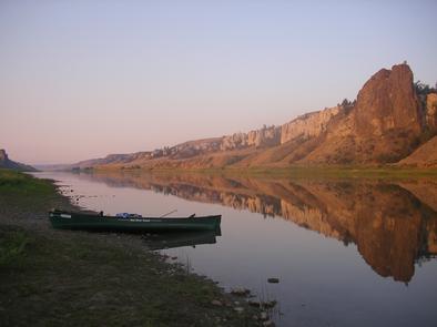
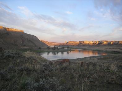
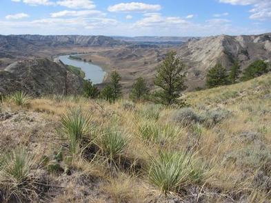
The Upper Missouri National Wild and Scenic River Management Plan highlights; the uniqueness, special values and wild and scenic qualities that were instrumental in the designation on October 12, 1976. Of special note is the fact that the Upper Missouri contains segments of all three river classifications contained in the Wild and Scenic Rivers Act of 1968. These classifications are Wild, Scenic and Recreational. To this day the Upper Missouri remains relatively unchanged and its settings vary from riparian vegetation, to the unique and beautiful White Cliffs, to the sharply carved and rugged Badlands, to the rolling, pine and juniper covered slopes of the Breaks. These contrasting habitats provide for a diverse and plentiful wildlife population, numerous recreational opportunities, livestock grazing and other multiple use activities. Though the Upper Missouri lacks the stimulating whitewater runs much sought after by thrill seekers it more than makes up for the river runners fix with its mesmerizing glimpse of the American west as it once was.
For the family who plays together, the Upper Missouri caters to boaters of all degrees, from the beginning novice to the expert paddler to the leisurely motor boat aficionado. Visitors embark into a capacious river corridor that seemingly swallows even the largest groups and are treated to a remoteness not often found in the 21st Century. Optimum periods for boating are May through September with fishing and hunting use replacing leisure boating during the shoulder seasons. Compared to other rivers in the Northwest visitation is relatively low with an annual average over the past ten years of about five thousand registered boaters during the boating season. With 149 miles of river and several public launch points to choose from, trip lengths may vary from one day to ten days or more. By far the most popular float, taking in the scenic White Cliffs, expends two nights with the takeout on the third day. In this section, visitors will find developed boat camps with vault toilets, fire rings and superb hiking opportunities, not to mention the hauntingly beautiful, geographic splendor of the region. For those with a few days to spare, an extension of this trip permits the adventurous sort to take in the even more remote and uniquely appealing, Breaks of the lower river section.
The contact point for any excursion on the Upper Missouri should begin by contacting the Lewistown Field Office or the Fort Benton River Management Station, co-located with the Upper Missouri Breaks Interpretive Center on the north bank of the river in Fort Benton, Montana.
The staff at this first rate facility can provide a wealth of information on the Monuments varied recreational opportunities, as well as other significant cultural, and historical sites in the surrounding area. Visitors not fully equipped to go it alone can enlist the aid of commercial outfitters, many of whom live locally and offer a plethora of services such as canoe rentals, fully guided canoe trips, motorized boat trips and vehicle shuttles.