
Directions
GPS: Lat: 35.139 Long: -106.711 From Interstate 40, take the Unser Blvd. exit (#154) proceed north 3 miles to Western Trail. Turn left or west onto Western Trail and follow road to the Visitor Information Center parking lot. From Interstate 25, take the Paseo del Norte exit (#232) and proceed west to Coors Road exit south (must be in center lane to veer left at the Y). Proceed south on Coors Road to Western Trail. Turn right or west onto Western Trail and follow road to the Visitor Info Center parking lot.
Phone
(505) 899-0205
Activities
HIKING
Camping Reservations
Reserve your campsite at these camping areas:
Hiking Trails
Looking for nice hiking areas to take a hike? Choose from these scenic hiking trails:
Related Link(s)
More New Mexico Recreation Areas
Petroglyph National Monument Official Website
Petroglyph National Monument Map
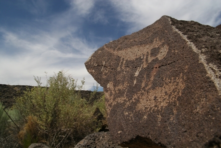
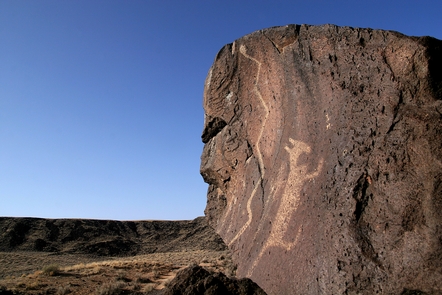
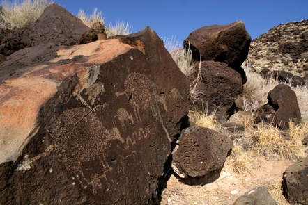
Petroglyph National Monument protects one of the largest petroglyph sites in North America, featuring designs and symbols carved onto volcanic rocks by Native Americans and Spanish settlers 400 to 700 years ago. These images are a valuable record of cultural expression and hold profound spiritual significance for contemporary Native Americans and for the descendants of the early Spanish settlers.