Directions
Rainbow Bridge National Monument is located between Glen Canyon National Recreation Area and the Navajo Nation. There are no roads in the vicinity of the monument. Rainbow Bridge can be reached by boat on Lake Powell or by hiking one of two trails around Navajo Mountain on the Navajo Nation, by permit only. Boat tours are available. The entrance to Forbidding Canyon is located at buoy 42 on Lake Powell. Boaters should be familiar with the Aids to Navigation (buoy) system and use a navigational map.
Phone
(928) 608-6200
Activities
BOATING, HIKING
Camping Reservations
Reserve your campsite at these camping areas:
Hiking Trails
Looking for nice hiking areas to take a hike? Choose from these scenic hiking trails:
Related Link(s)
Rainbow Bridge National Monument Official Website
Rainbow Bridge National Monument Map
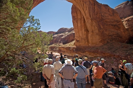
Rainbow Bridge is one of the world’s largest known natural bridges. The span has undoubtedly inspired people throughout time–from the neighboring American Indian tribes who consider Rainbow Bridge sacred, to the 85,000 people from around the world who visit it each year. Please visit Rainbow Bridge in a spirit that honors and respects the cultures to whom it is sacred.


