

Directions
Accessible year round, weather permitting. Located 15 miles west of Sitka on the southeast shore of Kruzof Island. Access is 30 minutes by boat from Sitka. Helicopter landing on the beach is possible at lower tides. Refer to USGS topographic maps Sitka A-5, A-6.
Boat access can only occur at certain stages of the tide. Please check current conditions prior to your trip. Click here for more information.
Erratic and abnormally large waves have been reported on Kruzof Island at low slack tide. Avoid approaching the beach by boat and unloading while the tide is turning. Non-boaters or out-of-town visitors are encouraged to use a local charter boat operator.
Phone
907-747-6671
Activities
CAMPING, FISHING, HIKING, HUNTING
Keywords
BREN,Brent’s,Brent’s Beach,Brents Beach,BRENT S BEACH CABIN,TONGASS NF – FS
Related Link(s)
Overview
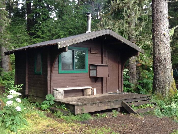
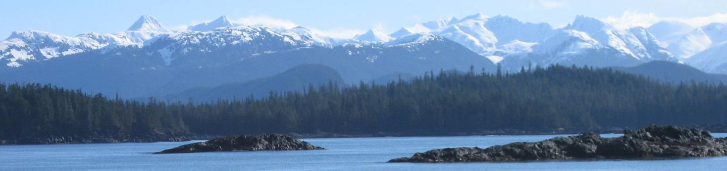
Brent’s Beach Cabin is located on the eastern shore of Kruzof Island in Crab Bay in the Tongass National Forest, 15 miles northwest of Sitka, Alaska. The cabin is open year-round and makes an excellent base to experience this beautiful corner of Alaska. Fred’s Creek Cabin is 5 miles south.
The original A-frame cabin located at this site was donated by a former Forest Service district ranger in memory of his teenage son, Brent, who along with two friends, drowned in Sitka Sound while halibut fishing in the early 1970s. In 1985, the current cabin replaced the well-worn A-frame.
This is a remote location. The cabin can be accessed only by boat or helicopter, weather permitting. Visitors are responsible for their own travel arrangements and safety, and must bring many of their own amenities.
Recreation
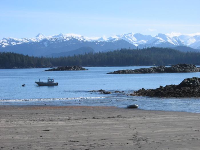
Visitors enjoy beachcombing, sunbathing and sculpting in the sands in front of the cabin, saltwater fishing in the bay and hunting deer in-season in the surrounding forest. Volcanic features are a 10-minute hike north of the cabin. Be sure to bring a compass. For information about fishing and hunting permits and seasons, visit the Alaska Department of Fish and Game website.
Facilities
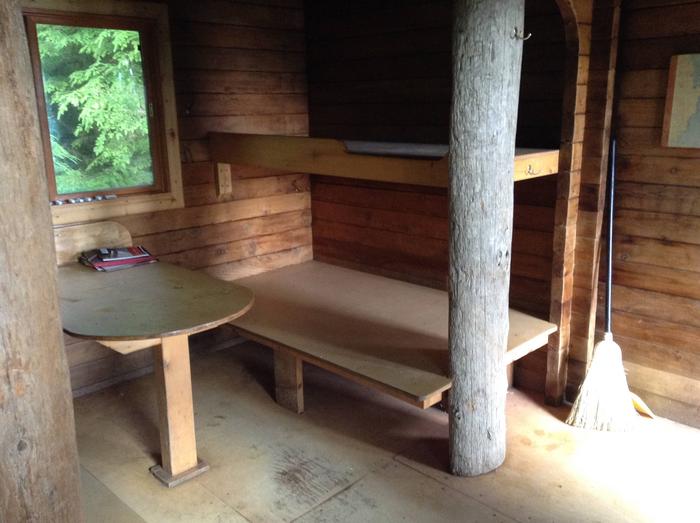
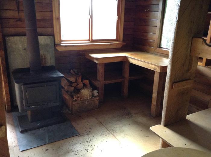
The one-room, Pan-abode-style cabin sleeps six and is furnished with two double plywood bunks and two single plywood bunks (no mattresses). The cabin includes a wood stove, axe or splitting mail, a table and benches, cooking counter, a broom and an outhouse toilet.
Guests should bring sleeping bags and pads, a cooking stove, pots, pans, plates, utensils, food, toilet paper, a lantern, garbage bags, a fire extinguisher, fire starter, raingear and rubber boots.
Water is available from the nearby inlet stream. Treat all water before using. It is recommended that visitors bring their own water.
A mooring buoy is provided on a first-come, first-served basis for boat anchorage. It can be used by cabin visitors or general forest users. Cabin reservation does not include exclusive use of the buoy. Mooring buoys are configured using a 4200-lb concrete block with 90 feet of 7/8th-inch stud link chain. Mariners are responsible for determining how suitable an anchoring system is for the size of their craft.
Click here for more cabin information and maps.
Natural Features
The cabin sits just inside timberline on a beautiful, sandy beach facing Crab Bay and is surrounded by a dense forest of spruce and hemlock. Brown bears frequent the area.