HOPEWELL LAKE CAMPGROUND, NM Campground Reservation, Info, Images, Map, Directions

HOPEWELL LAKE CAMPGROUND, New Mexico Campground Images, Info & Reservations

Listen

Directions

From Taos, New Mexico, take U.S. 64 about 40 miles west. The campground is on the south side of the road.

Phone

435-245-6521

Activities

CAMPING, FISHING, HUNTING

Keywords

CARSON NF-FS,Carson National Forest

Related Link(s)

Rec Area Info & Images

New Mexico State Road Conditions

New Mexico State Tourism

Forest Service Concessionaire

Overview

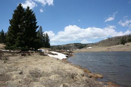
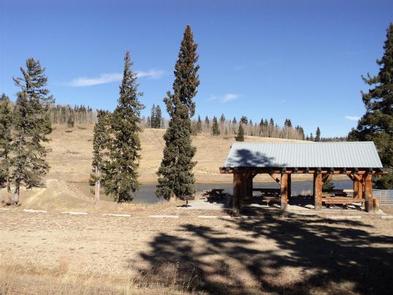
Hopewell Lake Campground sits next to its scenic namesake lake between Tres Piedras and Tierra Amarilla in northern New Mexico. Visitors enjoy horseback riding, hiking, fishing and canoeing.

Recreation

The 14-acre lake is perfect for canoeing and is regularly stocked with rainbow and brook trout. The Contiental Divide National Scenic Trail goes through the campgound, and is popular with horseback riders and hikers.

Facilities

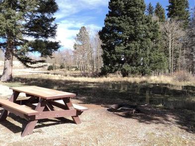
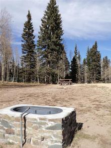
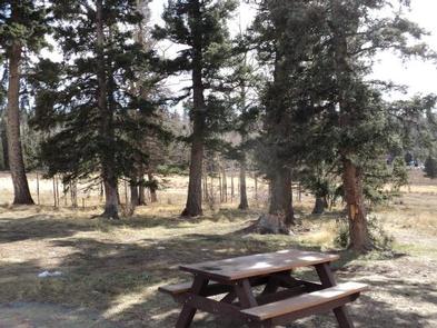
The campground has 31 camping sites. There is also a group day-use shelter and group overnight campsite, both available by reservation. Horse corrals and water troughs are available at two campsites. Vault toilets and drinking water are provided. First-come, first-served sites are available.

Natural Features

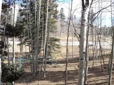
Hopewell Lake is a small, man-made lake, set high in the Carson National Forest at an elevation of 9,500 feet. A forest of conifer and aspen trees covers the area and offers partial shade in the campground.

Reservation

More from CampingHiking.net:

BANDITS ROOST, North Carolina Campground Images, Info & Reservations

Listen Directions From Winston-Salem, North Carolina, take Highway 421 North (approximately 55 miles) to Exit 286B, turn left onto Highway 268 and continue for approximately 5 miles. Turn right onto Jess Walsh Road. Campground entrance is located at the end of the road. From Charlotte, North Carolina, take I-77 North

LAKE CANYON REC AREA, Utah Campground Images, Info & Reservations

Listen Directions The recreation area is located just south of Utah Highway 31, on Miller Flat Road. The Miller Flat road connects Highway 31 with Joe’s Valley Reservoir 21 miles to the south. Phone 435-384-2372 Activities BIKING, BOATING, CAMPING, FISHING, HIKING, HUNTING, WILDLIFE VIEWING Keywords LAKC Related Link(s) Rec Area

MEADOW RIDGE, Colorado Campground Images, Info & Reservations

Listen Directions From Colorado Springs, drive west on Highway 24 for about 24 miles to Woodland Park. Turn right (north) on Baldwin St. (which becomes Rampart Range Road). Drive about 2 miles to Loy Creek Road, turn right, and then take another right on Forest Road 300 (Rampart Range Road).

ROBIE CREEK PARK GROUP SHELTER, Idaho Campground Images, Info & Reservations

Listen Directions From the intersection of Warm Springs Road and Highway 21, turn onto northbound Highway 21 towards Idaho City. Continue straight along Highway 21 for 9.2 miles, passing by Lucky Peak Dam and the Forest Service Nursery. Continue straight after crossing the Mores Creek "High Bridge" another 2.3 miles.

CHILCOOT, California Campground Images, Info & Reservations

Listen Directions From Reno, Nevada, travel north on Highway 395. Merge onto Highway 70 west and continue 5 miles to Chilcoot. Turn north on Highway 284 and continue 5 miles to the campground. Phone 530-836-2575 Activities BOATING, CAMPING, FISHING, HIKING, WATER SPORTS, SWIMMING SITE Keywords CHCO,CHILLICOOT,FRENCHMAN LAKE,LITTLE LAST CHANCE LAKE,PLUMAS