
Directions
From Highway 80, take Highway 183 south to Alma, Nebraska. Turn left onto Highway 136. then turn right on Berrigan Road and travel 1.25 miles to the intersection of Road B. Turn right and travel one mile; the park entrance is on south side of the road.
Phone
308-799-2105
Activities
BOATING, CAMPING, FISHING, HIKING
Keywords
HUNC,HARLIN COUNTY LAKE,HUNTER,HARLAN COUNTY LAKE
Related Link(s)
Nebraska State Road Conditions
Overview
Hunter Cove Park is located on the eastern end of Harlan County Lake near Republican City, Nebraska.
The 13,000-acre Harlan County Lake is the second largest lake in Nebraska. The lake and surrounding land hold great appeal for sportsmen, birders, naturalists or anyone wanting to just get away.
Recreation
Harlan County Lake is popular for fishing, hiking, hunting and boating.
Walleye, wipers, white bass, northern pike and channel catfish are the most sought-after fish species. Game animals include pheasant, quail, prairie chicken, white-tailed and mule deer, turkey, waterfowl, rabbit and squirrel.
The lake offers a variety of hiking trails of varying length and style, as well as one equestrian trail a short drive away. An off-road vehicle trail is located in nearby Republican City.
Facilities
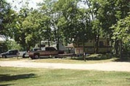
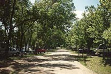
Hunter Cove Park offers 150 campsites, both with and without electric hookups. There are also several tent-only sites.
The facility provides two playgrounds, a volleyball court and a boat ramp and two full service marinas are located on the east end of the lake.
The main road is hard surfaced, while others are gravel. A fish cleaning station with grinder and running water is located near the entrance.
Natural Features
Located in south central Nebraska, lands surrounding Harlan County Lake are primarily mixed grass prairie land. The campground is mostly forested, offering ample shade during the warmth of summer.
The Republican River Valley was once occupied by one of the greatest concentrations of buffalo on the Great Plains and was a favored hunting ground for the Pawnee, Sioux, Cheyenne, and Arapaho Indian tribes.