SAILOR LAKE, WI Campground Reservation, Info, Images, Map, Directions

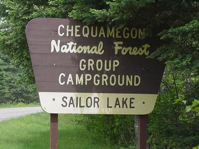
SAILOR LAKE, Wisconsin Campground Images, Info & Reservations

Listen

Directions

From Fifield, follow State Highway 70 east for about 7 miles and turn right (south) on Forest Road 139 and continue for 3 miles.

Phone

715-762-2461

Activities

BOATING, CAMPING, FISHING, HIKING, HUNTING, WILDLIFE VIEWING, CANOEING, HISTORIC SITES

Keywords

SAIL,CHEQUAMEGON-NICOLET NF – FS

Related Link(s)

Rec Area Info & Images

Wisconsin State Tourism

Wisconsin State Road Conditions

Overview

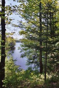
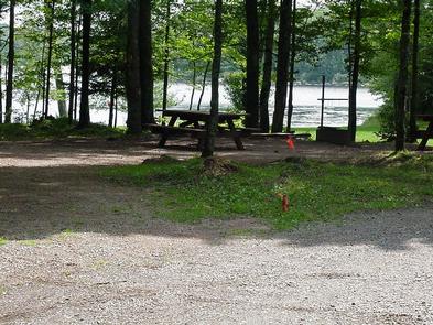
Rustic Sailor Lake Campground sits on the northwestern shores of scenic Sailor Lake. Its scenic views and secluded location make it popular for campers and explorers alike. The campground offers access to the lake as well as a beautiful picnic area and access to off-road vehicle trails.

Recreation

Sailor Lake Campground is a favorite among off-road enthusiasts, offering direct access to the 70-mile Flambeau Trail System. The trail is highlighted by rolling terrain, tree-lined corridors, wooden bridges and vistas overlooking various bogs and lakes. It is a popular snowmobiling location during winter months. The campground is adjacent to 170-acre Sailor Lake, which is popular for boating and fishing. Anglers will find healthy populations of pan fish and northern pike. A boat ramp is located a mile south of the campground at the Sailor Lake Picnic Area. A picnic shelter is also avaialble at the picnic area.

Facilities

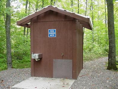
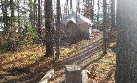
The campground offers about two dozen sites for tent or RV camping. There are no hookups available and parking spurs are either grass or gravel. Some sites are available on a first-come, first-served basis. Each site is equipped with a table and campfire ring. Vault toilets and drinking water are provided. Some sites are secluded by trees and some are situated on the waterfront.

Natural Features

The campground is laid out in two loops and situated on the shores of Sailor Lake at an elevation of about 1,460 feet. The sites are shaded by a mixed hardwood forest.

Nearby Attractions

The campground is located approximately 11 miles southeast of Fifield. The city boasts a variety of tourist attractions, including historic sites, a reconstructed logging dam and a couple of war memorials.

Reservation

More from CampingHiking.net:

DEEP CREEK PICNIC PAVILION, North Carolina Campground Images, Info & Reservations

Listen Directions Seasonal phone is 828-488-3184 From downtown Bryson City, NC: Follow signs to Deep Creek, 3 miles away. Phone 865-436-1261 Activities HISTORIC & CULTURAL SITE, CAMPING, FISHING, HIKING, HORSEBACK RIDING, VISITOR CENTER, WILDLIFE VIEWING Keywords Great Smoky Mountains National Park,Great Smokey Mountains National Park,Great Smoky Mountain National Park Related

BALD BUTTE LOOKOUT, Oregon Campground Images, Info & Reservations

Listen Directions From the Paisley District Office, travel 0.5 miles north on Highway 31 and turn left on Mill Street. Stay on Mill Street to the Y junction (turns into gravel at this point) , then turn right on Forest Road 3315. Continue on Forest Road 3315 for 21 miles.

BUCKSAW, Missouri Campground Images, Info & Reservations

Listen Directions From Highway 7, take Highway U south for 3 miles. Turn left at SE 803. Stay on the paved road and follow signs into the campground. Phone 660-477-3402 Activities BOATING, CAMPING, FISHING, SWIMMING SITE Keywords BUCS,TRUMAN LAKE,HARRY S TRUMAN Related Link(s) Rec Area Info & Images Missouri State

Priest Rock Cabin, Alaska Campground Images, Info & Reservations

Listen Directions The cabin is 120 air miles from Anchorage and 8 miles from Port Alsworth. Visitors must arrange their own transportation. This cabin is accessible by float plane, water taxi, or private vessel. Kayakers with advanced skills can reach the cabin from Port Alsworth. There are no mooring buoys

SHADY COVE GROUP CAMPGROUND, California Campground Images, Info & Reservations

Listen Directions From Running Springs, drive approximately one mile on Highway 18 to the Deerlick Ranger Station/Children’s National Forest Visitor Center. Turn right on Keller Peak Road and continue about five miles. Follow signs to the campground. Phone 909-866-8550 Activities BIKING, CAMPING, INTERPRETIVE PROGRAMS, FISHING, HIKING, WILDLIFE VIEWING Keywords SHAC,Shady