STANLEY LAKE CAMPGROUND, ID Campground Reservation, Info, Images, Map, Directions

STANLEY LAKE CAMPGROUND, Idaho Campground Images, Info & Reservations

Listen

Directions

Travel 4.5 miles west of Stanley, Idaho on State Highway 21. Turn on paved Stanley Lake Road and drive 3 miles to the campground.

Phone

928-537-8888

Activities

BIKING, BOATING, CAMPING, FISHING, HIKING, WILDLIFE VIEWING, SWIMMING SITE

Keywords

STNL,SAWTOOTH NF – FS

Related Link(s)

Rec Area Info & Images

Idaho State Road Conditions

Forest Service Concessionaire

Idaho State Tourism

Overview

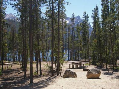
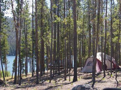
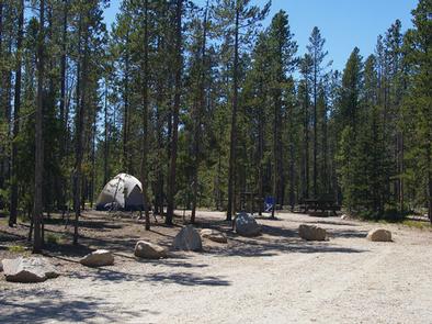
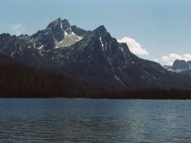
Stanley Lake Campground is located on the shoreline above beautiful Stanley Lake at the foot of the Sawtooth Mountains.

Recreation

Stanley Lake offers excellent boating, water skiing, canoeing, kayaking and fishing for rainbow, cutthroat, brook and bull trout. A boat ramp is located just outside the campground.

The Idaho Centennial Trail passes nearby and can be accessed from the Stanley Lake Trailhead across the lake.

Facilities

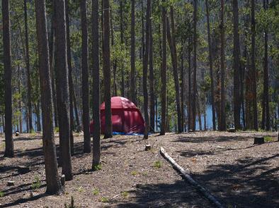
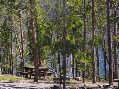
The campground offers 17 reservable sites, as well as additional first come, first served sites. Vault toilets and drinking water are provided. Roads and spurs within the site are gravel.

A scenic overlook is located next to sites 3 and 4, with outstanding views of McGowan Peak and Stanley Lake. Painters and photographers frequent the overlook to capture the views.

Natural Features

The campground is situated on a hillside above the lake in a thick grove of lodgepole pines, at an elevation of 6,500 feet. Most campsites have partial shade and views of the lake and/or the rugged 9860-foot McGowan Peak. Temperatures are cool, with an average summer high of 78 degrees and a low of 40 degrees.

Nearby Attractions

Stanley Lake lies within the Sawtooth National Recreation Area, which offers a myriad of excellent hiking and biking opportunities. An estimated 750 miles of trails crisscross the valley and surrounding mountains.

Numerous sparkling lakes and streams, including the Salmon River, dot the area, making for great rainbow and native Westslope cutthroat trout fishing. Redfish Lake is nearby, offering additional water recreation opportunities.

Popular area events include an Arts and Crafts Fair in July, and Wagon Days, Salmon Festival, Quilt Fair and Fireman’s Ball in September.

Reservation

More from CampingHiking.net:

ORLAND BUTTES, California Campground Images, Info & Reservations

Listen Directions From Interstate 5, take the Black Butte Lake exit at Orland, CA. Travel west on County Road 200/Newville Road for 6 miles. Turn left on County Road 206 and drive 4 miles to the campground. Phone 530-865-4781 Activities BOATING, CAMPING, FISHING, HIKING, HUNTING, WILDLIFE VIEWING, SWIMMING SITE Keywords

TRUMBULL LAKE, California Campground Images, Info & Reservations

Listen Directions Travel 13.5 miles south of Bridgeport on Highway 395. Turn right at Conway Summit. Travel 5.9 miles on Forest Road 21 to where the asphalt turns to gravel. Turn right at campground entrance. Phone 760-932-7092 Activities BOATING, CAMPING, FISHING Keywords TRUM,HUMBOLDT-TOIYABE NF-FS,TRUMBALL LAKE Related Link(s) Rec Area Info

DAM SITE(GREERS FERRY), Arkansas Campground Images, Info & Reservations

Listen Directions From Heber Springs, AR, take SR-25 3 miles north and follow signs to the campground. Phone 501-362-5233 Activities BOATING, CAMPING, SWIMMING SITE Keywords DAM3,GREERS FERRY LAKE,DAM SITE Greers Ferry,GREERS FERRY LAKE Related Link(s) Rec Area Info & Images Arkansas State Road Conditions Arkansas State Tourism Overview Dam Site

PICKLE GULCH, Colorado Campground Images, Info & Reservations

Listen Directions From Interstate 25 in Denver, travel west on 6th Avenue to State Highway 6 and continue through Clear Creek Canyon. Turn on State Highway 119 toward Black Hawk and Central City. Follow the highway 4 miles north of Black Hawk, to the campground. Phone 801-226-3564 Activities BIKING, CAMPING,

FOXTAIL GRP PICNIC AREA, Nevada Campground Images, Info & Reservations

Listen Directions From Las Vegas, Nevada, take Highway 95 north to the junction with Highway 156/Lee Canyon, turn left and travel approximately 19 miles to the picnic area, which is on the left. Phone 702-872-5486 Activities BIKING, CAMPING, HIKING Keywords FOXT,MOUNT CHARLESTON,LAS VEGAS,SPRING MTNS NAT REC AREA,HUMBOLDT-TOIYABE NF-FS Related Link(s)