

Directions
From Naches, Washington, take Route 12 west 4.4 miles to the intersection with State Route 410. Turn left at the intersection, staying on Route 12. Travel 15 miles to campground on the left.
Phone
541-338-7869
Activities
CAMPING, FISHING, HIKING
Keywords
WLLS,RIMROCK LAKE,TIETON RIVER,OKANOGAN – WENATCHEE NF -FS,Flaming Gorge National Recreation Area
Related Link(s)
Washington State Road Conditions
Overview
Willows Campground sits on the eastern slopes of the Cascade Mountains at the southern end of the Okanogan-Wenatchee National Forest, offering visitors some of the most stunning scenery in Washington and easy access to an abundance of recreational activities.
Recreation
In addition to being a prime location for hiking fishing, hunting, horseback riding, and mountain biking in summer and early fall, Willows Campground offers excellent skiing, snowshoeing and snowmobiling in the winter months.
Hikers and backpackers are especially fortunate to have access to a variety of spectacular trails near the campground and in the surrounding areas. Designated Wilderness provides thousands of pristine acres of incredible landscapes to enjoy in solitude or with a small group.
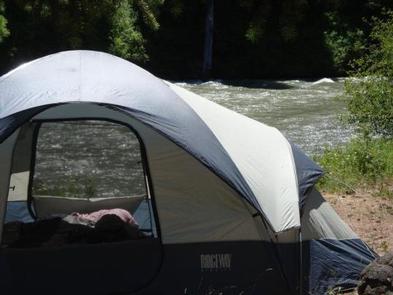
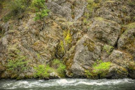
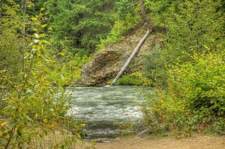
Whitewater paddling on the Tieton River, adjacent to Willows Campground, is also a popular activity.
Facilities
Willows Campground offers sites that accommodate both tent and RV camping.
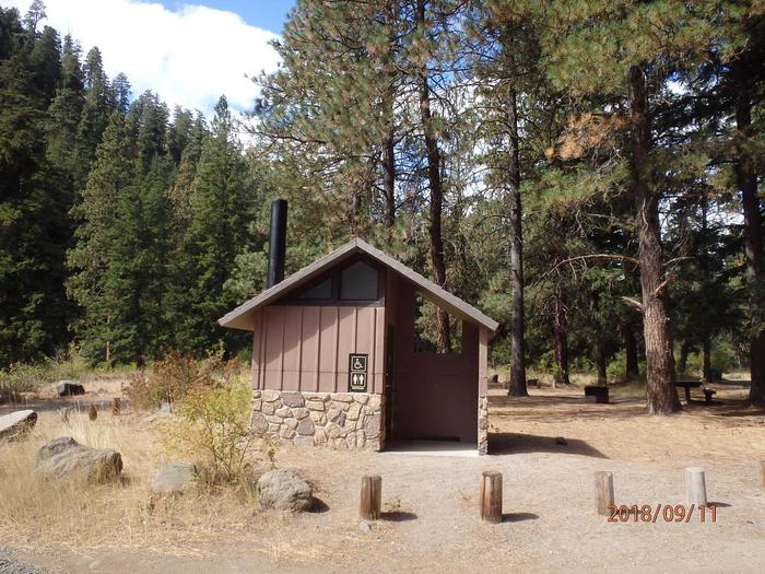
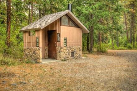
Sites are equipped with tables and campfire rings with grills. Vault toilets and drinking water are also available.
Natural Features
Encompassing more than 4 million acres and stretching north to south from the Canadian border to the Goat Rocks Wilderness, the Okanogan-Wenatchee is a stunning and diverse National Forest.
High, glaciated alpine peaks tower along the Cascade Crest and lush valleys of old growth forest define its western boundary. At its eastern edge, rugged shrub-steppe country comprises a more arid region. Elevations range from below 1,000 feet to more than 9,000 feet.
Visitors to the area can expect many days of clear, sunny weather in the summer, and winters with clear skies and plenty of snow.
Nearby Attractions
A historic highlight of the area is the last remaining lookout in the Naches Ranger District, Jumpoff Lookout.
Visitors will also enjoy traveling the Cascade Lakes Scenic Byway, which climbs into the clouds on a 66-mile drive through the Cascade Mountain range, weaving through snow-capped peaks and alpine lakes.