MCCLINTIC POINT, VA Campground Reservation, Info, Images, Map, Directions

MCCLINTIC POINT, Virginia Campground Images, Info & Reservations

Listen

Directions

From Warm Springs, Virginia take US 39 west 12 miles to state route (SR) 600, turn left (south)on SR 600. Continue 10 miles on SR 600 (2.25 miles past entrance of Bolar Flat Marina) to the McClintic Point Sign. Turn right at the McClintic Point Sign.

Phone

540-279-4144

Activities

BOATING, CAMPING, FISHING, HIKING, HUNTING, WATER SPORTS, WILDLIFE VIEWING, SWIMMING SITE

Keywords

MCNT,LAKE MOOMAW,MOOMAW,GEORGE WASHINGTON/JEFFERSON NF-FS

Related Link(s)

Rec Area Info & Images

Virginia State Tourism

Forest Service Concessionaire

Virginia State Road Conditions

Overview

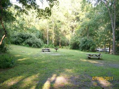
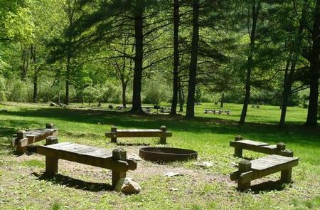
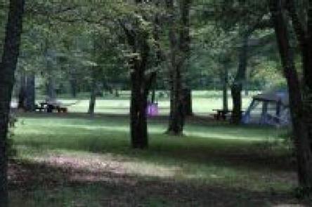
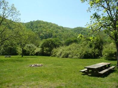
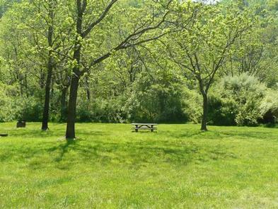
Enjoy the easygoing, peaceful vibe of McClintic Point’s rustic campground set among scattered trees and open fields. This angler’s paradise provides plentiful shoreline fishing and some lakefront campsites.

Recreation

Boating, canoeing, water skiing and and fishing are popular activities on the lake. Brown and rainbow trout, bass and crappie are some of the popular species anglers catch. The campground’s open spaces are also handy for running around of stretching out on the grass.

Facilities

Amenities include vault toilets and seasonal drinking water, which is available April through October. The three group campsites range in capacity from 20 to 35 guests.

Natural Features

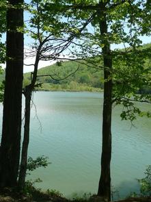
The campground sits on the northern end of Lake Moomaw. The lake boasts 2,530 surface acres with 43.5 miles of shore line and a maximum depth of 150 feet.

Nearby Attractions

Head to the quaint town of Warm Springs for restaurants or to visit the Bath County Historical Society.

Reservation

More from CampingHiking.net:

EAGLE LAKE CABIN, Alaska Campground Images, Info & Reservations

Listen Directions The cabin is located southeast of Wrangell, on the east shore of Eagle Lake. The lake is on the mainland south of Bradfield Canel (at an elevation of about 300 feet) and is about 44 miles by air from Wrangell. This cabin is accessible by float plane only.

SOUTH OVERLOOK (IA), Iowa Campground Images, Info & Reservations

Listen Directions 1105 North HWY T15 Knoxville, Iowa 50138 From Pella, Iowa, follow county road T-15 southwest for 4 miles, then follow signs to South Overlook. Phone 641-828-7522 Activities BIKING, BOATING, CAMPING, HUNTING, WILDLIFE VIEWING Keywords Related Link(s) Rec Area Info & Images Iowa State Road Conditions Iowa State Tourism

Priest Rock Cabin, Alaska Campground Images, Info & Reservations

Listen Directions The cabin is 120 air miles from Anchorage and 8 miles from Port Alsworth. Visitors must arrange their own transportation. This cabin is accessible by float plane, water taxi, or private vessel. Kayakers with advanced skills can reach the cabin from Port Alsworth. There are no mooring buoys

AUK RECREATION AREA SHELTER 5, Alaska Campground Images, Info & Reservations

Listen Directions From the cruise ship terminal on South Franklin Street in downtown Juneau, head northwest along the waterfront. South Franklin Street becomes Marine Way, then Egan Drive, named for William A. Egan (1914 – 1984), first governor of the State of Alaska. Egan Drive becomes Glacier Highway at Milepost