

Directions
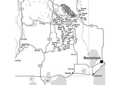
From the Intersection of US-2 and Forest Highway 13 (about 14 miles east of Rapid River or 22 miles west of Manistique), drive north 8.4 miles on Highway 13 to CR 442. Turn right (east) and drive 5.8 miles to FR 2052B. Turn right (southeast) and follow it to the campsites.
Phone
906-474-6442 OR 906-387-2512
Activities
CAMPING
Keywords
Dispersed campsites,Manistique,Rapid River,lyman lake,swan lake,bass lake,bear lake,camp cook,carr lake,chicago lake,clear lake,crooked lake,east lake,gooseneck lake,ironjaw lake,jackpine lake,lake nineteen,leg lake,little bass lake,minerva lake,mowe lake
Related Link(s)
Michigan State Road Conditions
Overview
The campsites on the Rapid River/Manistique Ranger District are located on inland lakes and are in a rustic forest environment with few, if any amenities. The rustic environment offers a wonderfully serene and peaceful setting for your next camping experience.
Recreation
Visitors will be able to enjoy swimming, berry picking, and fishing at these dispersed campsites. Licenses are required for fishing in Michigan waters. Some of these campsites offer only one site on these inland lakes allowing for a very peaceful and wilderness-like experience.
Facilities
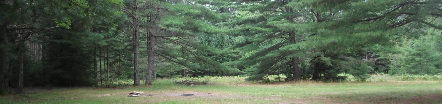
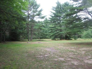
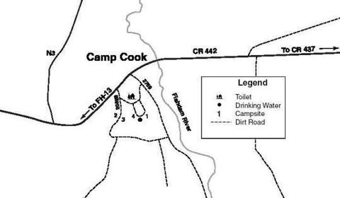
Once the site of a Civilian Conservation Corps (CCC) camp (established in 1934), Camp Cook offers 4 campsites that can be reserved singly or as a group. The large, grassy opening of site #4 makes it particularly well-suited for group gatherings such as scouts or family reunions. Its proximity to the Fishdam River makes it popular among anglers, and the drinking water and toilet are ideal for hunters looking to set up camp for deer season. Sites 1 and 4 are adjacent to one another; sites 2 and 3 are small and are suited for one family each. Trailers are not recommended in site #3.
Camp Cook does not offer swimming, but there is an excellent beach at Camp 7 Lake campground which is only two miles away. The Fishdam River provides opportunities for good brook trout fishing.
Groceries, gasoline, fishing and camping supplies, ice, and deli are available nine miles northeast on County Road 437 in the Thunder Lake Area.
| Lake Name | Number of Sites | Maximum number of people per site | Toilets | Boat Access | Lake Size (acres) |
|---|---|---|---|---|---|
| Camp Cook | 1 | 8 | Yes | N/A | N/A |
Natural Features
All of these sites are nestled in hardwood trees and pines. All of them are on small inland lakes, which offer a wide variety of fishing opportunities. There is one exception; Camp Cook, which is close to the Fishdam River and provides opportunities for good brook trout fishing.
Nearby Attractions
There are a number of horse, bike, and hiking trails within minutes of several of the sites. In over a mile from these campsites, visitors can expect to find: bait shops, general and grocery stores, gas, a pay phone, trailheads, a fishing pier, biking, and kayak/canoe rentals.