ANGEL LAKE, NV Campground Reservation, Info, Images, Map, Directions

ANGEL LAKE, Nevada Campground Images, Info & Reservations

Listen

Directions

Take Interstate 80 to the West Wells exit. Turn south on Angel Lake Road (State Route 231) and travel 12 miles to the end of the road at Angel Lake.

Phone

775-752-3357

Activities

BOATING, CAMPING, FISHING, HIKING, WILDLIFE VIEWING

Keywords

ANGL,RUBY MOUNTAINS,HUMBOLDT-TOIYABE NF-FS

Related Link(s)

Rec Area Info & Images

Nevada State Road Conditions

Forest Service Concessionaire

Nevada State Tourism

Overview

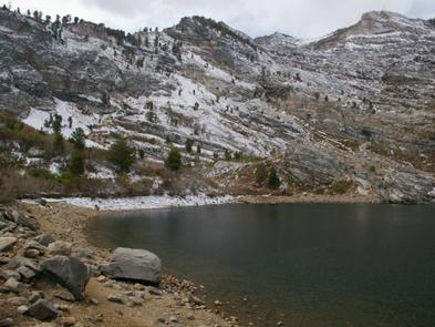
Angel Lake Campground is located next to beautiful Angel Lake, high on the East Humboldt Mountain Range. It sits at an elevation of 8,400 feet, just 12 miles from the city of Wells, in northeast Nevada. Visitors enjoy canoeing, fishing, hiking and viewing wildlife.

Recreation

Angel Lake offers great canoeing and fishing for rainbow and brook trout. Greys Lake Trail, a 4.75-mile roundtrip path to a hidden alpine lake, begins at the campground entrance.

Facilities

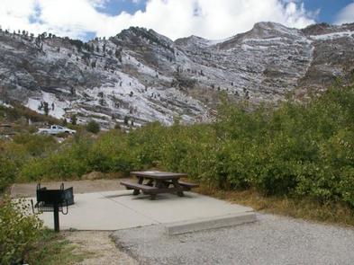
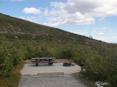
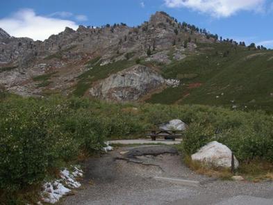
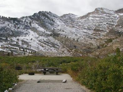
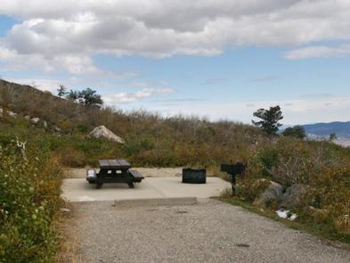
The campground offers single and double campsites, some of which have lake views. Each site contains a picnic table, campfire ring and grill. Vault toilets, drinking water and trash collection are also provided. Firewood is available for purchase from the campground host. A day-use picnic area is adjacent to the campground, along the lakeshore.

Natural Features

The campground sits at the foot of rugged and scenic glacial cirques, that top out around 10,000 feet. Dwarf aspens cover the campground, providing privacy between campsites, but little to no shade.

A variety of wildlife, including bighorn sheep, mountain goats, deer and birds of prey, make its home around the lake, creating good viewing opportunities.

Reservation

More from CampingHiking.net:

OLALLIE ON MCKENZIE HIGHWAY, Oregon Campground Images, Info & Reservations

Listen Directions From Eugene, take I-105 east to McKenzie Highway 126 for 55 miles to McKenzie Highway. Travel 13 miles beyond McKenzie Highway on 126 East. Olallie is on the left-hand side of the road. Phone 801-226-3564 Activities FISHING, HIKING Keywords OLAL,WILLAMETTE NF -FS Related Link(s) Rec Area Info &

HILLTOP CAMPGROUND, Arizona Campground Images, Info & Reservations

Listen Directions From Phoenix, Arizona: Traveling Northbound on I-17 take Exit 262 onto Hwy 69 North to Prescott and cointnue on Hwy 69 for 30 miles to S Walker Rd. Turn left and proceed South on S. Walker Rd. (by Costco, Petsmart, and AM/PM gas station). Drive about 3.8 miles

FIR COVE CAMPGROUND, California Campground Images, Info & Reservations

Listen Directions When traveling north on Highway 101, do not turn off at the Zenia Road exit at Garberville. This will result in a 2-hour delay driving on winding back roads. Instead, continue north until you reach the Hwy 36 exit near Fortuna. Turn right, heading east for approximately an

MONARCH PARK, Colorado Campground Images, Info & Reservations

Listen Directions From Poncha Springs, travel west on Highway 50 for about 15 miles, then turn left on County Road 231 and drive south to the Monarch Park Campground. Phone CAMPGROUNDS DO NOT HAVE PHONE SERVICE, CALLING TO CHECK AVAILABILITY PRIOR TO ARRIVAL IS NOT POSSIBLE. FOR RESERVATIONS CALL: 1-877-444-6777