MCPHEE RECREATION COMPLEX, CO Campground Reservation, Info, Images, Map, Directions

MCPHEE RECREATION COMPLEX, Colorado Campground Images, Info & Reservations

Listen

Directions

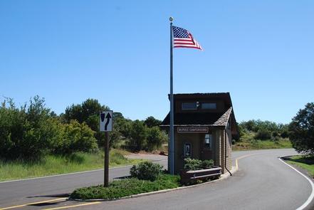
From Dolores, take Highway 145 for 2 miles, turn right onto Highway 184. Travel 4 miles on Highway 184, turn right at the McPhee Recreation Complex entrance. Proceed on Road 271 to the campground.

Phone

(970) 882-7296

Activities

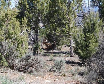
BOATING, CAMPING, FISHING, HIKING, WATER SPORTS, WILDLIFE VIEWING

Keywords

MCPH,SAN JUAN NF – FS

Related Link(s)

Rec Area Info & Images

Colorado State Tourism

Colorado State Road Conditions

Forest Service Concessionaire

Overview

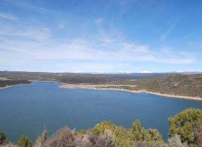
McPhee Recreation Complex is located on the south shore of McPhee Reservoir near the town of Dolores in southwestern Colorado. Visitors enjoy the area for its boating, water skiing and fishing opportunities.

Recreation

McPhee Reservoir, the largest within the San Juan National Forest and second-largest in Colorado, has 50 miles of shoreline. Boating, water skiing and fishing are popular activities. A boat ramp and fish cleaning station are located within the complex.

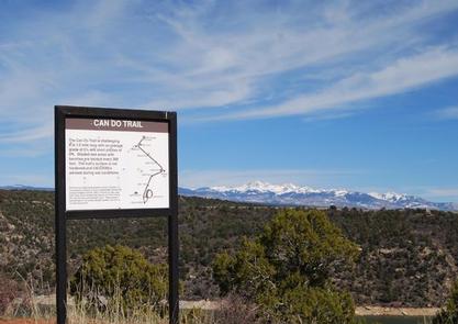
The half-mile Can Do Trail climbs to a scenic overlook with panoramic views of the reservoir and the beautiful peaks surrounding Mesa Verde to the south.

Facilities

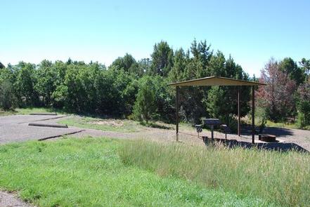
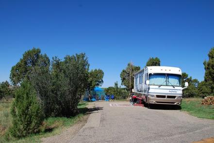
This large campground offers group sites, RV and tent sites, some of which have electric hookups. Several sites have shelters for shade. Picnic tables and campfire rings are provided, as are flush toilets.

Natural Features

The campground is situated on a mesa 500 feet above the reservoir, at an elevation of 7,400 feet. Pinyon and juniper trees offer shade throughout the campground.

Nearby Attractions

Southwestern Colorado, part of the Four Corners region, contains more than 4,000 archaeological sites and more than 600 cliff dwellings. Many sites offer glimpses of the ancient Anasazi culture for which the area is known.

Anasazi Heritage Center is 10 minutes away in Dolores. Mesa Verde National Park is one hour south of the campground. The Canyon of the Ancients is an hour southwest and Hovenweep National Monument is an hour west.

Reservation

More from CampingHiking.net:

BUNKER HILL CAMPGROUND, Oregon Campground Images, Info & Reservations

Listen Directions From Roseburg, OR, travel east on OR-138 / NE Diamond Lake Boulevard for approximately 72 miles. Turn left onto Forest Road 2610 (Birds Point Road). Continue 5.5 miles, crossing the Lemolo Lake Dam, then turn right onto Forest Road 2612. The campground is located on the right side

BELTON LAKEVIEW PARK, Texas Campground Images, Info & Reservations

Listen Directions From Interstate 35 in Belton, Texas take exit onto Road 317 (North Main Street). Turn left onto Farm-to-Market Road 439 (Lake Road), and travel west about four miles to the park. Phone 254-939-2461 Activities BOATING, CAMPING, FISHING, PICNICKING Keywords BELT,OVERLOOK PAVILION (BELTON LK),BELTON GROUP USE AREA,FRANKS PAVILION,BELTON PARK,BELTON

ALTURAS LAKE INLET, Idaho Campground Images, Info & Reservations

Listen Directions From Highway 75, turn onto Forest Road 205/Alturas Lake Road. Travel approximately 3 miles to the campground. Phone 928-537-8888 Activities BIKING, BOATING, CAMPING, FISHING, HIKING, WATER SPORTS, SWIMMING SITE Keywords ALTL,ALTURAS INLET,SAWTOOTH NF – FS Related Link(s) Rec Area Info & Images Idaho State Tourism Idaho State Road

EAST SULLIVAN, Washington Campground Images, Info & Reservations

Listen Directions Campground is located 95 miles north of Spokane, Washington. From the junction of State Highway 20, follow State Highway 31 three miles north to the junction of the Sullivan Lake Road (County Road 9345). Follow the Sullivan Lake Road for 12.5 miles to the junction of Forest Road