Directions
The Refuge is located 6 miles south of Columbia, NC off Hwy 94 on the east and 18 miles south of Plymouth, NC off Hwy 45 on the west. There are several access points to the refuge. The Pungo Unit can be accessed by taking Hwy 45 South to Pantego, NC. Other parts of the Refuge can be accessed by taking Hwy 64 to Roper and turning onto Newland Road and then taking Shore Drive. The Walter B. Jones, Sr. Center for the Sounds, refuge visitor center and headquarters complex, is located on Hwy 64 in Columbia, NC next to the Tyrrell County Visitor’s Center.
Phone
252-796-3004
Activities
AUTO TOURING, BOATING, FISHING, HIKING, HUNTING, WILDLIFE VIEWING
Camping Reservations
Reserve your campsite at these camping areas:
Hiking Trails
Looking for nice hiking areas to take a hike? Choose from these scenic hiking trails:
Related Link(s)
More North Carolina Recreation Areas
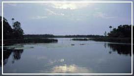
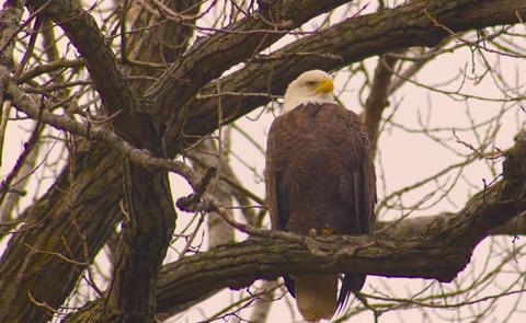
Pocosin Lakes National Wildlife Refuge Pocosin Lakes NWR was established in 1990 when the Conservation Fund in conjunction with the Richard King Mellon Foundation donated over 93,000 acres to the U.S. Fish & Wildlife Service. The adjacent 12,000 acre Pungo NWR, established in 1963 to serve as a sanctuary for migratory waterfowl, was combined with these new refuge lands and became the Pungo Unit of Pocosin Lakes NWR. Today the Refuge encompasses more than 113,000 acres. Prior to its establishment, many acres of refuge wetlands were drained through a network of canals and ditches to expand agricultural areas; an alteration that has made the refuge more vulnerable to wildfires. Pocosin Lakes NWR was established to provide habitat for migratory waterfowl and other birds, to protect and enhance a unique type of wetlands called pocosin, to protect and enhance habitat for those species which are classified as endangered, threatened, or of special concern, and to provide opportunities for wildlife-oriented interpretation, outdoor recreation and environmental education.

