LITTLE COTTONWOOD GROUP, WY Campground Reservation, Info, Images, Map, Directions

LITTLE COTTONWOOD GROUP, Wyoming Campground Images, Info & Reservations

Listen

Directions

From Jackson, travel south on Highway 191/89/26 for about 13 miles, to Hoback Junction. Turn right on Highway 26/89 and continue along Snake River Canyon for 17 miles. The campground is on the south side of the road.

Phone

541-351-1182

Activities

BOATING, CAMPING, FISHING, WATER SPORTS

Keywords

LICG,BRIDGER-TETON NF – FS

Related Link(s)

Rec Area Info & Images

Overview

Little Cottonwood Group Campground is located in beautiful Snake River Canyon, just 30 miles southwest of Jackson, in western Wyoming. It sits at an elevation of 5,700 feet. Visitors enjoy fishing and whitewater rafting on the adjacent Snake River.

Recreation

Fly-fishing for cutthroat, rainbow and brown trout is a popular activity on the Snake, as is whitewater rafting and kayaking. A boat ramp is nearby.

Facilities

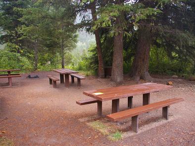
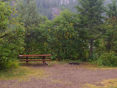
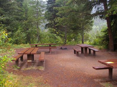
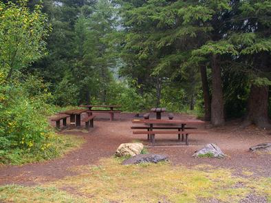
The campground offers one group campsite that can accommodate up to 40 people. The site is equipped with picnic tables, a campfire circle and food storage lockers. Vault toilets, drinking water and trash collection are provided, but there is no electricity. The parking area within the campground is dirt.

Natural Features

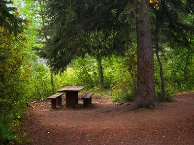
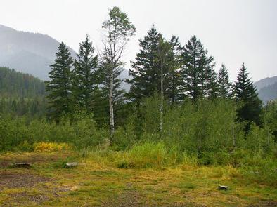
The campground is situated in a forest of pine and aspen trees, which provide partial shade. Summer wildflowers are abundant. The Snake River is below the campground, down the hillside.

Nearby Attractions

The city of Jackson is about 25 miles north, offering restaurants, groceries, shops, galleries and ski resorts with summer activities.

Grand Teton National Park is approximately 40 miles north of the campground. It provides opportunities for boating, fishing, hiking, canoeing and outstanding mountain scenery.

Reservation

More from CampingHiking.net:

FOX CREEK HORSE CAMP, Virginia Campground Images, Info & Reservations

Listen Directions From exit 45 on I-81, take State Route 16 South for approximately 17 miles to State Route 603 at Troutdale, Va. Turn right on State Route 603. Campground is approximately 4 miles down 603 on the right. Phone 800-628-7202 Activities CAMPING, FISHING, HORSEBACK RIDING, HUNTING, WILDLIFE VIEWING Keywords

RED DIAMOND CAMPGROUND, Oregon Campground Images, Info & Reservations

Listen Directions From Blue River, OR, travel 4 miles east on Highway 126 to Aufderheide Drive (Forest Service Road 19). Turn right and proceed south on Aufderheide Drive, taking the Y and climbing to the top of Cougar Reservoir. Continue south on Aufderheide Drive for 13 miles to Red Diamond

SHORELINE, Idaho Campground Images, Info & Reservations

Listen Directions From Boise, Idaho, travel 85 miles north on Highway 55 to Cascade. Turn east on Warm Lake Highway and go 25 miles to Forest Road 489. Turn south and continue a half-mile to the campground. Phone 208-382-7400 Activities BIKING, BOATING, CAMPING, FISHING, HIKING, HUNTING, WILDLIFE VIEWING, SWIMMING SITE

HOPEWELL LAKE CAMPGROUND, New Mexico Campground Images, Info & Reservations

Listen Directions From Taos, New Mexico, take U.S. 64 about 40 miles west. The campground is on the south side of the road. Phone 435-245-6521 Activities CAMPING, FISHING, HUNTING Keywords CARSON NF-FS,Carson National Forest Related Link(s) Rec Area Info & Images New Mexico State Road Conditions New Mexico State Tourism

HICKORY CREEK PARK, Arkansas Campground Images, Info & Reservations

Listen Directions From Rogers, AR, take Highway 264 east for 4.5 miles. Turn right on Cow Face Road. After a mile, turn left on Hickory Creek Road. The park entrance sign is on the right after about a mile. Phone 479-750-2943 Activities BOATING, CAMPING, FISHING, HIKING, SWIMMING SITE Keywords HIC2,BEAVER