

Directions
The campground is located off I-40 Exit 451 (Waterville). It sixteen miles east of Newport, TN. Follow Waterville road, crossing over the Pigeon River, past the Walters Power Generating Station and continue one mile to the 4-way intersection at Mt Sterling Gap.
Follow the signs to Big Creek.
Drive up Big Creek Park Road. Shortly after passing the Ranger Station, take the first left turn into the horse camp.
Coordinates: 35°45’15.7″N 83°06’25.8″W
35.754361, -83.107167
Mailing Address: (Do not use GPS directions by name)
236 Big Creek Park Road
Newport, Tennessee, 37821
Phone
865-436-1261
Activities
CAMPING, FISHING, HIKING, HORSEBACK RIDING, WILDLIFE VIEWING, WILDERNESS, BACKPACKING
Keywords
CG25,Big Creek National Park,Great Smokey Mountains National Park,Big Creek Group Sites,Great Smoky Mountains National Park
Related Link(s)
North Carolina State Road Conditions
National Park Services Concessionaire
Overview
The only horse camp in the Great Smoky Mountains with potable water and flushing toilets!
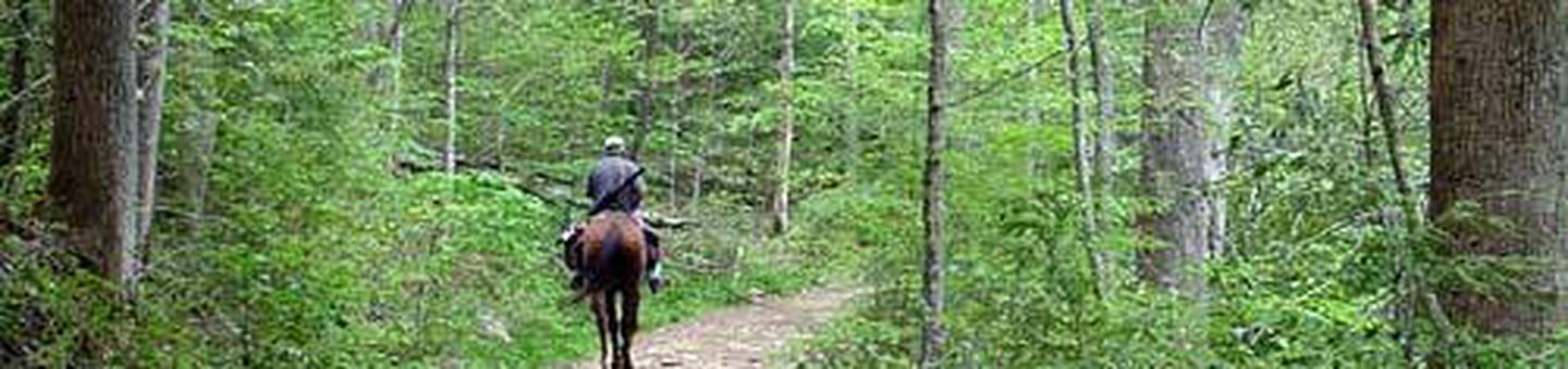
Pack up your horses for a getaway at Big Creek Horse Camp, located on far northeastern side of Smoky Mountains National Park, approximately 16 miles from Newport, Tennessee. This campsite sits along the gently rolling waters of Big Creek and offers miles of horse trails with breathtaking scenic backdrops.
You MUST have a HORSE to camp in Big Creek Horse Camp!
Recreation
The rolling terrain surrounding the campsite makes for some of the best horseback riding trails in the park. Numerous trails are accessible from Big Creek and for riders looking for a little hiking, the Appalachian Trail can be easily reached via the 2.1 mile Chestnut Branch Trail, located within walking distance from the camp.
Day Use horse area- so invite your horse riding friends and family for a fun day even if they don’t want to camp with you.
Campers can also enjoy high-quality backcountry fishing in the cool waters of the countless streams that snake through the mountains, with Rainbow and Brook trout available in abundance, particularly during spring months.
Facilities
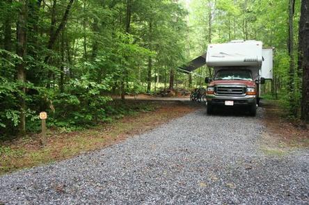
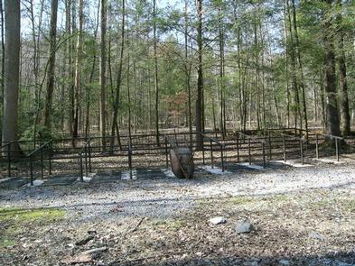
Big Creek Horse Camp is fairly primitive, providing only the basic amenities, but an unforgettable outdoors experience. The sites are large and the facility does offer flush toilets, drinking water and plenty of shade.
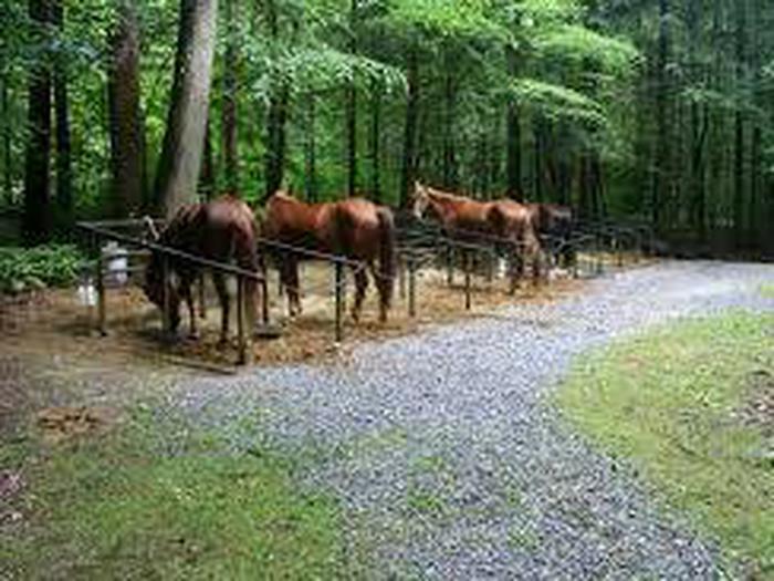
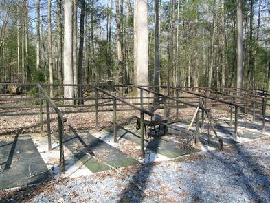
Since horses are not permitted in the camping area, horse stalls and hitching rails are provided to guests.
There are no hookups or showers at the campground, but water is available from the campground spigot.
You MUST have a HORSE to camp in Big Creek Horse Camp!
Natural Features
At a 1,700 foot elevation, Big Creek provides a moderate climate, characterized by mild winters and hot, humid summers. The camp is surrounded by picturesque mountain ranges and pristine mountain streams.
Nearby Mouse Creek Falls, a 35 foot waterfall forming at the confluence of Mouse Creek and Big Creek, is reachable by horseback or on foot via the Big Creek trailhead located on-site.
The beautiful falls splits over moss covered rocks and falls about 20 ft. before pooling and falling another 15 ft. into Big Creek. The falls can be reached via the Big Creek Trail, which is covered in wildflowers during spring months.
Nearby Attractions
The Big Creek Group Campground is located nearby, with plenty of space for larger groups.
Full service grocery stores and medical facilities are located 16 miles away in Newport, Tennessee.