
Directions
From Hartwell, GA, take Highway 29 North towards Anderson, SC for about 5 miles. Big Oaks is located on the left next to the Hartwell Visitor Center and Manager’s Office. 5823 DAM ROAD HARTWELL, GA 30643
Phone
888-893-0678 HARTWELL PROJECT OFFICE
Activities
BOATING, FISHING, PICNICKING, DAY USE AREA, SWIMMING, WATER ACCESS
Keywords
BIGO,HARTWELL LAKE PROJECT
Related Link(s)
Overview
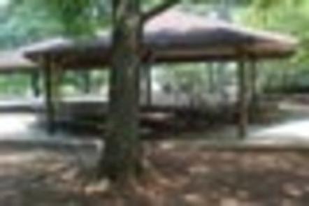
Big Oaks Recreation Area is a 12 acre gently sloping site with good grass cover and scattered pine and hardwood trees throughout.. . . The area experiences high levels of intense public use during peak recreation season and serves to host numerous large special events annually, e.g. Hartwell Dam Run, Pre-Fourth Fireworks, etc. The site presently offers day use and boat launching facilities to include a large picnic shelter (with water and electric service), 26 picnic sites, a two lane boat ramp, 1 courtesy dock, 1 comfort station, 1 playground, and associated paved roads and parking areas throughout. The area is also the access point to the paved walking trail located atop the Georgia earthen embankment of Hartwell Dam.
Recreation
Boating and water sports top the list of popular activities. A two-lane boat ramp with a courtesy dock is provided for easy lake access.
Facilities
The site presently offers day use and boat launching facilities to include a large picnic shelter (with water and electric service), 26 picnic sites, a two lane boat ramp, 1 courtesy dock, 1 comfort station, 1 playground, and associated paved roads and parking areas throughout.
Natural Features
Hartwell Lake is a man-made lake bordering Georgia and South Carolina on the Savannah, Tugaloo and Seneca Rivers. The dam and lake area boasts 8 campgrounds and 11 day-use facilities that are operated by the US Army Corps of Engineers. The Hartwell Project was originally authorized for hydropower, flood control, and navigation. Later, recreation, water quality, water supply, and fish and wildlife management were added. Surrounding vegetation allows for plenty of shade, and the 962 miles of shoreline provide numerous swimming beaches, picnic areas and boat ramps.
Nearby Attractions
A 2.75 mile (rountrip) paved, walking, and bicycling path is located at the entrance to Big Oaks.
Charges & Cancellations
A $10 service fee will apply if you change or cancel your reservation more than 14 days in advance of the arrival. If you cancel a resrvation within 14 days of your scheduled arrival date, you will forfeit the reservation fee.