HURRICANE CREEK, KY Campground Reservation, Info, Images, Map, Directions

HURRICANE CREEK, Kentucky Campground Images, Info & Reservations

Listen

Directions

From Paducah, Kentucky: Take I-24 east to exit 45. Turn right on Highway 293 west and go 0.3 miles. Turn left on Highway 93 south, go 5.3 miles. Turn right on Highway 274 south, go 5.7 miles. Turn right on Hurricane camp road. Campground on left.

From Nashville, Tenn.: Take I-24 west to Exit 56. Turn left on Highway 139 north and go approximately one mile. Turn right on Highway 276, go eight miles. Turn right on Highway 274 and drive one mile. Turn left on Hurricane Camp Road; campground is on left.

Phone

HURRICANE CREEK CAMPGROUND: 270-522-8821; LAKE BARKLEY RESOURCE MANAGERS OFFICE: 27-362-4236

Activities

CAMPING, FISHING, SWIMMING SITE

Keywords

HUR1,LAKE BARKLEY,BARKLEY LOCK & DAM

Related Link(s)

Rec Area Info & Images

Kentucky State Road Conditions

Kentucky State Tourism

Overview

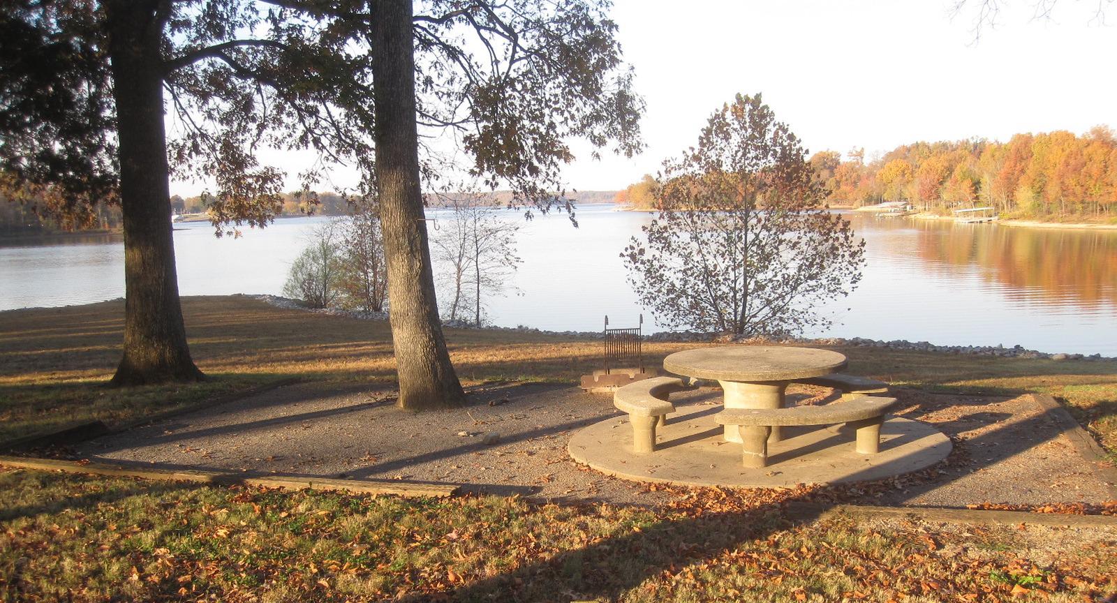
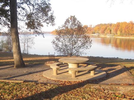
Hurricane Creek Campground sits along the beautiful Lake Barkley, providing plenty of fresh air and recreation opportunities.

While away the hours boating or hiking on shore. Anglers a plenty come in search of catfish and trophy bass. Wildlife spotting includes white-tailed deer and raccoons.

Recreation

From water sports to wildlife viewing to hiking and biking, Hurricane Creek is the perfect setting for outdoor activities.

Facilities

The campground offers 51 sites with water and electric hookups. Six of these are walk-to sites. Hot showers, laundry facilities and a playground are available.

Natural Features

The campground is nestled in the wooded, rolling hills of southwestern Kentucky. Lake Barkley covers 57,900 acres with 1,004 miles of shoreline and offers comfortable and refreshing water temperatures in summer months.

Nearby Attractions

The three-mile Lake Barkley State Park Trail is highly recommended. Plus the Lyon County Museum, listed on the National Register of Historic Places, makes for an enjoyable visit. Items in the museum highlight the area’s immigration history dating back to 1865.

Reservation

More from CampingHiking.net:

ELK LAKE CAMPGROUND, Oregon Campground Images, Info & Reservations

Listen Directions From Bend, travel 33.1 miles southwest on Cascade Lakes Hwy (46) to north end of Elk Lake. Phone 541-323-1746 Activities CAMPING Keywords Related Link(s) Rec Area Info & Images Oregon State Tourism Oregon State Road Conditions Overview Elk Lake Campground is located on the north end of Elk

BURNS RUN WEST, Oklahoma Campground Images, Info & Reservations

Listen Directions From Highway 75 in Denison, Texas, take Exit 72 to Highway 91, travel north on 91 across Denison Dam, 5 miles. Take the second left, follow signs for about 1.5 miles. Physical address: 825 West Burns Run Road, Cartwright, OK 74731 Phone 580-965-4922 Activities CAMPING, SWIMMING SITE Keywords

INDIAN CELINA LAKE, Indiana Campground Images, Info & Reservations

Listen Directions From St. Crois, Indiana, travel south on State Route 37 about 2 miles to the Indian-Celina Recreation Area sign. Turn right and continue to the campground. Phone 812-843-4880 Activities BOATING, HISTORIC & CULTURAL SITE, CAMPING, HIKING, HUNTING Keywords INDL,HOOSIER NF – FS Related Link(s) Rec Area Info &

KOOK LAKE CABIN, Alaska Campground Images, Info & Reservations

Listen Directions Accessible May through November. Located near the eastern shore of Chichagof Island between the outlets of Tenakee Inlet and Peril Strait, about 45 miles northeast of Sitka. Access is by floatplane, 30 minutes from Sitka or Juneau; or by boating to Corner Bay and hiking 7 miles on

WARM LAKE, Idaho Campground Images, Info & Reservations

Listen Directions From Boise, Idaho, travel 85 miles north on Highway 55 to Cascade. Turn east on Warm Lake Highway and travel 25 miles to Forest Road 579KA. Turn south and travel a short distance to the campground. Phone 208-382-7400 Activities BIKING, BOATING, CAMPING, FISHING, HIKING, WILDLIFE VIEWING, SWIMMING SITE

DEER RIDGE LOOKOUT, Idaho Campground Images, Info & Reservations

Listen Directions Take Highway 95/2 north from the Bonners Ferry Ranger Station for 5 miles. Turn right onto Highway 2 and head east for 2 miles. Turn left onto Meadow Creek Road and head north and east for 10 miles to the bridge over the Moyie River. Turn right onto