
Directions
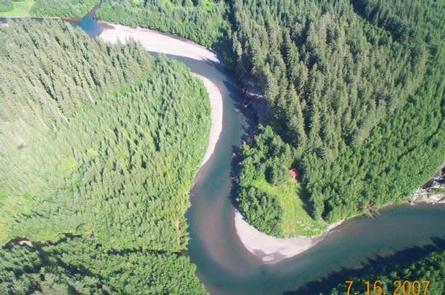
Access to the cabin is by wheel plane only, on the beach at low tide, typically 45 minutes from either Seward or Cordova. The cabin is located less than a mile from beach landing area. Click here for local tide tables.
Phone
1 (907) 424-7661
Activities
CAMPING, FISHING, HIKING, HUNTING, WILDLIFE VIEWING
Keywords
NELL,CHUGACH NF – FS
Related Link(s)
Overview
Nellie Martin River Cabin offers guests access to a variety of recreational activities, relaxation and a remote lodging experience on Montague Island in southcentral Alaska. Fishing, hunting, kayaking, beachcombing and wildlife viewing are all within walking distance of the facility. Access to the cabin is by wheel plane only, on the beach at low tide, typically 45 minutes from either Seward or Cordova. Visitors are responsible for their own travel arrangements and safety, and must bring several of their own amenities.
Recreation
The Nellie Martin River has one of the largest coho salmon runs in the Prince William Sound area, therefore getting heavy use in August through September when the fish run. In addition to coho salmon, there are plenty of pink salmon earlier in the season, along with sea-run Dolly Varden and cutthroat trout tagging along to eat the eggs. The river is generally shallow and easy to wade, but there are deep pools where the river meanders.
Hunters can take advantage of a long hunting season in the surrounding national forest. Bear season occurs during spring and fall, while deer season begins in late summer and lasts through late fall.
The beach, located less than a mile from the cabin, is a good place for beachcombers to search for glass, Japanese fishing floats and other sea-borne treasures.
Facilities
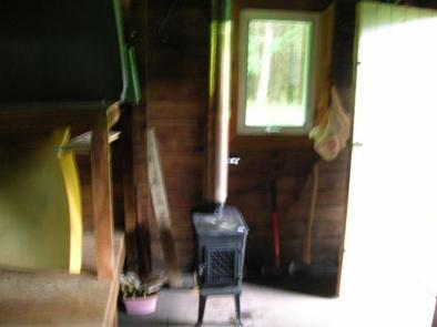
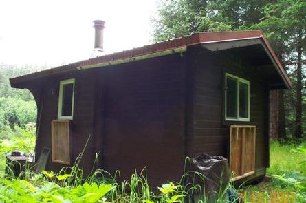
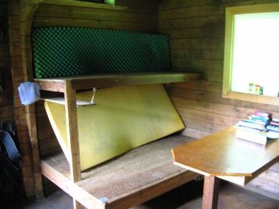
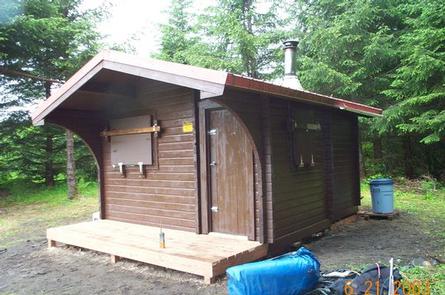
The rustic, 12-by-14 cabin has wooden bunks without mattresses, to accommodate up to six people. It is also equipped with a table, wood and oil stoves, a rainwater catchment barrel, axe, saw, splitting maul and an outdoor pit toilet.
The cabin does not have running water, electricity, cut firewood, mattresses or cooking utensils. Guests must bring their own water, food, sleeping bags, sleeping pads, cook stoves, matches, cooking gear, light source, No.1 stove oil, toilet paper, first aid kit and garbage bags, among other necessities.
Click here for more cabin details.
Natural Features
Montague Island is an island in the Gulf of Alaska, at the entrance to Prince William Sound. The cabin sits on the Nellie Martin River at the edge of a dense spruce forest, less than a mile from the beach landing area. An understory of shrubs and grasses compliment the flat forested area, and the sandy, pebble-strewn shoreline offers views of the Gulf of Alaska and surrounding mountains.
Wildlife in the area abounds, including migratory waterfowl, Sitka black-tail deer and brown bears (learn more about bear safety).
Nearby Attractions
Guests should be aware that the cabin sits within the Chugach National Forest, however some of the land within a half-mile northwest of the cabin is owned by the Chugach Alaska Corporation. Access to the lands requires permission from the corporation.
Contact the Cordova Ranger District at (907) 424-7661 for a detailed map of land ownership in this area.