
Directions
From Willow Creek, California, take State Route 299 for 2 miles west. Enter the campground directly from the highway.
Phone
530-629-2118
Activities
BIKING, BOATING, HISTORIC & CULTURAL SITE, CAMPING, FISHING, HIKING, HUNTING, VISITOR CENTER, WATER SPORTS, WILDLIFE VIEWING, SWIMMING SITE
Keywords
BOCR,Boise Creek Campground
Related Link(s)
California State Road Conditions
Overview
Boise Creek Campground is nestled between Brush Mountain and Brannan Mountain in northern California’s vast Six Rivers National Forest.
The campground sits under a canopy of large Pacific madrone evergreen, Douglas fir and California bay trees, less than two miles from the small mountain town of Willow Creek, known as the Bigfoot capital of the world.
Fishing, swimming and whitewater rafting are all close by in the popular Trinity River.
Recreation
Fishing, swimming and whitewater rafting are all available in the Trinity River. The area also provides opportunities for biking, hiking and horseback activities, as well as fishing for migratory salmon and steelhead trout.
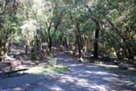
Campers can walk the 1/2-mile trail from the campground to the nearby Boise Creek and find a swimming hole or explore native plants and wildlife. A drive on the nearby Trinity Scenic Byway is a favorite activity of many visitors.
Facilities
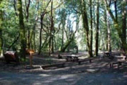
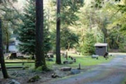
The campground offers several single-family campsites, three of which are for tent camping only. All campsites are furnished with tables and campfire rings with grills. Vault toilets and drinking water are provided.
Natural Features
The campground sits at a 680-foot elevation and provides several shady campsites on a creek about two miles west of the Trinity River. A forest of conifers covers the campground, and stands of oak woodland dot the landscape, providing habitat for eight threatened and endangered species, including the bald eagle and the peregrine falcon.
The Six Rivers National Forest lies east of Eureka in northwestern California, stretching southward from the Oregon border for about 140 miles. U.S. 101, the famed “Redwood Highway,” parallels the inland Forest along the coastline. The Forest is just east of the Redwood National Park.
Nearby Attractions
Boise Creek Campground is located less than two miles west of Willow Creek, where most services are available, including fuel, propane, medical services, restaurants, groceries and laundry facilities. Visitors can also check out the town’s 18-hole public disc golf course or participate in the area’s numerous cultural and social events, like the annual Bigfoot Days on Labor Day weekend. Three miles southwest of Willow Creek lies the Brush Mountain Lookout tower, which, at 3,988 feet, provides a 360-degree view of the forest’s sweeping canyons and valleys.