
Directions
Black River Harbor is located in Gogebic County, Michigan, approximately 15 miles north of the city of Bessemer. Turn off of U.S. Highway 2 and travel north on County Road 513. The pavilion is located in the harbor day use area.
Phone
906-932-1330
Activities
BOATING, CAMPING, FISHING, HIKING
Keywords
BRHP,Black River Harbor Pavilion,Pavilion,Picnic Shelter
Related Link(s)
Michigan State Road Conditions
Overview
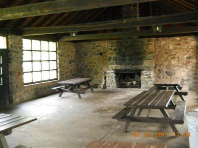
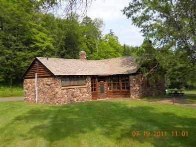
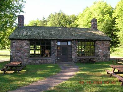
The Black River Harbor Pavilion is located within the Black Harbor Recreation Area on Lake Superior in Michigans Upper Peninsula. The historic stone and wood pavilion was constructed by the Civilian Conservation Corps in the 1930s.
Recreation
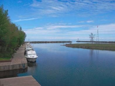
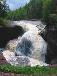
Lake Superior offers great opportunities for boating, fishing, and swimming. The North Country National Scenic Trail, which traverses through the recreation area, offers access to all five waterfalls and a scenic 12 mile hike to the Porcupine Mountain Wilderness State Park in Michigan.
The Black River Harbor Boating Club sponsors an annual fishing derby over Labor Day weekend.
Facilities
The recreation area offers an enclosed pavilion with a fireplace and flush toilet facilities. A campground with first-come, first-served sites is also available. Facilities include vault toilets and a pressurized water system. A sandy beach is located on-site.
Natural Features
Visitors enjoy boating, fishing, hiking, swimming, and viewing waterfalls. The Black River Harbor Recreation Area has docking and fuel services for day and transient boaters, a boat launch, a large picnic area with a swing set, a campground with 39 campsites, beach access to Lake Superior, and five scenic waterfalls along the wild and scenic Black River. The day-use picnic area has a suspension bridge over the Black River with a hiking trail to a beautiful sand and pebble beach on Lake Superior. The campground is situated among hemlock and pine trees at an elevation of 840 feet, on a bluff overlooking Lake Superior and offers a scenic overlook of Lake Superior’s Apostle Islands.
The Ottawa National Forest encompasses nearly one million acres on the west side of Michigan’s Upper Peninsula. The forest extends from the south shore of Lake Superior to the Wisconsin border. It is distinguished by rolling hills dotted with lakes, rivers and waterfalls.
Nearby Attractions
For a panoramic view of the area, visit Copper Peak International Ski Flying Hill, a 17-story steel ski jump. Visitors can take an elevator up to the top. The attraction is a short drive from the campground. The Porcupine Mountain Wilderness State Park in Michigan can be seen in the distance from the beach and is less than a one-hour drive from the Harbor.