FISHHOOK PARK, WA Campground Reservation, Info, Images, Map, Directions

FISHHOOK PARK, Washington Campground Images, Info & Reservations

Listen

Directions

From Pasco, Washington, take Highway 12 east. After crossing the Snake River Bridge, take the first exit and head east on State Route 124. Continue for 19 miles, then turn left, heading north on Fishhook Park Road. Follow for 4 miles to the park entrance; the campground is on the left.

Phone

509-547-2048

Activities

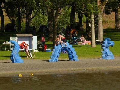
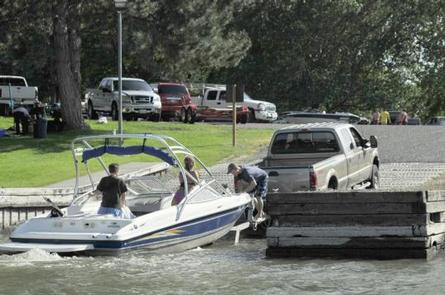
BOATING, CAMPING, FISHING, DAY USE AREA, SWIMMING SITE

Keywords

FIHO,ICE HARBOR,LAKE SACAJAWEA,ICE HARBOR LOCK & DAM

Related Link(s)

Rec Area Info & Images

Washington State Tourism

Washington State Road Conditions

Overview

Fishhook Park is located on the shores on Lake Sacajawea in Eastern Washington. The lake is formed by Ice Harbor Lock and Dam on the Lower Snake River.

The park was named for Fishhook Rapids, which were once nearby, where Lewis and Clark spent time in October 1805. Today Fishhook is a fishing destination, as the name implies, attracting boaters and anglers alike to its black rock canyons. Visitors also enjoy camping, upland hunting, hiking, swimming and water sports.

Recreation

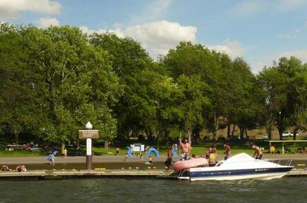
The lake provides great boating and swimming opportunities, and a boat ramp is provided for guests.

Fishing is also a popular pastime, and anglers will find excellent salmon and steelhead fishing on the lake.

Facilities

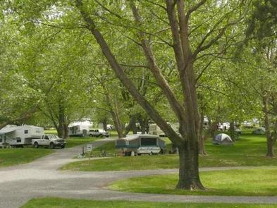
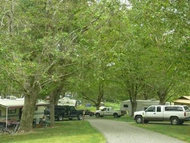
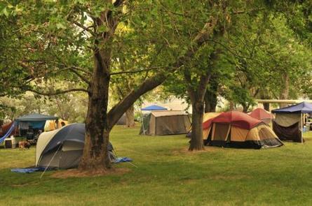
Fishhook Park offers 41 family sites and one day-use group picnic shelter, all with electric hookups. Eleven primitive, walk-up tent sites are available as well with two of them being group sites with sun shelters.

Natural Features

The campground is situated on the waterfront. Visitors enjoy relaxing in the shade under the mature trees scattered throughout the park.

Reservation

More from CampingHiking.net:

SARGE CREEK, Oklahoma Campground Images, Info & Reservations

Listen Directions From Kaw City, Oklahoma, travel nearly 3 miles east on Highway 11, then follow signs to the campground. Phone 580-762-5611 Activities BOATING, CAMPING, FISHING, HIKING, WILDLIFE VIEWING, DAY USE AREA Keywords SARG,KAW LAKE,KAW LAKE Related Link(s) Rec Area Info & Images Oklahoma State Tourism Oklahoma State Road Conditions

TIMPOONEKE, Utah Campground Images, Info & Reservations

Listen Directions From Salt Lake City, Utah, take I-15 to the Alpine-Highland exit 284. Travel east on Highway 92 for 5 miles to the junction of Highway 92 and the North Fork of American Fork Canyon. Keep going straight east up the South Fork. Continue on the Alpine Scenic Loop

GIANT GAP, California Campground Images, Info & Reservations

Listen Directions From Interstate 80, take the Auburn/Ravine Road exit. Continue east for 17 miles to Foresthill. Travel through town, about 9 miles, to Forest Road 10/Sugar Pine Road. Turn left and drive 9 miles, crossing a boat ramp and the dam, to the Sugar Pine Campground. Turn right and

PICKETT BUTTE LOOKOUT, Oregon Campground Images, Info & Reservations

Listen Directions Important note regarding GPS use: please be advised that GPS units can, and have sent guests down the wrong roads to access the lookout. Please consider following the directions below rather than your GPS unit. Directions: From Canyonville take West 1st Street and turn onto SE 3rd St/OR-227.

HORSFALL SAND CAMPING, Oregon Campground Images, Info & Reservations

Listen Directions From North Bend Oregon, travel north on Highway 101 for 1 1/2 miles to Trans Pacific Parkway. Turn west (left) on Trans Pacific Pkwy, proceed 1 mile and turn right onto Horsfall Beach Road. For access via Horsfall Campground drive ½ mile on Horsfall Beach Road, the campground