MICHIGAN VALLEY, KS Campground Reservation, Info, Images, Map, Directions

MICHIGAN VALLEY, Kansas Campground Images, Info & Reservations

Listen

Directions

From US 75 and K-268 junction, proceed east on K-268 for 7 miles to Pomona Dam Road. Turn north and travel 2.5 mi across the dam. Turn west on Wolf Creek Pkwy for 500 feet, then turn south and proceed to park entrance.

Phone

785-453-2201

Activities

BOATING, CAMPING, SWIMMING SITE

Keywords

MICH,LAKE POMONA,POMONA LAKE

Related Link(s)

Rec Area Info & Images

Kansas State Road Conditions

Kansas State Tourism

Overview

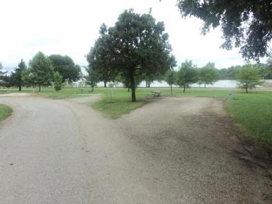
Michigan Valley Campground is located in eastern Kansas on the shores of Pomona Lake. The scenic park appeals to family campers, sportsmen and water sport enthusiasts. The reservoir covers 4,000 acres and offers excellent fishing and boating opportunities.

Recreation

Fishing, boating, picnicking,and hunting are favorite activities on and around Pomona Lake. The lake’s fish and wildlife resources provide ample opportunities for sportsmen and women.

Three nearby trails meander around Pomona Lake, providing visitors with hiking and nature study opportunities. Deer Creek Nature Trail and Witches’ Broom Trail are short trails for hikers. The Black Hawk Trail offers a 33 mile loop with several trailheads and is a popular hiking, horseback riding and mountain biking path.

Facilities

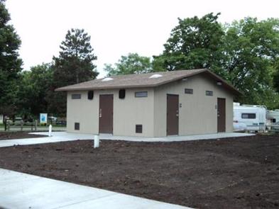
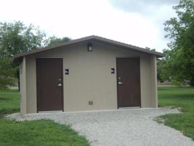
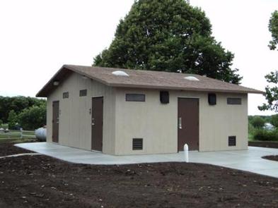
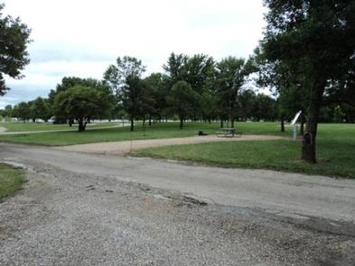
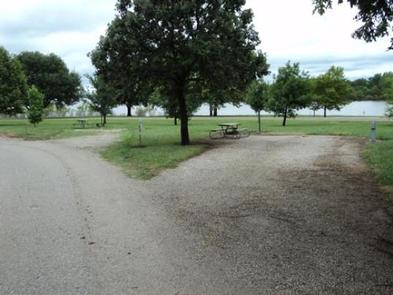
Michigan Valley Campground offers 87 campsites, 51 of which have electric and water hookups. Three additional group picnic shelters have electric hookups. Other amenities include flush and vault toilets, a shower building, playground, basketball court, swim beach and dump station.

The site is adjacent to North Shore Marina and boat ramp, an accessible fishing dock, and numerous bank-fishing areas. All campsites are within easy walking distance of lakeshore fishing.

A visitor center is located a short distance from this park and provides educational displays about the lake and its environment.

Natural Features

Pomona Lake is situated among the rolling hills, mixed grasslands, croplands and forests of eastern Kansas. Wildlife and numerous species of birds can be observed at this secluded, heavily shaded campground. Bald eagles, white-tailed deer, Canada geese, wild turkey, crappie, walleye, channel catfish and other wildlife can be found here.

Nearby Attractions

Numerous parks lie on the banks of Pomona Lake, offering additional boating, fishing, swimming, hunting and hiking opportunities.

The town of Lyndon, Kansas is 20 minutes away, with limited restaurants and shops. This small town is home to 22 historical sites and the smallest Carnegie library still in use.

Reservation

More from CampingHiking.net:

PIEDMONT PARK, Missouri Campground Images, Info & Reservations

Listen Directions From Piedmont, MO, follow Missouri State Highway HH. Travel on Highway HH for 6 miles to the top of the dam. Turn right and follow signs into campground. Phone 573-223-7777 (CLEARWATER LAKE PROJECT OFFICE) 573-223-4432 (PIEDMONT PARK GATE HOUSE) Activities BOATING, CAMPING, SWIMMING SITE Keywords PIED,CLEARWATER LAKE,PIEDMONT,PARK ABOVE

MAMMOTH CAVE CAMPGROUND, Kentucky Campground Images, Info & Reservations

Listen Directions Note: Do not rely exclusively on your mobile GPS, Google Maps or similar automated navigation systems to get to the Mammoth Cave Campground. Routes can be misleading and incorrect. Directions from the North: Take Interstate 65 to Exit 53 (Cave City Exit). Turn right onto KY-70. Follow 70/255

BELKNAP, California Campground Images, Info & Reservations

Listen Directions From Springville, California, proceed east on State Highway 190 for approximately 15 miles. Turn east on Nelson Drive and continue about a mile to the campground. Phone 559-539-5230 Activities BIKING, CAMPING, FISHING, HIKING Keywords BELK,GIANT SEQUOIA NATIONAL MONUMEN,SEQUOIA NF – FS Related Link(s) Rec Area Info & Images

REREG DAM DAY USE AREA SHELTER, Georgia Campground Images, Info & Reservations

Listen Directions From Atlanta: Take Interstate 75 North until Exit 293, turn right onto Georgia Highway 411 North, travel approximately 30 miles; take a right onto Georgia Highway 136 East; proceed across railroad tracks; turn left onto Old Highway 411 North, continue approximately 3/4 mile; turn right into Reregulation Dam

COYOTE GROUP, California Campground Images, Info & Reservations

Listen Directions From Auburn, Calif., take Highway 80 to the Foresthill Road, then travel 20 miles east to Foresthill. Turn right on Mosquito Ridge Road and continue east for 42 miles, to the French Meadows Reservoir. Follow signs to the campground. Phone 530-367-2224 Activities BIKING, BOATING, CAMPING, FISHING, HIKING, SWIMMING

TWIN KNOBS CAMPGROUND, Kentucky Campground Images, Info & Reservations

Listen Directions Coming from Lexington, Kentucky, on I-64, take exit 133. Turn right at the top of the exit ramp to proceed south on KY-801. Proceed 8.4 miles on 801. The campground entrance is on the right. Phone 606-780-7818 Activities BIKING, BOATING, CAMPING, INTERPRETIVE PROGRAMS, FISHING, HIKING, WATER SPORTS, WILDLIFE