JOHN C. BRISCOE GROUP USE, MO Campground Reservation, Info, Images, Map, Directions

JOHN C. BRISCOE GROUP USE, Missouri Campground Images, Info & Reservations

Listen

Directions

From Hannibal, MO, travel west on highway 36 for 17 miles, then continue south on Route J and head south 10 miles. From Perry, travel north on Rt. J for 9 miles.

Phone

573-735-4097

Activities

CAMPING

Keywords

MWBG,BOUDREAUX GROUP CAMP AREA,MARK TWAIN LAKE,MW Boudreaux Group Camp,Briscoe Group Camp,Boudreaux Group Camp,JOHN C JACK BRISCOE GROUP USE,MARK TWAIN LAKE,mw boudr,john c briscoe,john c. (jack) briscoe,briscoe group

Related Link(s)

Rec Area Info & Images

Missouri State Road Conditions

Missouri State Tourism

Overview

The scenic John C. "Jack" Briscoe Group area, previously named the M.W. Boudreaux Group Area, is an ideal place for families and groups to explore and enjoy Mark Twain Lake.

More than 2 million visitors travel to the Mark Twain lake region to enjoy the overall magnetism of the area, thanks in part to the author’s beloved classics, "The Adventures of Tom Sawyer" and sequel, "Adventures of Huckleberry Finn."

Recreation

Fishing, boating and hunting are very popular at John C. Briscoe. Deer and turkey are common wildlife, and bass is the most popular catch in the lake.

Facilities

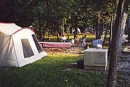
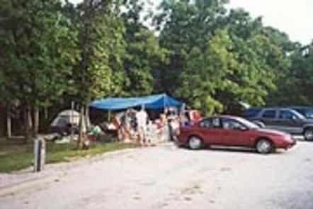
The John C. "Jack" Briscoe Group Use Area includes six group campsites with picnic shelters, showers and a central playground. Most sites hold a maximum of 24 to 36 people and offer paved parking for RVs, a shaded area for tent campers and an open area for sporting activities. All sites have electric hookups.

Natural Features

Mark Twain lake is large reservoir fed by the waters of the Salt River in northern Missouri. A variety of recreation areas line the lake, in addition to Mark Twain State Park on the western edge of the lake.

Nearby Attractions

Beside the lake is the village of Florida, where Mark Twain was born. Twenty-five miles east is the town of Hannibal, where visitors can tour the author’s boyhood home.

Reservation

More from CampingHiking.net:

HARD ROCK CAMPGROUND, Oregon Campground Images, Info & Reservations

Listen Directions From Blue River, OR, travel 4 miles east on Highway 126 to Aufderheide Drive (Forest Service Road 19). Turn right on Aufderheide Drive and continue south about 3/4 mile. Veer right at the Y and continue 10 miles to the campground. Phone 801-226-3564 Activities FISHING, WILDLIFE VIEWING Keywords

Soda Springs Campground, Washington Campground Images, Info & Reservations

Listen Directions Take Highway 410 to milepost 88.4, then turn left on Bumping Lake Road and continue for 5 miles to the campground. Phone 541-338-7869 Activities CAMPING, FISHING, HIKING, WATER SPORTS Keywords SOSP,Bumping River,OKANOGAN – WENATCHEE NF -FS Related Link(s) Rec Area Info & Images Washington State Tourism Washington State

POINT SUPREME CAMPGROUND, Utah Campground Images, Info & Reservations

Listen Directions Routes to Cedar Breaks National Monument Traveling south on I-15: Take exit 78 to Parowan Travel south on Main Street for 1.3 miles Turn left onto E. Center Street. Travel 0.3 Miles Turn right onto Utah Highway 143 East Continue approximately 15 miles to Cedar Breaks National Monument

DAN MOLLER CABIN, Alaska Campground Images, Info & Reservations

Listen Directions Located 3.5 miles southwest of Juneau on Douglas Island. Access is by a 3-mile trail on Pioneer Street off Cordova Street in West Juneau or at a trailhead at the end of Jackson Road. The cabin is also accessible by helicopter. Phone 907-586-8800 Activities CAMPING, HIKING, WILDLIFE VIEWING,