TIONESTA REC. AREA CAMPGROUND, PA Campground Reservation, Info, Images, Map, Directions

TIONESTA REC. AREA CAMPGROUND, Pennsylvania Campground Images, Info & Reservations

Listen

Directions

From Tionesta, PA: Go 0.5 mile south on SR 36 and follow signs into the campground.

Phone

814-755-3512

Activities

BOATING, CAMPING, FISHING, HIKING, PICNICKING, WILDLIFE VIEWING, WILDERNESS, ENVIRONMENTAL EDUCATION, PHOTOGRAPHY, RANGER STATION, CANOEING, DISC GOLF, RECREATION PROGRAMS, SCENIC DRIVE

Keywords

TIONESTA DAM,TIONESTA LAKE,OUTFLOW CAMP LEFT BANK,TIONESTA OUTFLOW CAMPGROUND,TIONESTA CAMPGROUND,TIONESTA REC AREA CAMPGROUND,TIONESTA LAKE

Related Link(s)

Rec Area Info & Images

Pennsylvania State Road Conditions

Pennsylvania State Tourism

Overview

Half of Forest County, where Tionesta Lake is located, is preserved as public lands. The region is known as one of Pennsylvania’s best big game regions and is home to a remarkable variety of wildlife.

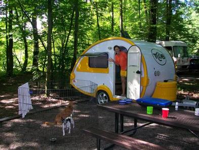
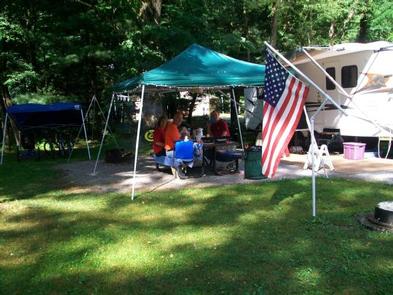
Campers come to the Tionesta Recreation Area Campground to enjoy the forested area just below the Tionesta Dam. The area is ideal for fishing as well as scenic hiking.

Tionesta is a culturally rich region with a long history. The Seneca Indian tribe named this area “where the water separates the land.” Nearly a century ago, narrow gauge railways dotted the surrounding countryside, hauling out virgin timber from the hillsides.

Recreation

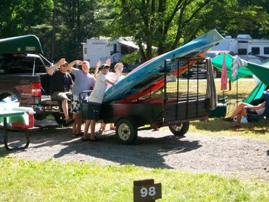
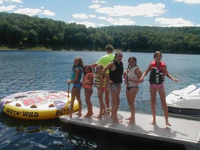
In-season hunting, fishing, boating, hiking and water skiing, are all available from Tionesta.

Visitors interested in wildlife viewing are likely to spot white-tailed deer, porcupine, wild turkey, osprey and opossum.

Outside the campground entrance is a beach area for swimming and picnicking along Tionesta Creek. No lifeguards are on duty.

Facilities

A boat ramp and marina are near-by for easy access to water sports. Shower houses and restrooms are located throughout the campground for easy access.

Natural Features

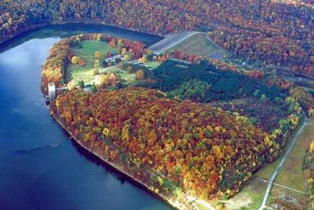
Tionesta Lake winds its way through the rugged hills of northwestern Pennsylvania. Surrounding public areas include the Allegheny National Forest, Cooks Forest State Park, Cornplanter and Clear Creek State Forests, the state fish hatchery and state game lands.

Nearby Attractions

Tionesta Creek Road, which winds through the Tionesta Creek valley upstream of the dam, is an excellent scenic drive with spectacular views.

The nearby Allegheny National Forest also makes a great day trip.

Reservation

More from CampingHiking.net:

COTTONWOOD (NE), South Dakota Campground Images, Info & Reservations

Listen Directions From U.S. Hwy 81 in Yankton, South Dakota, drive four miles west on South Dakota Highway 52, then south on Dam Toe Road and follow signs. Phone 402-667-2546. FOR RESERVATIONS, CALL 877-444-6777. Activities BIKING, BOATING, CAMPING, FISHING, HIKING, PICNICKING, WILDLIFE VIEWING, DAY USE AREA, PLAYGROUND PARK SPECIALIZED SPORT

UPPER BILLY CREEK CG, California Campground Images, Info & Reservations

Listen Directions Take Highway 168 east from Clovis to Shaver Lake. Continue through Shaver Lake to Huntington Lake. Continue around Huntington Lake for 3.2 miles to Upper Billy Creek Campground. Phone 559-893-2111 Activities BOATING, HISTORIC & CULTURAL SITE, CAMPING, INTERPRETIVE PROGRAMS, FISHING, HIKING, WATER SPORTS, SWIMMING SITE Keywords BICR,HUNTINGTON LAKE,SIERRA

OAK GROVE, Arkansas Campground Images, Info & Reservations

Listen Directions From DeQueen, AR, take Highway 71 north for 3 miles. Turn west onto DeQueen Lake Road and continue for 5.3 miles, following signs into the campground. Phone 870-584-4161 Activities BOATING, CAMPING, FISHING, HUNTING, DAY USE AREA, SWIMMING SITE Keywords OAG2,DEQUEEN LAKE,DEQUEEN LAKE Related Link(s) Rec Area Info &

SUNNY GULCH CAMPGROUND, Idaho Campground Images, Info & Reservations

Listen Directions From Stanley, Idaho, take Highway 75 south approximately 3 miles. Campground is on the north side of the road, between the highway and the Salmon River. Phone 928-537-8888 Activities CAMPING, FISHING, HIKING Keywords SUNN,SAWTOOTH NF – FS Related Link(s) Rec Area Info & Images Forest Service Concessionaire Idaho

BOOMER PARK SHELTER, North Carolina Campground Images, Info & Reservations

Listen Directions From Charlotte, North Carolina, take I-77 North (approximately 60 miles) before merging onto Highway 421 North towards Wilkesboro/Boone. Continue to Exit 286B (approximately 20 miles), turn left onto Highway 268 and continue for approximately 6 miles. Turn left onto Boomer Road and the park will be on the