WILLIAMS NARROWS, MN Campground Reservation, Info, Images, Map, Directions

WILLIAMS NARROWS, Minnesota Campground Images, Info & Reservations

Directions

From Deer River, take Highway 46 north 15 miles. Turn west on Bowen/Williams Narrows Road (County Road 148) and travel two miles to the campground.

Phone

218-246-2123

Activities

BIKING, BOATING, CAMPING, INTERPRETIVE PROGRAMS, FISHING, HIKING, HUNTING, WATER SPORTS, WILDLIFE VIEWING, SWIMMING SITE

Keywords

WLNR,CHIPPEWA NF – FS

Related Link(s)

Rec Area Info & Images

Minnesota State Road Conditions

Minnesota State Tourism

Overview

Williams Narrows Campground is located on Cut Foot Sioux Lake in the heart of the Chippewa National Forest. Visitors come to the area for boating, trophy muskie fishing and beautiful scenery.

Recreation

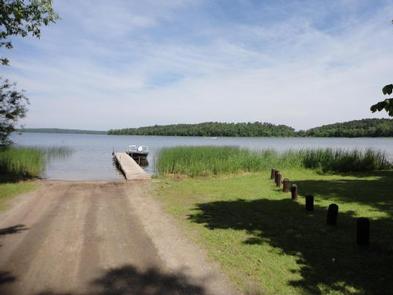
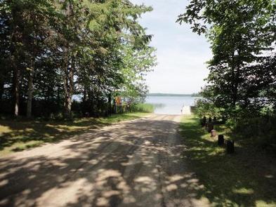
Boating, swimming and fishing are popular activities on Cut Foot Sioux Lake. A boat ramp and swimming beach are located between the campground’s two loops.

Miles of trails in the area provide great hiking, horseback riding, mountain biking and birding opportunities. The Simpson Creek Trail and Cut Foot Sioux National Recreation Area Trail can be accessed by boating across the narrows.

Cut Foot Sioux Lake is located next to Lake Winnibigoshish. Lake Winnie offers excellent fishing opportunities for walleye, perch and muskie. It is one of Minnesota’s premier fisheries. Boating and water skiing are popular activities there.

Facilities

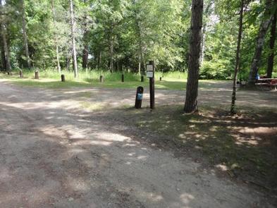
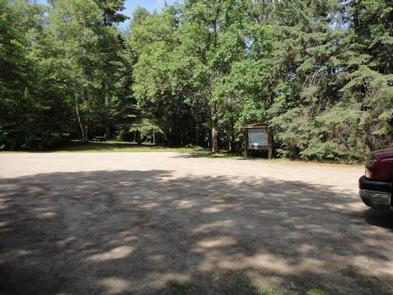
The campground offers several single-family campsites, each equipped with a picnic table and campfire ring. Vault toilets and hand-pumped drinking water are provided. Firewood is available for purchase from the host, who is on-site May 1 through Labor Day.

Natural Features

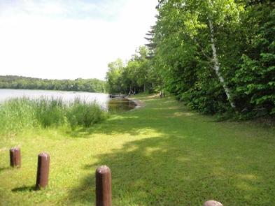
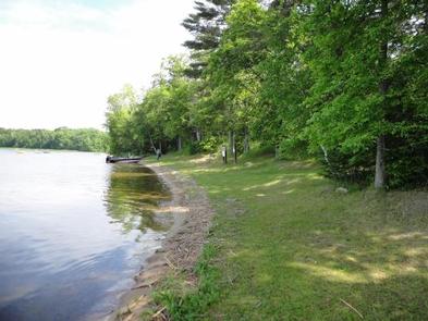
The campground is situated on the eastern shore of Cut Foot Sioux Lake. A scenic forest of birch, oak and pine trees shades the campground. A few campsites have lake views.

The lake is home to a variety of waterfowl and birds of prey, including loons, osprey and bald eagles.

Reservation

More from CampingHiking.net:

BIG BEND (WV), West Virginia Campground Images, Info & Reservations

Directions Follow 28/55 from Petersburg, West Virginia, for 8 miles. Turn left onto Smoke Hole Road, Route 28/11, and travel for 13 miles to County Route 2. Turn left onto the Smoke Hole Road, County Route 2, and follow for approximately 3 miles to Big Bend Campground. Phone 304-358-3253 Activities

DONEY CABIN, Montana Campground Images, Info & Reservations

Directions Phone 406-859-3211 Activities BIKING, CAMPING, HIKING, HUNTING, WINTER SPORTS, WILDLIFE VIEWING Keywords DONE,DONEY LAKE CABIN,BEAVERHEAD-DEERLODGE NF -FS Related Link(s) Rec Area Info & Images Montana State Road Conditions Montana State Tourism Overview DUE TO EARTHQUAKE DAMAGE THIS CABIN IS NO LONGER FOR RENT AND IS OFF THE SYSTEM. Recreation

DELTA NATIONAL FOREST – CAMPING, Mississippi Campground Images, Info & Reservations

Directions From Jackson, MS- take I-20 towards Vicksburg; exit 5A towards Rolling Fork (US 61N); turn right on Hwy. 16 and travel for approximately 7 miles; turn right on the Delta National Forest. Phone 662-873-6256 Activities BOATING, CAMPING, INTERPRETIVE PROGRAMS, FISHING, HIKING, HORSEBACK RIDING, VISITOR CENTER, WILDLIFE VIEWING Keywords Delta

LOFERS BEND EAST, Texas Campground Images, Info & Reservations

Directions From I-35 in Hillsboro, take Highway 22 west 12 miles to Whitney. Continue 7 miles past Whitney, turn right before dam. Follow park road to 4-way stop. Turn left to go to West Lofers or right to go to East Lofers. Phone 254-622-3332 Activities BOATING, CAMPING, SWIMMING SITE Keywords