
Directions
From Jacksonville, Oregon, take Highway 238 west 7 miles and turn left at Ruch on Road 859. Go 14 miles to Applegate Dam, cross over the dam (Road 1075) and continue on pavement 2 miles. When pavement ends, continue 7 miles to the campground.
Phone
(541) 899-9220
Activities
BIKING, BOATING, CAMPING, FISHING, HIKING, WILDLIFE VIEWING, SWIMMING SITE
Keywords
SQWL,Applegate,ROGUE RIVER,SISKIYOU,ROGUE RIVER NATIONAL FOREST,SISKIYOU NATIONAL FOREST,ROGUE RIVER-SISKIYOU NATIONAL,ROGUE RIVER SISKIYOU NATIONAL,ROGUE RIVER-SISKIYOU,ROGUE RIVER SISKIYOU,ROGUE RIVER – SISKIYOU NF – FS
Related Link(s)
Overview
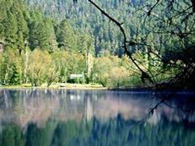
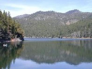
Squaw Lakes Campground is nestled in the deep shade of a mixed-conifer forest on the banks of Squaw and Little Squaw Lakes. The facility provides tent-only campsites that are reachable via foot trails. The unique, remote setting offers visitors stunning scenery and access to a multitude of recreational opportunities.
Recreation
Hiking and fishing top the list of recreational opportunities at Squaw Lakes Campground. Two mountain lakes, a river and a handful of hiking trails are accessible from the campground.
Anglers enjoy the remote location and scenic backdrop of two natural lakes, providing excellent fishing opportunities for coldwater and warmwater species. Squaw Lake, larger than its sister, sustains rainbow and cutthroat trout, yellow perch, brown bullhead and black bass. Little Squaw Lake provides a rare fishery for 8-11" wild, native coastal cutthroat trout. A 0.25-mile hiking trail connects the lakes. Motors are not permitted on the lakes.
From the campground, Little Squaw Trail is a 1-mile interpretive hike that provides visitors with many opportunities for picnicking and swimming. The 2-mile Summit Lake Trail travels through a mixed conifer forest and small water crossings.
Facilities
Squaw Lakes Campground contains 10 individual sites and five group sites. All sites are walk-in and designated for tent camping only. They are reachable by walking on foot trails from the parking area. Vehicles must be parked outside the gated area, and all personal belongings must be carried to the campsite. The closest campsites are approximately 1/4 mile from parking and the farthest campsites are approximately 1.5 miles from parking.
During specific hours (variable) we do offer an ATV portage service for your camping gear. We will not transport people. This service is at the discretion of the Camp Host, and charged at $10 per trip.
Picnic tables, campfire rings and vault toilets are provided. Drinking water is provided via a hand-pump, located near site # 2. Most sites are located at the water’s edge.
Please note, there is a two-night minimum when you desire to reserve a Friday or Saturday night. Visit www.applegatelake.com for more information.
Natural Features
The Rogue River-Siskiyou National Forest is composed of two distinct geological provinces: the Cascade Range and the Siskiyou Mountains. The Cascade Range is dominated by snow-capped volcanic peaks such as 9,495 foot Mt. McLoughlin within the Sky Lakes Wilderness. The Siskiyou area embodies world-class rivers, remarkable fisheries and the most complex and treasured plant communities in the Pacific Northwest.
Diverse landscapes provide habitat for a wide-range of wildlife, from spotted owls and elk to salamanders and sandhill cranes.