

Directions
From the Lakeview Ranger District Office, travel 6 miles north on Highway 395, and turn right on Highway 140. Take Highway 140 east for 8 miles, then turn left on Forest Road 3615. Continue on Forest Road 3615 for 7.5 miles and turn right on Forest Road 019. Follow Forest Road 019 for 5 miles to the lookout.
Phone
541-947-6300
Activities
HISTORIC & CULTURAL SITE, HIKING, HORSEBACK RIDING, HUNTING, PICNICKING, WILDLIFE VIEWING, MOUNTAIN BIKING, STAR GAZING, BIRDING
Keywords
DRAK,FREMONT WINEMA NF – FS
Related Link(s)
Overview
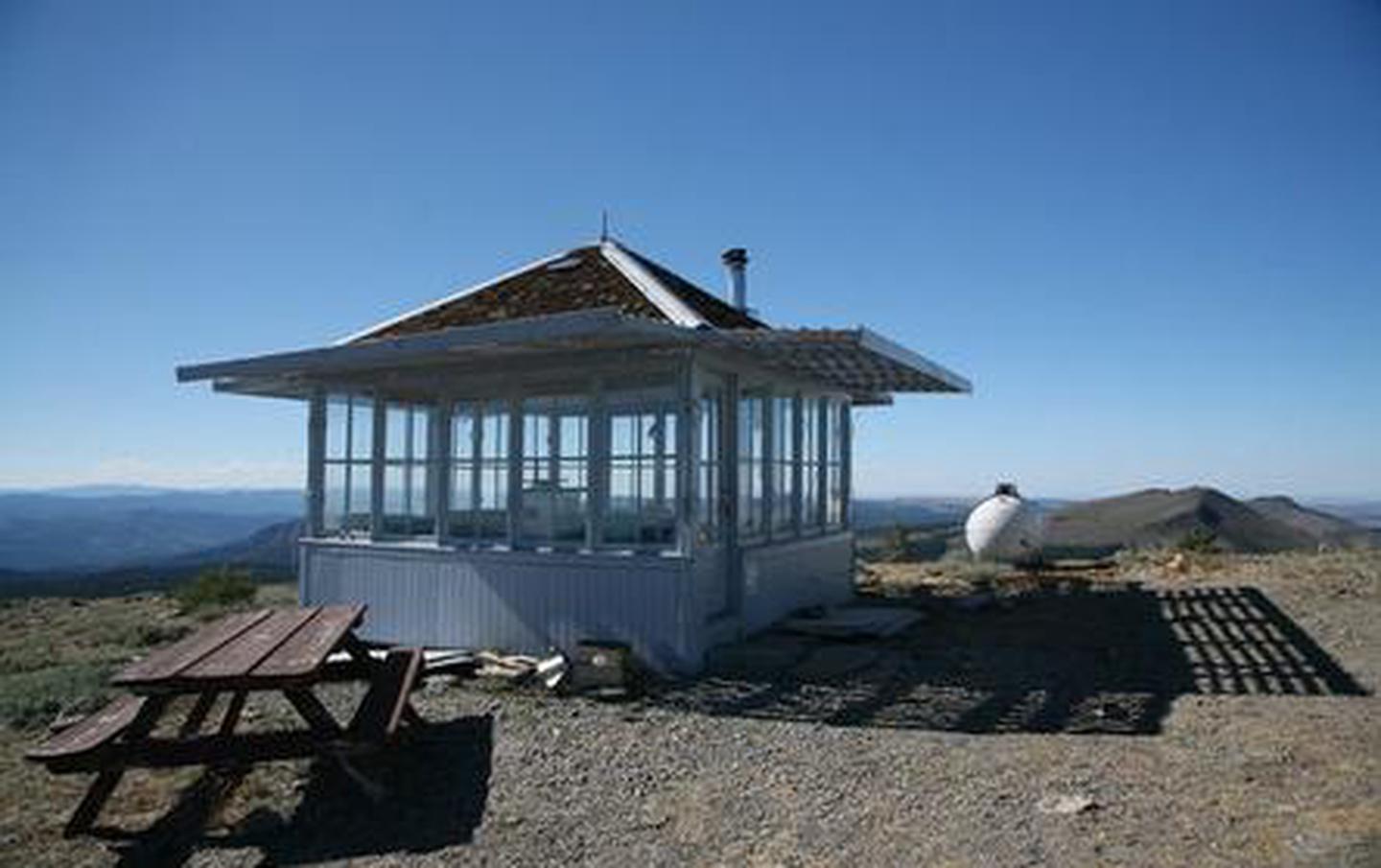
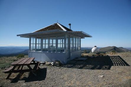
Located on the crest of the Warner Mountain Range at an elevation of 8,222 feet, Drake Peak Lookout hugs the wind-swept land surrounding it, offering unparalleled views into Oregon, California and Nevada. The lookout was built in 1948 and has served as a fire detection site for the surrounding area.
Historically, Forest Service personnel lived long seasons in the cabin, scanning the region for lightning, flames, curls of smoke or any other indicator of possible forest fires. At one time, hundreds of these types of lookouts were in service throughout the Pacific Northwest. Today the lookout provides a unique lodging experience for guests seeking recreation and relaxation in the Fremont-Winema National Forest.
Although the lookout offers some basic amenities, for guests to enjoy their experience completely, they must bring several of their own supplies.
Recreation
Hiking, stargazing and wildlife viewing are popular activities. The Drake-McDowell area provides solitude for backpackers and horseback riders with spectacular views of the Warner Mountains, Hart Mountain, Warner Valley and Abert Rim. A hike to the summit of Drake Peak is a popular excursion from the lookout.
At night the lookout is an ideal setting for stargazing, as constellations and planets put on a dazzling display.
Facilities
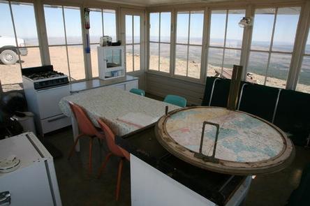
The small, 14 x 14-foot lookout is designed to accommodate up to four people and is furnished with folding cots, a table and chairs, a wood stove for heat and limited counter space for food preparation. A picnic table is located outdoors, as is a vault toilet. There is no water on site, so guests must bring sufficient supplies for drinking, cooking and washing. Guests may fill water jugs at Mud Creek Campground approximately 6 miles away. Guests must also provide their own sleeping bags, sleeping pads, towels, dish soap, matches, cooking gear, first aid kit and firewood. Although lighting is available, it is recommended that guests bring an additional light source in case of emergencies. The Forest Service does not provide firewood for this facility.
Natural Features
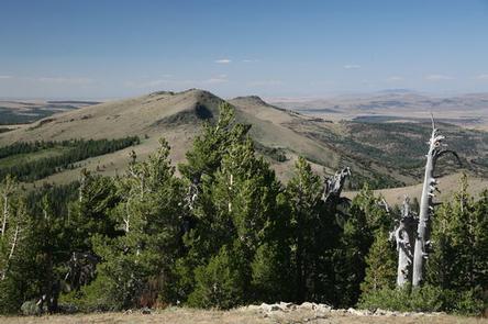
Drake Peak Lookout sits beneath a vast sky, overlooking distant peaks, volcanic landscapes and wide-open sage basins. From its scenic perch, the lookout offers panoramic vistas and glimpses into wild places where visitors can still find solitude.
Although the lookout does not sit on Drake Peak, the nearby mountain is one of several high peaks in the immediate vicinity, including Twelvemile Peak, Light Peak and Crook Peak. Composed of uplifted and eroded basalt, and sparse vegetation, views from this mountain offer unobstructed views of unique geological landforms.
Diverse habitats support a variety of species. Deer, Rocky Mountain elk and pronghorn find homes in nearby forests, while several varieties of trout inhabit the lakes and streams. In the spring and fall, migrating geese, ducks and swans frame the Oregon sky. Black bears, mountain lions and bobcats, also find homes in the surrounding area.