WARD MTN. CAMPGROUND (MURRAY SUMMIT), NV Campground Reservation, Info, Images, Map, Directions

WARD MTN. CAMPGROUND (MURRAY SUMMIT), Nevada Campground Images, Info & Reservations

Listen

Directions

From Ely, travel south on Highway 6 for 10 miles. Turn left just before Murray Summit, at the sign for the recreation area.

From Las Vegas, travel north on Highway 93 for about 86 miles, to the junction with State Route 318. Follow State Route 318 north for 124 miles, to Murray Summit. Turn right at the sign for the recreation area.

Phone

775-289-3031

Activities

BIKING, CAMPING, HIKING, WILDLIFE VIEWING, DAY USE AREA

Keywords

WARD,WARD MOUNTAIN,WARD MOUNTAIN REC. AREA,ELY,WARD MTN. RECREATION AREA,WARD MOUNTAIN REC AREA CAMP,HUMBOLDT-TOIYABE NF-FS,MURRAY SUMMIT

Related Link(s)

Rec Area Info & Images

Nevada State Tourism

Nevada State Road Conditions

Overview

Ward Mountain Recreation Area and Campground sits in the shadow of its namesake, just 10 miles southwest from the city of Ely, in eastern Nevada. It sits at an elevation of 7,400 feet. Many trails are available for hiking, mountain biking and horseback riding.

Recreation

Ward Mountain and the surrounding area offers miles of trails for hiking, mountain biking and horseback riding. Many of the trails offer scenic views of the surrounding high desert terrain.

Facilities

This campground offers single-family campsites and three large group sites that can accommodate up to 100 or more people. Multiple access points for trails are found throughout the campground with the main trailhead located at the eastern most side.

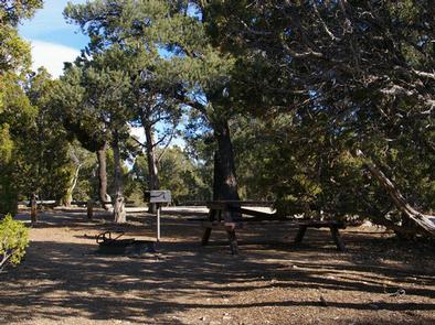
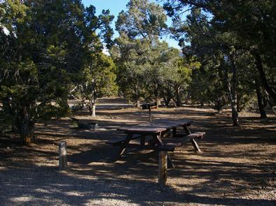
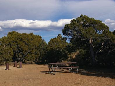
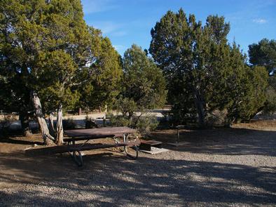
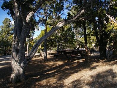
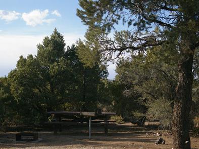
All campsites are equipped with picnic tables, campfire rings and grills. Vault toilets, drinking water and trash collection are provided, but there is no electricity. A campground host is on-site.

Natural Features

Ward Mountain is the highest point in the Egan Range, topping out near 10,800 feet. The campground is well below the summit, but sits high above the desert floor below. A forest of pinyon pine and juniper trees covers the area, offering partial shade and privacy between campsites.

Nearby Attractions

Comins Lake is about 13 miles from the campground offering boating and fishing for trout and bass. Cave Lake State Park is less than 20 miles away, with opportunities for boating and fishing for rainbow and brown trout.

Ward Charcoal Ovens State Park is 26 miles away, with interesting historic stone ovens and an interpretive trail. The Northern Nevada Railway in Ely has a museum and offers train rides. Stop by the Chamber of Commerce for more information on local events and sites.

Reservation

More from CampingHiking.net:

LOFERS BEND WEST, Texas Campground Images, Info & Reservations

Listen Directions From I-35 in Hillsboro, take Hwy 22 west 12 miles to Whitney, continue 7 miles past Whitney, and turn right before dam. Follow park road to 4-way stop. Turn left for West Lofers or right for East Lofers. Phone 254-622-3332 Activities CAMPING, SWIMMING SITE Keywords LOFW,WHITNEY LAKE,LAKE WHITNEY,WEST

BALD KNOB LOOKOUT, Oregon Campground Images, Info & Reservations

Listen Directions From Portland take 1-5S to OR-42 West. Take OR 542 S to Powers. Drive south from the Powers Ranger District office on Highway 242 through the town of Powers to the Forest boundary. Continue on Forest Service Road 33 along the South Fork of the Coquille River for

LAGUARDO, Tennessee Campground Images, Info & Reservations

Listen Directions From Nashville, take I-40 East to exit 232-B. Continue North on Hwy. 109 approximately 7.5 miles. Entrance to the park will be on the left. Phone 615-449-6544 Activities BOATING, CAMPING, FISHING, SWIMMING, KAYAKING, CANOEING Keywords LAGU,OLD HICKORY LAKE,OLD HICKORY LAKE Related Link(s) Rec Area Info & Images Tennessee

BUSHYTAIL, California Campground Images, Info & Reservations

Listen Directions From I-5, take 299 west to Weaverville. Then take State Highway 3 north for 16 miles. Turn right at Minersville/Bushytail, then turn left into campground. Phone 530-275-8113 Activities BOATING, CAMPING, FISHING, HIKING, WATER SPORTS, SWIMMING SITE Keywords BUSH,SHASTA-TRINITY -FS Related Link(s) Rec Area Info & Images Forest Service

TYEE CAMPGROUND (UMPQUA RIVER), Oregon Campground Images, Info & Reservations

Listen Directions From I-5 in Sutherlin, head west 12 miles on Highway 138. Turn left and cross over Bullock Bridge and immediately turn right only Country Road 57 (Bullock Road). Travel .5 miles to the campground. Phone 541-440-4930 Activities CAMPING, FISHING Keywords Related Link(s) Rec Area Info & Images Oregon

WINDY POINT GROUP (CO), Colorado Campground Images, Info & Reservations

Listen Directions From I-70, take the Silverthorne exit 205. Travel east on Highway 6 approximately 4 miles to Swan Mountain Road. Proceed 2 miles to Swan Mountain Recreation Area. Take dirt road to campground. Phone 970-468-7681 Activities BOATING, CAMPING, FISHING, HIKING, PICNICKING, WILDLIFE VIEWING Keywords WINP,WHITE RIVER NF -FS Related