

Directions
From Winston-Salem, North Carolina, take Highway 421 North (approximately 61 miles) and turn left onto S. Recreation Road. Continue for approximately 1.5 miles. Campground entrance is located at the end of the road. From Charlotte, North Carolina, take I-77 North (approximately 60 miles) before merging onto Highway 421 North towards Wilkesboro/Boone, continue to S. Recreation Road (approximately 28 miles), turn left onto S. Recreation Road and go approximately 1.5 miles. Campground entrance is located at the end of the road. Travel times from: Winston Salem: 1 hour Charlotte: 1.5 hours
Phone
336-973-0104
Activities
HISTORIC & CULTURAL SITE, CAMPING, FISHING, HIKING, HUNTING, DAY USE AREA, SWIMMING SITE, DISC GOLF, ARCHERY
Keywords
HAMB,FT HAMBY,W KERR SCOTT DAM
Related Link(s)
North Carolina State Road Conditions
Overview
Fort Hamby Park is located on the north side of W. Kerr Scott Reservoir in western North Carolina.
Constructed in the beautiful Yadkin River Valley, the lake offers extensive opportunities for outdoor recreational activities.
Recreation
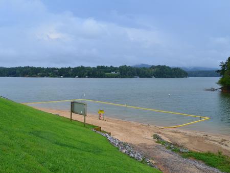
The 1,475-acre reservoir offers excellent boating, canoeing, kayaking and swimming opportunities. Anglers will find channel catfish, large and smallmouth bass, bluegill, threadfin shad, spotted bass, striped bass, and hybrid striped bass. Miles of multi-trails, that allow hiking and mountain biking, surround the lake, including the Overmountain Victory National Historic Trail. An additional 25 miles of trails can be found at the Warrior Creek and Dark Mountain areas.
Facilities
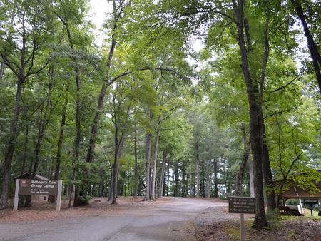
The campground offers a thick canopy of forest on one side and the scenic lake shore on the other. There are 32 campsites available, all with electric hookups, and one large group site that can accommodate up to 100 guests. Modern amenities like flush toilets, drinking water and showers create a comfortable camping experience, while a playground, sandy beach, basketball court and horseshoe pit provide additional recreation opportunities.
Natural Features
The gentle Yadkin River flows through its scenic namesake valley in the foothills of the eastern Blue Ridge Mountains. Forests of mixed hardwoods, including sycamore, poplar, oak and hickory, cover the region. Wildlife is abundant in the valley. White-tailed deer, black bear, eastern cottontails and more can be found among the hills. Birds in the area include wild turkey, woodpeckers, Carolina chickadees, red-eyed vireo, ovenbirds, mallards and wood ducks.