
Directions
From Dillon, travel about 40 miles southeast on Forest Road 202 (Blacktail Creek Road), to Antone Station turnoff. Turn north onto Forest Road 325 and continue about 6 miles to the cabin. During winter months, snowmobiles may be required for the majority of the drive, depending on conditions. Call ahead for road conditions.
Phone
406-682-4253
Activities
CAMPING, FISHING, HIKING, HUNTING, WINTER SPORTS
Keywords
ANTO,ANTONE STATION,ANTONE FS STATION,ANTONE GUARD STATION,BEAVERHEAD-DEERLODGE NF -FS
Related Link(s)
Overview
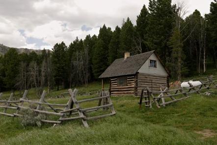
The Antone Cabin sits in a beautiful open meadow, at the edge of a thick forest, providing visitors with a unique camping experience in the mountains of southwestern Montana. The cabin opens for use on July 1and stays open through December, and it is most popular during hunting season. In addition to hunting access, the facility provides ample opportunities for hiking, backpacking and horseback riding, as well as winter sports, such as snowshoeing and cross country skiing. The cabin lies within proposed wilderness so snowmobiling and bicycling is not permitted beyond the road. Visitors are responsible for their own travel arrangements and safety, and must bring several of their own amenities to really enjoy their stay at Antone Cabin.
Recreation
A variety of hiking, backpacking and horseback riding trails extend into the Snowcrest Range, including the Snowcrest Trail, which covers the entire range, providing panoramic views. The 40-mile trail can serve as the means for a hearty horseback adventure, a lengthy backpacking trip, or make for several day trips into the wilderness. Antone Peak is a popular day hike. The nearby Blacktail Deer Creek, and other seasonal mountain streams, offer access to freshwater fishing. Anglers can enjoy a possible catch of brook trout, among other species.
Facilities
You must call the Madison Ranger District at 406-682-4253 Monday – Friday 8:00 am to 4:30 pm for the cabin combination. The office is NOT open on Federal Holidays.
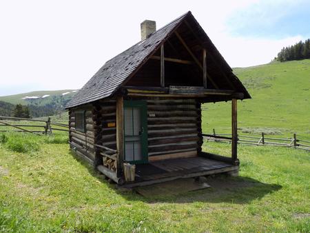
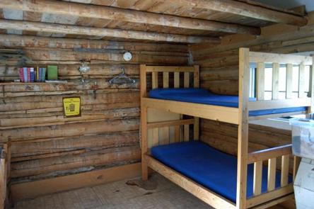
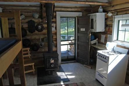
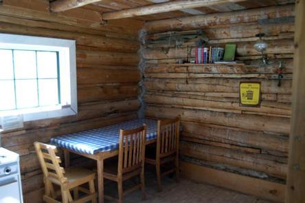
The cabin is a small, primitive, one-room log cabin, equipped with bunk beds that sleep up to two people, a table and chairs. The cabin has a loft, but it is not available for public use, due to safety regulations.
Also inside the cabin is a propane stove with an oven, a wood stove for heat, a shelf and cupboard space, cooking pots, eating utensils, a broom and dust pan, bucket, shovel, axe and cleaning supplies. Foam pads are supplied on the beds.
Outside there is a toilet approximately 40 feet southeast of the cabin. Two propane lights are supplied by a large propane tank outside and firewood is stacked near the outside fence on the porch, however the supply cannot be guaranteed.
Guests must bring their own water. The spring just south of the cabin may have sufficient water for cleaning, but is unreliable. Sleeping bags and blankets are not supplied, and users will also need to bring their own matches, food, toilet paper and garbage bags. Garbage and cleaning services are not provided.
Natural Features
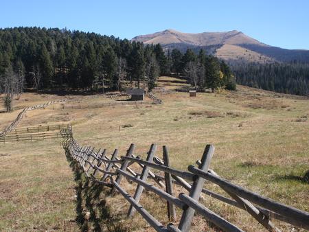
The historic log cabin is located along the grassy foothills at the southern end of the Snowcrest Range, at an elevation of 8,100 feet. Together with the nearby Gravelly Range, the area is one of Montana’s most popular hunting grounds.
The two mountain ranges are home to nearly 10,000 elk and a growing population of grizzly bears (learn more about bear safety). Moose are also frequent visitors to the meadow where the cabin lies.
The large horse pasture adjacent to the cabin is for administrative use only. The public may rent the small horse corral that is next to the trailhead for an additional $10.00/night fee. No livestock is permitted inside the small fenced area immediately around the cabin.